
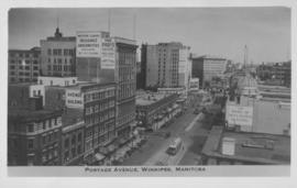
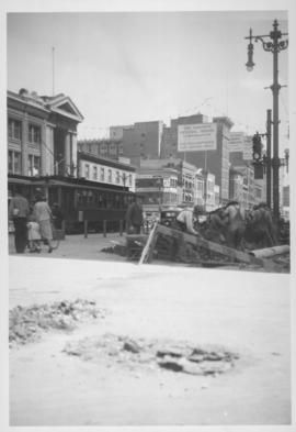
Portage Avenue, Winnipeg, Manitoba
- i01806
- Item
- 1940
Photograph shows view of Paris and Avenue buildings and Bank of Nova Scotia building. Date of photograph is approximate, ca. 1940.
116 results with digital objects Show results with digital objects
Portage Avenue, Winnipeg, Manitoba
Photograph shows view of Paris and Avenue buildings and Bank of Nova Scotia building. Date of photograph is approximate, ca. 1940.
![Logan Avenue and Salter Street [Aerial view]](/uploads/r/city-of-winnipeg-archives-amp-records-control-branch/9/8/0/980f8ba4214d821c9b49366ae35d9ea9ed5b7f44366c5cd894e04befdd6c7a22/C0013_0000_0000_P0018_0033_001_142.jpg)
Logan Avenue and Salter Street [Aerial view]
Inscription (on recto): A161 3-9-43 Logan Ave and Salter St Wp [Winnipeg?] about 4000' 5".
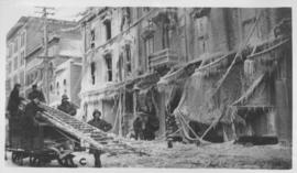

Photograph is one of five photos mounted on page with caption "Assiniboine River flooded, Spring 1916."
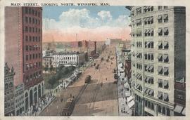
Main Street, looking north, Winnipeg, Man.
Postcard showing Main Street looking north from Bannatyne Avenue. Date of postcard is unknown.

Corner Portage Avenue and Main Street, Winnipeg, Manitoba
Print is a photographic image of the intersection of Portage Avenue and Main Street. Date of print is uncertain, [193-].
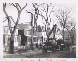
City crews trimming tree branches
Photograph shows city crews trimming tree branches.

The Cove Restaurant, corner of Portage and Carlton
Photograph of "The Cove" Restaurant at 355 Portage Avenue, at Carlton Street. The photograph was taken from a building on Carlton Street looking southeast towards the Eaton's Building, Mitchell-Copp, Zeller's, and the Carlton Building.

Main Street looking northeast to Grace Methodist Church
Photograph of a muddy Main Street in 1871, facing northeast from around St. Mary Avenue. Featured on the photograph's right-hand side is Grace Methodist Church, located at Main Street and Water Avenue (now William Stephenson Way), which was opened on September 17 of that year.

Thoroughfares: Academy Road at Wellington Crescent
View of cars and cyclists heading down Academy Road towards Wellington Crescent and the Maryland Bridge. A small portion of Misericordia Hospital can be seen across the bridge.

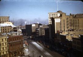
Page shows five street views of Winnipeg, ca. 1903: 1) Main Street from Commercial Club, 2) Elgin Avenue, 3) Geo. Velie, Wholesale Wines and Liquors, 4) William Avenue, looking west, and 5) Main Street, looking north from Portage Avenue.

View of Main Street south from Higgins showing Alberta Hotel
Date of photograph is uncertain, [before 1949].

Photograph shows old St. James Bridge approach, looking north up Madison Street (now Century Street/Route 90). Present Viscount Gort site in center. Date of photograph is uncertain, [after 1932].

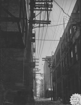
Overhanging Signs: North side of Portage Avenue looking West from Young Street
Photograph shows signs for multiple businesses, including Club Morocco, Riviera Restaurant, Princeton Café Fish and Chips, Portage Credit Jewellers. Date of photograph is uncertain, [196-?].
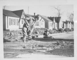
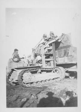
Screed - Inkster Boulevard, east of McKenzie Street
Item consists of a photograph showing construction of concrete road.
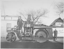
#7 - Roller, rolling hot asphalt, Dufferin, east of Arlington - 1947
Ogden's shown in background of photograph.