
Army & Navy Imperial and Colonial Veteran's Association
- i03935
- Item
- 1901
A photograph of the Army & Navy Imperial & Colonbial Veteran's Association, taken in 1901.
957 results with digital objects Show results with digital objects
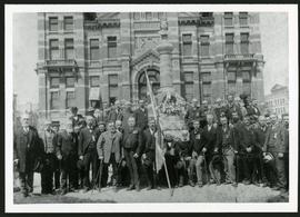
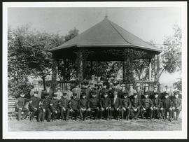
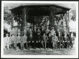
Army & Navy Imperial and Colonial Veteran's Association
A photograph of the Army & Navy Imperial & Colonbial Veteran's Association, taken in 1901.

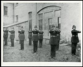
Winnipeg Police with outstretched arms
A photograph of Winnipeg Policeman standing outside of a building.
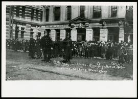
Police during 1906 Winnipeg Street Railway Strike
A photograph of the street Railway strike in Winnipeg, taken March 30th,1906.

American battalion in front of City Hall
A photograph of the U.S. Battalion in Winnipeg, taken ca. 1917.

1926 Canadian Champion Revolver Team
A photograph of the Canadian Champion Revolver Team, taken in 1926.
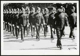
A photograph of the Winnipeg Policeman marchin, taken 1936.
Group photo of Winnipeg Police
A photograph of Winnipeg Police officers, taken ca. 1913.
Group photo of Winnipeg Police
A photograph of Winnipeg Police officers, taken ca. 1913.
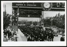
Police on Osborne Street Bridge during 1935 parade
A photograph of a parade on Osborne Street Bridge, taken 1935.

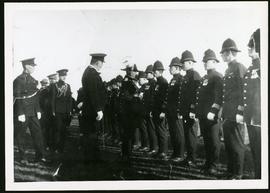
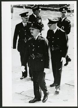
Mayor McLean and Chief Newton inspecting Police Force
A photograph of Police Chief Christopher Newton and Mayor Dan McLean inspecting a line of police officers. Other identified officials include Alderman John O'Hare, Alderman E.T. Leech, Inspector McLachlan, and Magistrate Robert Graham.
A photograph of Winnipeg Police officers.
A photograph of Winnipeg Police officials taken in 1931.
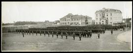
78th Overseas Battalion (Winnipeg Grenadiers)
Panorama of the 78th Oversees Battalion (Winnipeg Grenadiers) lined up in formation at Fort Osborne Barracks. Photograph taken by Royal Studio.
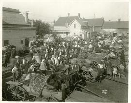
The North End market behind Dufferin Avenue and Derby Street
Carts of goods and shoppers in a bustling market around Dufferin Avenue and Derby Street in the North End.

Northdale Shopping Centre panorama
View of Northdale Shopping Centre, 963 Henderson Highway, 7.65 acres. From left to right: Loblaws Groceteria, Zeller's County Fair, various shops, the Royal Bank, the Canadian Imperial Bank of Commerce, A & P Food Store, Lord Wolseley School. Consists of 3 separate photographs pasted together on cardboard to create a panorama. The cardboard is a scrap made from an old sign of the Metropolitan Corporation of Greater Winnipeg (visible on the reverse). The cardboard is numbered “1”, presumably as part of a compilation with other shopping centre panoramas.
Metropolitan Corporation of Greater Winnipeg (Man.). Planning Division

Rossmere Shopping Centre panorama
View of Rossmere Shopping Centre, 1070 Henderson Highway, southwest corner Rowandale, 4.25 acres. From left to right: a garage or car wash, Red River Co-Op Store, Rossmere Lanes Bowling Alley, Library, Dry Cleaners, Co-operators Credit Union Society Limited, Rowandale Baptist Church, Rowandale Apartments, Red River Co-Op Gas Station. Consists of 3 separate photographs pasted together on cardboard to create a panorama. The cardboard is a scrap made from an old sign of the Metropolitan Corporation of Greater Winnipeg (visible on the reverse). The cardboard is numbered “2”, presumably as part of a compilation with other shopping centre panoramas.
Metropolitan Corporation of Greater Winnipeg (Man.). Planning Division

Crossroads Shopping Centre panorama
View of Crossroads Shopping Centre, 1580 Regent Avenue W., 18 acres. From left to right: Woolco Department Store, Various shops, Safeway, Pacific 66 Gas Bar. Consists of 3 separate photographs pasted together on cardboard to create a panorama. The cardboard is a scrap made from an old sign of the Metropolitan Corporation of Greater Winnipeg (visible on the reverse). The cardboard is numbered “3”, presumably as part of a compilation with other shopping centre panoramas.
Metropolitan Corporation of Greater Winnipeg (Man.). Planning Division

Clark’s Department Store at Highway 59 panorama
View of Clarks at Highway 59, southwest corner of Panet Road and Nairn Avenue, 8.5 acres. From left to right: B/A gas bar, Loblaws, Clarks Discount Store and Auto Centre, B/A gas bar, Kavanaugh's Hamburgers. Consists of 3 separate photographs pasted together on cardboard to create a panorama. The cardboard is a scrap made from an old sign of the Metropolitan Corporation of Greater Winnipeg (visible on the reverse). The cardboard is numbered “4”, presumably as part of a compilation with other shopping centre panoramas.
Metropolitan Corporation of Greater Winnipeg (Man.). Planning Division

Southdale Shopping Centre panorama
View of Southdale Shopping Centre, 35 Lakewood Boulevard, 12.8 acres. From left to right: Dominion Store, Canadian Imperial Bank of Commerce, Mall Entrance, Quintons, Ebbeling Pharmacy, Kmart Department Store. Consists of 3 separate photographs pasted together on cardboard to create a panorama. The cardboard is a scrap made from an old sign of the Metropolitan Corporation of Greater Winnipeg (visible on the reverse). The cardboard is numbered “5”, presumably as part of a compilation with other shopping centre panoramas.
Metropolitan Corporation of Greater Winnipeg (Man.). Planning Division