

- i02065
- Item
- 1923
Photograph is one of three photos mounted on page with caption "Elsie and Mabel - 1923."
957 results with digital objects Show results with digital objects
Photograph is one of three photos mounted on page with caption "Elsie and Mabel - 1923."
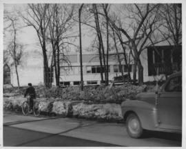
Elmwood homes, downtown businesses, and rural Winnipeg
Photographs of various homes in Elmwood, possibly used for assessment purposes, as well as photographs of Winnipeg businesses and other buildings in the core area and unknown rural locations.
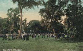
Postcard shows Elm Park, Winnipeg. Photo by Gibson. Published by Valentine & Sons' Publishing Company, Ltd., Montreal and Toronto, printed in Great Britain. Date of postcard is uncertain, [before 1949].
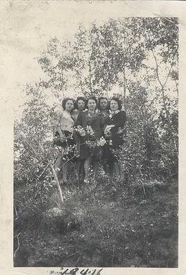
Photograph shows group of five students, unidentified women, from Central Normal School (Normal School), 442 William Avenue.

Photograph shows Eaton's storefront decorated with flags as part of the Victory in Europe Day (VE Day) celebrations that marked the end of World War II in Europe.
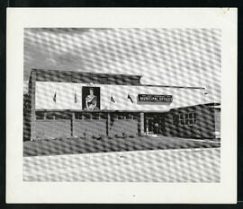
East Kildonan Municipal Offices.
East Kildonan Municipal Offices at 755 Henderson Highway.
![East Kildonan [Aerial view]](/uploads/r/city-of-winnipeg-archives-amp-records-control-branch/8/6/0/860fdea3b1f6bcb68bd68a791365ae9deb8f9cd14834a8814d48663ae6ce80b6/C0013_0000_0000_P0018_0031_001_142.jpg)
Inscription (on recto): WG A155, East Kildonan - 1944.
East Clarifier, placing mortar finish
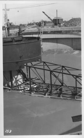
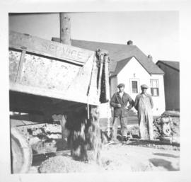
Photograph shows construction of sewer. Date of photograph is uncertain, [before 1949].
Dyking built up around Shaarey Zedek Synagogue, 1950 Flood
Photograph taken at Shaarey Zedek Synagogue, 561 Wellington Crescent off Academy Road, on the western bank of the Assiniboine River. - Stamp (on verso): by Harold K. White Studio, 274 Fort St. Winnipeg, Phone 924 289.
Harold K. White Studio
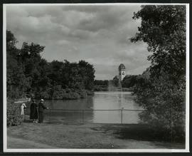
Duck pond and pavilion at Assiniboine Park
A family enjoying the duck pond and the view of the pavilion at Assiniboine Park.

Downtown Winnipeg - Section and Interior View of Winter Garden
Items shows drawing in printed format that record plans for downtown area.
Metropolitan Corporation of Greater Winnipeg (Man.). Planning Division
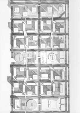
Downtown Winnipeg - Plan of St. Mary-Broadway Sector
Item shows drawing in printed format that records plans for downtown area.
Metropolitan Corporation of Greater Winnipeg (Man.). Planning Division

Downtown Winnipeg - Model photo of Downtown Plan (side view)
Item appears to show photographic reproduction of model (side view) in printed format that records plans for downtown area.
Metropolitan Corporation of Greater Winnipeg (Man.). Planning Division
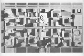
Downtown Winnipeg - Model Photo of Downtown Plan (aerial view)
Item appears to show photographic reproduction of model (aerial view) in printed format that records plans for downtown area.
Metropolitan Corporation of Greater Winnipeg (Man.). Planning Division

Downtown Winnipeg - Isometric of St. Mary-Broadway Sector
Item shows drawing in printed format that records plans for downtown Winnipeg.
Metropolitan Corporation of Greater Winnipeg (Man.). Planning Division
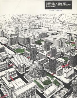
Downtown Winnipeg - Aerial view of St. Mary-Broadway Sector (Map Three)
Items shows drawing in printed format that record plans for downtown area.
Metropolitan Corporation of Greater Winnipeg (Man.). Planning Division

Photograph shows aerial view of downtown Winnipeg, looking north up Main Street from over Broadway and Main. Date of photograph is approximate, ca. 1924.

Item consists of a report cover for Downtown Winnipeg, created by the Metropolitan Corporation of Greater Winnipeg - Planning Division, April 1, 1969.
Metropolitan Corporation of Greater Winnipeg (Man.). Planning Division
Photograph shows Dufferin Avenue, east of the Arlington Bridge, in background. Date of photograph is approximate, ca. 1936.