
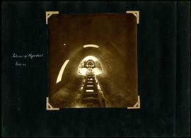
William Smaill Photo Album – Page 79
- p00197
- Part
- [1914 or 1915]
Part of William Smaill fonds
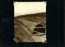
Captions read: Interior of aqueduct, mile 64.
Smaill, William
93 results with digital objects Show results with digital objects
William Smaill Photo Album – Page 79
Part of William Smaill fonds
Captions read: Interior of aqueduct, mile 64.
Smaill, William
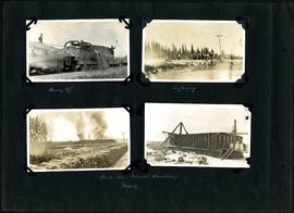
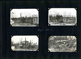
William Smaill Photo Album – Page 85
Part of William Smaill fonds
Captions read: Plouging off - Surfacing - Bush fires Patriotic Wood Camp, mile 57.
Smaill, William
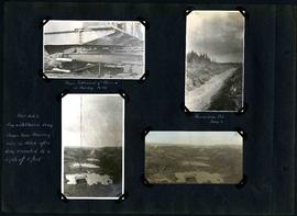
William Smaill Photo Album – Page 91
Part of William Smaill fonds
Captions read: Shows settlement of class 19[?] in muskeg, mile 86 - Foundation Fill, camp 6 - Pilot ditch dug with class in drag, shows how muskeg rises in ditch after being excavated to a depth of 8 feet.
Smaill, William
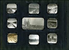
William Smaill Photo Album – Page 97
Part of William Smaill fonds
Captions read: Views at Camp 2, Mile 51 - Packed backfill, gravel - Inverst after Rainstorm - Boulders from trench - Mixer, concrete cars, and gas dinkey - Pads protected from frost with moss - Manhole and blowoff - Mixer.
Smaill, William
William Smaill Photo Album – Page 107
Part of William Smaill fonds
Smaill, William
William Smaill Photo Album – Page 108
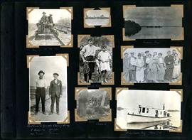
Part of William Smaill fonds
Captions read: My car at mile 38 - Indian Bay - First crew to operate class 7 drag, C. Walgren, operator, [W.H.?] Smaill, fireman - Lassie, Hamish - Fisherman's Tug, Shoal Lake. Also contains a photo showing Kekekoziibii Shoal Lake 40 First Nation in the distance.
Smaill, William
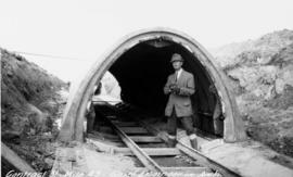
Chief Engineer Chace in aqueduct arch
Photograph of William G. Chace, Chief Engineer of the Winnipeg Aqueduct, standing in front of a completed aqueduct arch east of Brokenhead River. Photographer is unknown.
Greater Winnipeg Water District

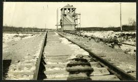
William Smaill Photo Album – Page 2
Part of William Smaill fonds
Captions read: First lift of ballast - Skeleton track - Joining the rails - Tracklayer at work.
Smaill, William
Interlocking tower over CNR track
Part of Morris Block collection
The reverse reads “Inter-locking tower, Diamond over CNR”, followed by unreadable text.
Block, Morris
William Smaill Photo Album – Page 5
Part of William Smaill fonds
Captions read: Track layer at work.
Smaill, William

William Smaill Photo Album – Page 10
Part of William Smaill fonds
Captions read: Views at Greater Winnipeg Water District gravel pit.
Smaill, William
William Smaill Photo Album – Page 16
Part of William Smaill fonds
Captions read: J. Nelson, Mrs. Carter, Mrs. Waugh, Miss James, Mr. Cummings, Mayor Waugh, Mrs. Reynolds, W.E. Davis, G.P. Richan, Tom Dunn, Sam Reynolds.
Smaill, William
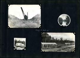
William Smaill Photo Album – Page 30
Part of William Smaill fonds
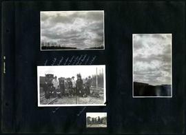
Captions read: Whitemouth - Indian Bay - Heading west, mile 68 - Big muskeg, mile 91 - Mile 89 - Indian Bay.
Smaill, William

William Smaill Photo Album – Page 34
Part of William Smaill fonds
Smaill, William
William Smaill Photo Album – Page 39
Part of William Smaill fonds
Captions read: First setting up of inside forms, mile 51.
Smaill, William
William Smaill Photo Album – Page 60
Part of William Smaill fonds
Captions read: Camp 5, mile 77.
Smaill, William
William Smaill Photo Album – Page 64
Part of William Smaill fonds
Captions read: Camp 1, mile 51 1/2.
Smaill, William
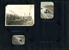
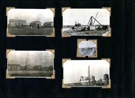
William Smaill Photo Album – Page 83
Part of William Smaill fonds
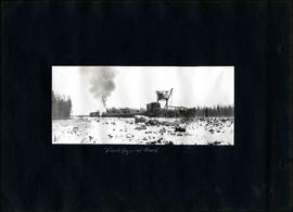
1 photograph appears to be missing. Captions read: Bay City dredge, mile 91 - Cracked arch, mile 85, broke with traveler sacks - Mile 58 - Bay City dredge, Mile 91.
Smaill, William
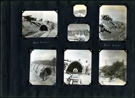
William Smaill Photo Album – Page 96
Part of William Smaill fonds
Captions read: Arch, mile 65 - Harold, Monty - Invert, mile 65.
Smaill, William

William Smaill Photo Album – loose page
Part of William Smaill fonds
Captions read: Water tank, Indian Bay, Greater Winnipeg Water District.
Smaill, William