
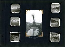
William Smaill Photo Album – Page 54
- p00172
- Part
- [1914 or 1915]
Part of William Smaill fonds
Captions read: Class 14 in muskeg, mile 86.
Smaill, William
William Smaill Photo Album – Page 54
Part of William Smaill fonds
Captions read: Class 14 in muskeg, mile 86.
Smaill, William
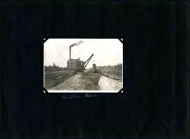
William Smaill Photo Album – Page 57
Part of William Smaill fonds
Captions read: Testing section, camp 2, mile 57 1/2.
Smaill, William
William Smaill Photo Album – Page 75
Part of William Smaill fonds
Smaill, William
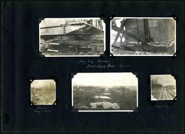
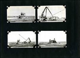
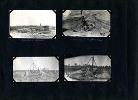
William Smaill Photo Album – Page 86
Part of William Smaill fonds
Captions read: Bay City dredge, Brokenhead River, March15 - Site for camp 8, December 15 - Camp 8, December 15.
Smaill, William
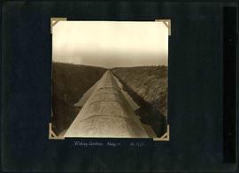
William Smaill Photo Album – Page 87
Part of William Smaill fonds
Captions read: Bay City dredge, Mile 92 - Pilot ditch, mile 92, looking west.
Smaill, William

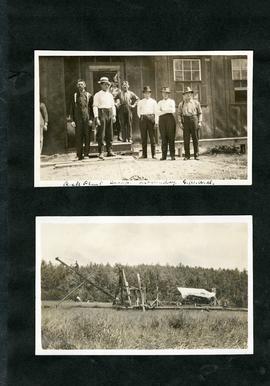
William Smaill Photo Album – Page 89
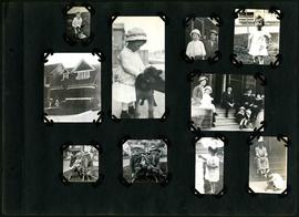
Part of William Smaill fonds
Captions read: Peg, Josh - Reg Halls, Hayward - E.P. Hayward - P.L. Leach.
Smaill, William
William Smaill Photo Album – Page 90
Part of William Smaill fonds
Captions read: Contains no captions.
Smaill, William
William Smaill Photo Album – Page 92
Part of William Smaill fonds
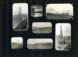
Captions read: Pile driver, mile 85 plus - Headquarter - Mile 86 - 4.5% grade - Mile 85 - Dominion Day, 1915, camp 6 - Mile 85 plus.
Smaill, William

William Smaill Photo Album – Page 98
Part of William Smaill fonds
Captions read: Whitemouth River crossing.
Smaill, William
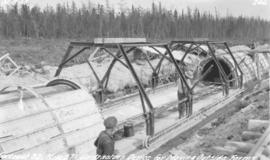
William Smaill Photo Album – Page 100
Part of William Smaill fonds
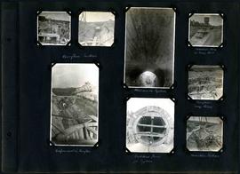
Captions read: Overflow section - Whitemouth syphon - Manhole form at sump well -Reinforcement in overflow - Bulkhead form for syphon - Overflow sump forms - Transition section.
Smaill, William
William Smaill Photo Album – Page 101
Part of William Smaill fonds
Captions read: Boat house, west bank - excavation for overflow and sump.
Smaill, William
William Smaill Photo Album – Page 103
Part of William Smaill fonds
Captions read: Inverts on foundation fill, mile 71 - Trench in hardpan after rain - excavating hardpan by hand, mile 71.
Smaill, William
William Smaill Photo Album – Page 105
Part of William Smaill fonds
Captions read: Backfilling, mile 65.
Smaill, William
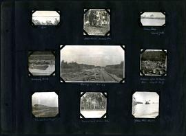
William Smaill Photo Album – Page 106
Part of William Smaill fonds
Captions read: Dyke - Blanchard's, Indian Bay - Indian Camp, Shoal Lake [Kekekoziibii Shoal Lake 40 First Nation] - Removing arch - Camp 5, mile 77 - Remains after oil House fire, camp 5, mile 77 - Excursion train, camp 6 -Tennis court, Indian Bay - Young wild ducks.
Smaill, William

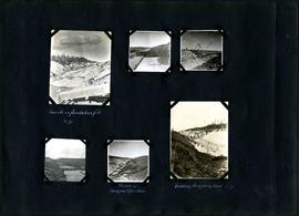
William Smaill Photo Album – Page 118
Part of William Smaill fonds
Captions read: Blank Page.
Smaill, William

William Smaill Photo Album – loose page
Part of William Smaill fonds
Captions read: Bunk houses, rock plant, Greater Winnipeg Water District - Rock crushing plant, Greater Winnipeg Water District.
Smaill, William
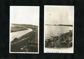
William Smaill Photo Album – loose page
Part of William Smaill fonds
Captions read: Completed aqueduct tube, Greater Winnipeg Water District - View of Shoal Lake, Greater Winnipeg Water District.
Smaill, William
William Smaill Photo Album – loose page
Part of William Smaill fonds
Captions read: Rock plant camp, on a Sunday, Greater Winnipeg Water District.
Smaill, William
Device for moving aqueduct arch forms near Spruce Siding
Photograph of workers using a contractor's device for moving outside arch forms of the Winnipeg Aqueduct near Spruce Siding, Manitoba. Photographer is unknown.
Greater Winnipeg Water District
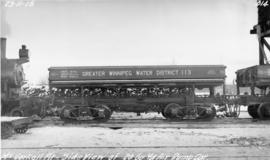
GWWD dump car at McCorkell Pit
Photograph of the side of a Greater Winnipeg Water District 20 cubic yard dump car at the McCorkell Pit, west of Ostenfeld, Manitoba. Photographer is unknown.
Greater Winnipeg Water District