
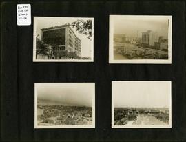
- i01718
- Item
- 1907
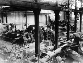
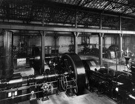
James Avenue Pumping Station – interior
Interior shot of the James Avenue Pumping Station on James Avenue and Amy Street, still under construction.
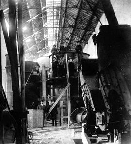
James Avenue Pumping Station – interior
Interior shot of the James Avenue Pumping Station on James Avenue and Amy Street, still under construction.

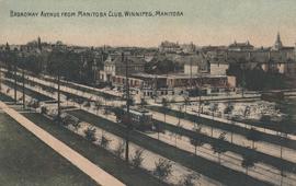
Broadway Avenue from Manitoba Club, Winnipeg

City Hall and Union Bank, Winnipeg
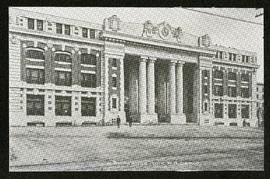
Postcard shows Winnipeg's second city hall (1886-1962) and Union Bank building.
James Avenue Pumping Station – interior
Interior shot of the James Avenue Pumping Station on James Avenue and Amy Street.

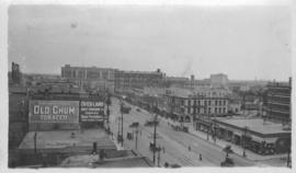
North side of Lombard, Rorie to Main Street
Part of City of Winnipeg (1874-1971)
A photograph of storefronts and advertisements on the north side of Lombard Avenue, between Rorie Street and Main Street. The photograph is part of small album containing photographs of maps tracking the outbreak of typhoid from 1905 to 1909 and other scenes. Item is loose and at back of album.
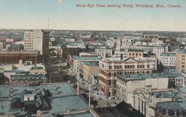
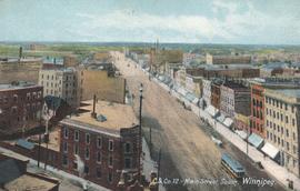
Bird's Eye View, looking North
Postcard shows view looking north, down Main Street from Lombard Avenue. Probably taken from roof of McArthur Building (Childs Building). Date of postcard is approximate, ca. 1910.
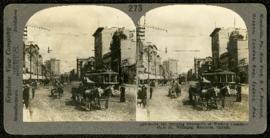
Main Street, looking north from Portage
Part of Morris Block collection
A promotional stereogram showing traffic and streetcars on Main Street, looking north from Portage Avenue, made by the Keystone View Company. The reverse side of the image contains information about Winnipeg.
Block, Morris
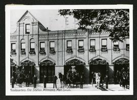
Fire Department no. 2, Smith and York
Part of Morris Block collection
Photograph of the number 2 fire station at Smith Street and York Avenue. Photograph is a reproduction of the original at the Archives of Manitoba.
Block, Morris
Part of Morris Block collection
Photograph of the main entrance to the Canadian Pacific Railway depot on Higgins Avenue.
Block, Morris

Photograph shows Winnipeg's second City Hall (1886-1952). Stamp (on verso) credits the photograph to the Geological Survey of Canada, No. 19549. Date of photograph is uncertain, [191-?].
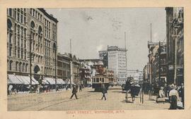
Postcard shows streetcar, horse buggies and Union Bank building.
Photograph taken from McLaren Hotel at Rupert and Main Street, looking northeast, probably during World War 1. Date of photograph is uncertain, [between 1912 and 1925].
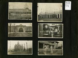
Photograph album of Winnipeg during WW1: Page 2
Item consists of a scrapbook page showing unidentified building (Item 7), Industrial Bureau Exhibition Building (Item 8), Canadian National Railway station (C.N.R. station) from Broadway looking east (Item 9), unidentified woman standing in front of residential building (Item 10), City Hall and Volunteer Monument (second City Hall) (Item 11), unidentified woman posing in front of what is likely the Assiniboine Park Pavilion (Item 12). Dates of photographs are approximate, [ca. 1913].

Banfiend’s Furniture carts in front of Empire Hotel
Part of Morris Block collection
Photograph mounted on cardboard of a cavalcade of horse-drawn wagons in front of the Empire Hotel on Main Street and York Avenue, advertising deals on 3-room furniture suites at Banfield’s Furniture, 492 Main Street.
Block, Morris

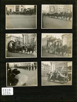
Photograph album of Winnipeg during WW1: Page 5
Item consists of a scrapbook page showing soldiers lined up in military parade in front of the Industrial Bureau Exposition Building (Item 21), soldiers lined up in military parade (Item 22),
soldiers on horse in military parade in front of the Industrial Bureau Exposition Building (Item 23), crowd forming on street in front of the Israelite Jewish Daily newspaper building (975 Main Street) and the H. Lindster's Bakery (971 Main Street). Soldiers and Police in foreground (Item 24), [ca. 1913].
Photograph album of Winnipeg during WW1: Page 3
Item consists of a scrapbook page showing the Young Men's Christian Association (YMCA) Building at 301 Vaughan Street (Item 13); view of Portage Avenue with Eaton's and Boyd buildings in foreground and Hotel Fort Garry in the background (Item 14); view of Ashford's Bakery at Portage Avenue and Furby Street, facing south towards Broadway (Item 15); Vaughan Street facing north towards St. Paul's College on Ellice Avenue (Item 16). Dates of photographs are approximate, [ca. 1913].
Photograph album of Winnipeg during WW1: Page 7
Item 29-31 consists of a scrapbook page showing a parade going down Portage Avenue at Garry Street. The Bank of Nova Scotia / A. A. Heaps Building and the post office can be seen in the background.