
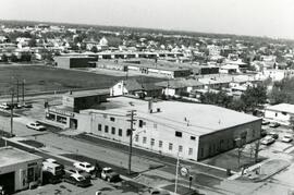
7-eleven and Shell station on Rothesay between Edison and Kingsford
- i04666
- Pièce
- [197-?]
Fait partie de City of Winnipeg Archives Photograph collection
7-Eleven store and Shell Service Station on Rothesay Street between Edison and Kingsford Avenues.
3968 résultats avec objets numériques Afficher les résultats avec des objets numériques
7-eleven and Shell station on Rothesay between Edison and Kingsford
Fait partie de City of Winnipeg Archives Photograph collection
7-Eleven store and Shell Service Station on Rothesay Street between Edison and Kingsford Avenues.
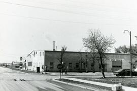
Businesses at the corner of Rothesay and Edison
Fait partie de City of Winnipeg Archives Photograph collection
Hagemier Corporation and 7-Eleven at the corner of Rothesay Street and Edison Avenue.
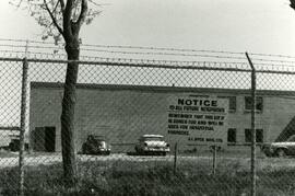
Sign about industrial zoning at business near Rothesay Street
Fait partie de City of Winnipeg Archives Photograph collection
Sign put up by J.I. Dyck Mfg. Ltd. Informing other that the property (near Rothesay Street) is zoned for industrial purposes.
Fait partie de City of Winnipeg (1874-1971)
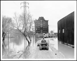
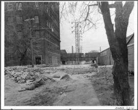
A photograph of a causeway near an underpass on Anabella Street during the 1950 flood in Winnipeg. A city employee is driving some equipment down the causeway.
Sans titre
Fait partie de City of Winnipeg (1874-1971)
A photograph of a flooded underpass on Anabella Street during the 1950 flood in Winnipeg.
Sans titre

Fait partie de City of Winnipeg (1874-1971)
A photograph, taken from the north, of a flooded underpass on Anabella Street during the 1950 flood in Winnipeg. Some people in a boat are travelling down the street.
Sans titre
Fait partie de Parks and Recreation Photograph collection
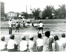
Children playing baseball at community diamond (Arbuthnot St. and Fleet Ave.).
Sans titre

Horse drawn Fire Department vehicle.
Fait partie de City of Winnipeg Archives Photograph collection
Philip C. Dolsen holding reins - driver for Winnipeg Fire Dept.
Western Canada Fire Underwriters' Association collection
Collection consists of fire insurance plans for the City of Winnipeg and the surrounding communities that comprise Greater Winnipeg. Fire insurance plans are maps showing, by colours and symbols, detailed information about each building including structure size and shape, construction materials and detailing, number of floors and lot size. Additional information can include street widths, street numbers, property lines and such fire protection facilities as water pipes or mains, fire hydrants and fire alarm boxes. The plans show streets, churches, hotels, industrial, commercial and public buildings. The plans were originally contained in eight bound atlases. These have been disassembled to facilitate access. Specific locations are accessed through a map key.
Sans titre