
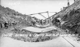
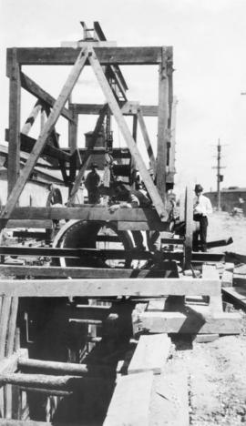
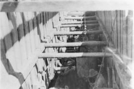
Leveling and floating aqueduct inverts between McMunn and East Braintree
- i01220
- Item
- 1917
Photograph of workers leveling and floating Winnipeg Aqueduct inverts between McMunn, Manitoba, and East Braintree, Manitoba.
Greater Winnipeg Water District
191 results with digital objects Show results with digital objects
Leveling and floating aqueduct inverts between McMunn and East Braintree
Photograph of workers leveling and floating Winnipeg Aqueduct inverts between McMunn, Manitoba, and East Braintree, Manitoba.
Greater Winnipeg Water District
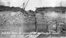
Empty cofferdam for aqueduct intake near Indian Bay
Photograph of an empty cofferdam near the Winnipeg Aqueduct's intake at Indian Bay. Photographer is unknown.
Greater Winnipeg Water District
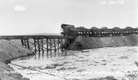
Filling in cofferdam for aqueduct's intake at Indian Bay
Photograph of dump cars filling in last gap of a cofferdam between dykes at the intake of the Winnipeg Aqueduct at Indian Bay, taken from the west dyke. Photographer is unknown.
Greater Winnipeg Water District

Clearing debris for aqueduct west of Snake Lake
Photograph of workers clearing debris between pole piling for the Winnipeg Aqueduct west of Snake Lake. Photographer is unknown.
Greater Winnipeg Water District
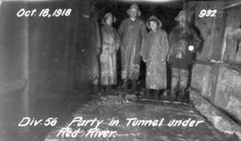
Party in Tunnel under Red River
Photograph of Greater Winnipeg Water District officials, engineers, and their families at the east end of the Winnipeg Aqueduct tunnel below the Red River linking downtown Winnipeg to St. Boniface. From left to right: Chief Engineer William G. Chace, Harriet Lily Waugh (née Logan), possibly Effie Waugh, and Division Engineer J. Armstrong. Photographer is unknown.
Greater Winnipeg Water District
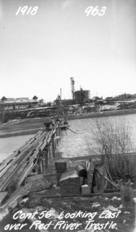
Looking east over Red River trestle bridge
Photograph of a Red River trestle bridge between downtown Winnipeg and St. Boniface, looking east towards the Taché surge tower. Photographer is unknown.
Greater Winnipeg Water District
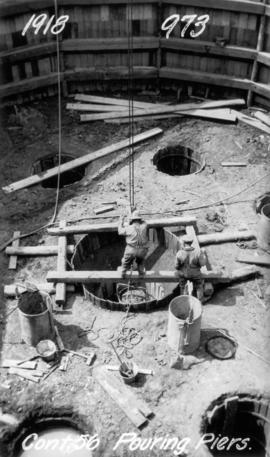
Pouring piers for Taché surge tower
Photograph of workers pouring piers for the Taché surge tower. Photographer is unknown.
Greater Winnipeg Water District

Seine River south of aqueduct crossing
Photograph of the Seine River just south of the Winnipeg Aqueduct's crossing, looking southeast towards Provencher Boulevard and the Tissot area. The St. Boniface water tower can be seen behind the buildings in the background. Photographer is unknown.
Greater Winnipeg Water District
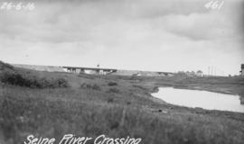
Photograph of the Seine River where the Winnipeg Aqueduct crosses, looking northeast towards the Canadian Northern Railway main line and Rue Notre Dame (at right). Photographer is unknown.
Greater Winnipeg Water District
Contract 65 - Mile 1.5 - View of hoist lowering 48 inch diameter pressure pipe into trench at Sta. 79+50 on Pacific Avenue, looking east toward Xante Street. Work progressed eastward from Alexander Avenue at Yeomans Street. Buildings of Western Packing
Greater Winnipeg Water District
Contract 65 - Mile 1.5 - View of men mucking out trench for 48 inch diameter pressure pipe approx. at Sta. 80+00 on Pacific Avenue. Work progressed eastward from Alexander Avenue at Yeomans Street.
Greater Winnipeg Water District
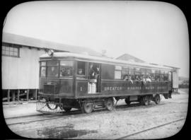
Passengers aboard GWWD Railway Service car at St. Boniface Station
Passengers aboard GWWD Railway Service car at St. Boniface Station. Image derived from glass lantern slide.
Greater Winnipeg Water District

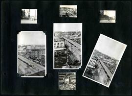
William Smaill Photo Album – Page 6
Part of William Smaill fonds
Captions read: Meeting of the rails between Winnipeg and Shoal Lake - December 1914.
Smaill, William
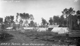
Contractor's camp at Indian Bay
Photograph of Greater Winnipeg Water District contractor Tomlinson and Fleming's camp at Indian Bay. Photograph taken by Douglas L. McLean.
Greater Winnipeg Water District
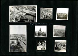
William Smaill Photo Album – Page 11
Part of William Smaill fonds
Captions read: Views from office window, Decoration Day, 1914 - Mrs. Mclean and Kathleen.
Smaill, William
William Smaill Photo Album – Page 12
Part of William Smaill fonds
Captions read: Decoration Day, 1914.
Smaill, William
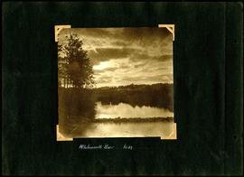
William Smaill Photo Album – Page 31
Part of William Smaill fonds
Captions read: Whitemouth River, mile 64.
Smaill, William

William Smaill Photo Album – Page 32
Part of William Smaill fonds
Captions read: Concrete mixers, mile 77.
Smaill, William

William Smaill Photo Album – Page 36
Part of William Smaill fonds
Captions read: Culvert, mile 77 - In muskeg, mile 58 - Ditch after heavy rain, mile 57 - Muskeg, mile 58 - Shaping bottom for inverts camp, mile 57.5.
Smaill, William

William Smaill Photo Album – Page 37
Part of William Smaill fonds
Captions read: Blaw Forms - Camp 2, Mile 57, Rear View - 8 foot clear muskeg - Camp 2, front view.
Smaill, William