
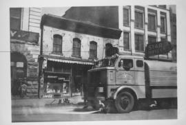
Sicard Flusher, Market Street - May 1948
- i01613
- Item
- 1948
Star Hotel, Market Café, Dirkfield's Novelty Mfg. shown in background of photograph.
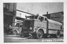
Sicard Flusher, Market Street - May 1948
Star Hotel, Market Café, Dirkfield's Novelty Mfg. shown in background of photograph.
Date of postcard is uncertain, [before 1949].
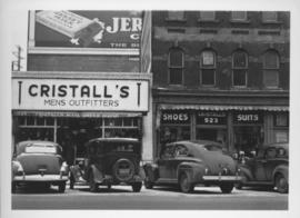
Southeast corner of back lane, north side of Market Avenue and Main Street, circa 1941
Photograph shows present site of the Centennial Concert Hall. Cristall's Mens Outfitters visible in photograph.
Entrance to Winnipeg and Parliament Buildings
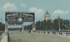
Postcard shows Osborne Street bridge, looking north. Sign over bridge says, "Welcome to Winnipeg, The Electrical City. City Hydro, Owned and Operated by its Citizens". Date of postcard is approximate, ca. 1940.
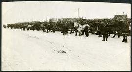
Unloading of relief wood at Greater Winnipeg Water District Station
Men at the Greater Winnipeg Water District station in St. Boniface standing in front of horses hauling wood piles for relief work. Photograph taken by Robinson Studio.
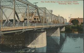
The Traffic Bridge over the Assiniboine River, Winnipeg
Date of postcard is uncertain, [before 1949].

Automobile Drive, from Royal Alexandra, Winnipeg
Date of postcard is uncertain, [before 1949].
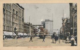
Postcard shows streetcar, horse buggies and Union Bank building.
Date of photograph is uncertain, [before 1949].
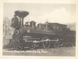
Pioneer Engine, Winnipeg, Man.
Photograph shows Countess of Dufferin. Date of photograph is approximate, ca. 1940.
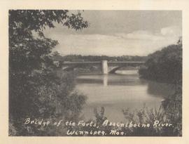
Bridge of the Forts, Assiniboine River, Winnipeg, Man.
Date of photograph is approximate, ca. 1940.
Date of photograph is approximate, ca. 1920.
VE Day in Winnipeg showing Portage Avenue and Eaton's building in background
Photograph shows Victory in Europe Day (VE Day) celebrations marking the end of World War 2 in Europe.
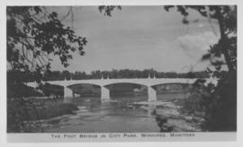
The Foot Bridge in City Park, Winnipeg, Manitoba
Photograph shows the foot bridge across the Assiniboine River in City Park. Date of photograph is approximate, ca. 1940.
![C.P.R. Yards looking West [Aerial view]](/uploads/r/city-of-winnipeg-archives-amp-records-control-branch/1/d/2/1d24b0471a50903dd76276838a7e169e4890a17020a9cfe6a0d34e153ebb9ec9/C0013_0000_0000_P0018_0027_001_142.jpg)
C.P.R. Yards looking West [Aerial view]
Inscription (on recto): WG A114 30-2-42 CPR [Canadian Pacific Railway] RR [Railroad] Yards looking West.

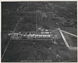
Aerial view of Stevenson Field (Winnipeg Airport)
Inscription (on recto): NE WG F24 AP117 45:55N 97.14W Stevenson Field 27-9-43 15:55 8" 6000'.
Aerial view of Stevenson Field looking South (Winnipeg Airport)
Inscription (on recto): 5A0S AP13 6-6-42 Stevenson Field looking South.
![CNR Yards [Aerial view]](/uploads/r/city-of-winnipeg-archives-amp-records-control-branch/3/a/c/3acce1afab65125da800d4ce81f386345349a1e9b9021d949ebfd6c8147f2db0/C0013_0000_0000_P0018_0044_001_142.jpg)
Inscription (on recto): WG M35: 3-8, 5 Mar '45, CNR Yards Wpg, appr scale 1/12000.