
- i00158
- Item
- 1950
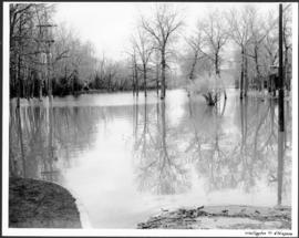
Part of City of Winnipeg (1874-1971)
A photograph of floodwater surrounding the Canada Packers plant during the 1950 flood in Winnipeg.
Harold K. White Studio
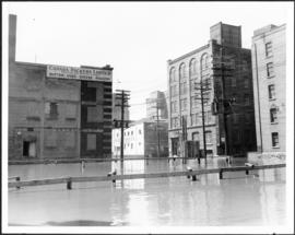
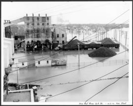
Part of City of Winnipeg (1874-1971)
A photograph of floodwater surrounding the Canada Packers plant during the 1950 flood in Winnipeg.
Harold K. White Studio
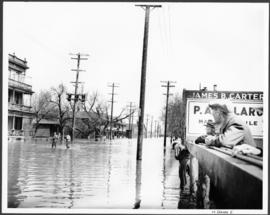
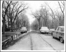
Part of City of Winnipeg (1874-1971)
A photograph of flooded Notre Dame Avenue East during the 1950 flood in Winnipeg.
Harold K. White Studio
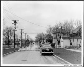
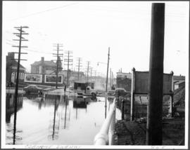
Part of City of Winnipeg (1874-1971)
A photograph, looking north, of flooding at the intersection of Atlantic Avenue and St. Cross Street during the flood of 1950 in Winnipeg.
Harold K. White Studio
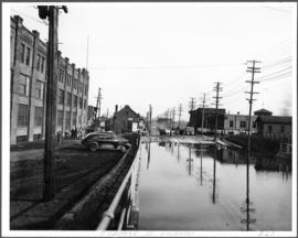
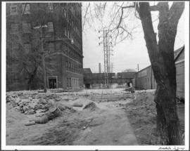
Part of City of Winnipeg (1874-1971)
A photograph of an underpass on Osborne Street during the 1950 flood in Winnipeg.
Harold K. White Studio
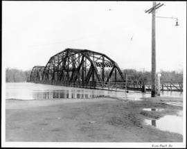
Part of City of Winnipeg (1874-1971)
A photograph of the Elm Park Bridge during the 1950 flood in Winnipeg.
Harold K. White Studio
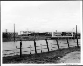
Part of City of Winnipeg (1874-1971)
A photograph of a flooded underpass on Pembina Highway during the 1950 flood in Winnipeg.
Harold K. White Studio
Part of City of Winnipeg (1874-1971)
A photograph of flooding at the corner of Wellington Crescent and Niagara Street during the 1950 flood in Winnipeg.
Harold K. White Studio

Part of City of Winnipeg (1874-1971)
A photograph of flooding at the corner of Wellington Crescent and Ash Street during the 1950 flood in Winnipeg.
Harold K. White Studio
Part of City of Winnipeg (1874-1971)
A photograph of flooding on West Gate during the 1950 flood in Winnipeg.
Harold K. White Studio

Gladstone Street from Sutherland Avenue
Part of City of Winnipeg (1874-1971)
A photograph of flooding on Gladstone Street during the 1950 flood in Winnipeg. The photograph was taken from Sutherland Avenue.
Harold K. White Studio

Causeway to Rover Street Station
Part of City of Winnipeg (1874-1971)
A photograph of high water surrounding a causeway that ran to the Rover Street hydro station during the 1950 flood.
Harold K. White Studio
From roof of Rover Sub Station. W.E. Co. Gas Plant
Part of City of Winnipeg (1874-1971)
A photograph of flooding, taken from the roof of the Rover Street hydro station, during the 1950 flood.
Harold K. White Studio
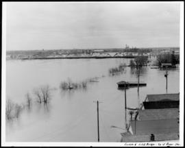
Louise and C.P.R. Bridge from top of Rover Station
Part of City of Winnipeg (1874-1971)
A photograph of the flooded Red River, nearly submerging the Louise and CPR bridges, taken from the roof of the Rover Street hydro station. Other flooded buildings can also be seen.
Harold K. White Studio
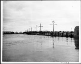
Part of City of Winnipeg (1874-1971)
A photograph of the flooded Norwood Bridge during the 1950 flood in Winnipeg.
Harold K. White Studio
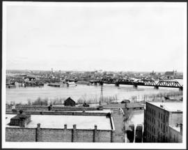
Flooding on the Red River towards St. Boniface.
Part of City of Winnipeg (1874-1971)
A photograph of the flooded Red River during the 1950 flood in Winnipeg. The photograph is taken looking toward St. Boniface.
Harold K. White Studio

Building Water Street causeway about 2nd day
Part of City of Winnipeg (1874-1971)
A photograph of the building of the Water Street causeway during the 1950 flood in Winnipeg. St. Boniface Cathedral can be seen in the background.
Harold K. White Studio
Part of City of Winnipeg (1874-1971)
A photograph of a flooded underpass on Anabella Street during the 1950 flood in Winnipeg.
Harold K. White Studio
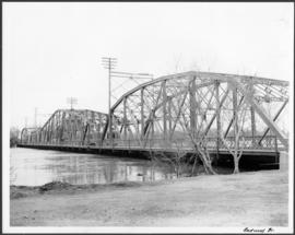
Part of City of Winnipeg (1874-1971)
A photograph of the Redwood Bridge during the 1950 flood in Winnipeg.
Harold K. White Studio
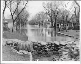
Flooding and diking in residential area
Part of City of Winnipeg (1874-1971)
A photograph of floodwater and sandbag dikes in a residential area during the 1950 flood in Winnipeg.
Harold K. White Studio
Part of City of Winnipeg (1874-1971)
A photograph of an underpass on Osborne Street during the 1950 flood in Winnipeg.
Harold K. White Studio