
William Smaill Photo Album – Page 68
- p00186
- Part
- [1914 or 1915]
Part of William Smaill fonds
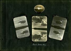
Captions read: Sunset, Indian Bay.
Smaill, William
126 results with digital objects Show results with digital objects
William Smaill Photo Album – Page 68
Part of William Smaill fonds
Captions read: Sunset, Indian Bay.
Smaill, William
William Smaill Photo Album – Page 74
Part of William Smaill fonds
Smaill, William
William Smaill Photo Album – Page 80
Part of William Smaill fonds
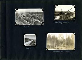
Captions read: Mile 58 - Backfilling, mile 65 - Mile 85 - Station mens hut, mile 70.
Smaill, William
William Smaill Photo Album – Page 84
Part of William Smaill fonds
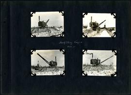
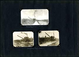
Captions read: Backfilling Camp 4, Mile 71.
Smaill, William
William Smaill Photo Album – Page 93
Part of William Smaill fonds
Captions read: Backfilling, camp 5, mile 77 - Backfilling, camp 1, mile 51 plus .
Smaill, William
William Smaill Photo Album – Page 102
Part of William Smaill fonds
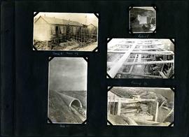
Captions read: Camp 2, mile 57 - Culvert - Camp 2- Mile 58.
Smaill, William
William Smaill Photo Album – Page 104
Part of William Smaill fonds
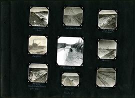
Captions read: Moving outside forms - Rails to hold sheeting - hand excavation in hardpan -Backfilling - 1st foundation fill - Rock Cut - Hardpan sloughed into trench after rain - Camp 4, mile 71 - Traveller.
Smaill, William

William Smaill Photo Album – Page 114
Part of William Smaill fonds
Blank page.
Smaill, William

William Smaill Photo Album – Page 119
Part of William Smaill fonds
Captions read: Blank Page.
Smaill, William
William Smaill Photo Album – loose page
Part of William Smaill fonds
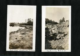
Captions read: Coal [dock?], Indian Bay, Greater Winnipeg Water District - Rock quarry, Greater Winnipeg Water District.
Smaill, William
William Smaill Photo Album – loose page
Part of William Smaill fonds
Captions read: Tube partly covered, Greater Winnipeg Water District.
Smaill, William
Part of William Smaill fonds
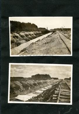
Item consists of a photo album created by William Smaill, Superintendent of the Winnipeg Aqueduct Construction Company, Ltd. The album contains photographs of the aqueduct’s construction, company men and their families, recreation, camps and homes used during construction, the Greater Winnipeg Water District Railway, and the surrounding landscape (Shoal Lake, Whitemouth River, Indian Bay, Birch River). There are also several photos of Winnipeg during Decoration Day 1914, photos of Mayors T.R. Deacon, Thomas Sharpe, and R.D. Waugh, and two photos of an Anishinaabe camp at Kekekoziibii Shoal Lake 40 First Nation.
The photos are heavily annotated. The annotations consist of names, locations, descriptions, and sometimes the section or specific mile of the aqueduct. A few photos appear to be missing and there are several loose pages with similar content. The photos are arranged somewhat chronologically – photos from 1914 generally precede photos from 1915 – but there are many exceptions.
Smaill, William

William Smaill Photo Album – Page 17
Part of William Smaill fonds
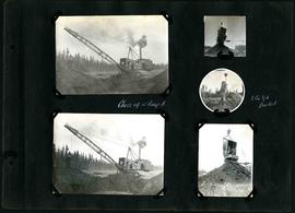
Captions read: First bucket on aqueduct - Erection number 3 class 7 at mile 64.
Smaill, William

William Smaill Photo Album – Page 18
Part of William Smaill fonds
Captions read: Class 9 at Oguaka, Iowa - Monighan machine.
Smaill, William
William Smaill Photo Album – Page 21
Part of William Smaill fonds
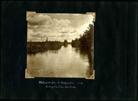
Captions read: Whitemouth River at headquarters looking east from foot bridge, mile 64.
Smaill, William
William Smaill Photo Album – Page 23
Part of William Smaill fonds
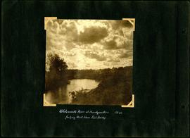
Captions read: Whitemouth River at headquarters looking west from foot bridge, Mile 64.
Smaill, William

William Smaill Photo Album – Page 24
Part of William Smaill fonds
Captions read: First foundation fill, mile 71.
Smaill, William
William Smaill Photo Album – Page 26
Part of William Smaill fonds
Captions read: Class 14 at camp 6 - 2 cubic yard bucket.
Smaill, William

William Smaill Photo Album – Page 33
Part of William Smaill fonds
Smaill, William

William Smaill Photo Album – Page 35
Part of William Smaill fonds
Captions read: Class 7 drag shows pads and rolls.
Smaill, William