

- i00179
- Item
- 1950
Part of City of Winnipeg (1874-1971)
A photograph of people boating down Oakwood Avenue in the Riverview neighbourhood during the 1950 flood in Winnipeg.
Harold K. White Studio
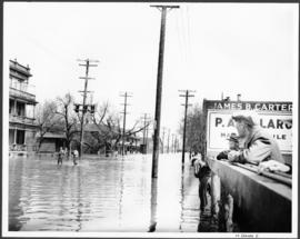
Part of City of Winnipeg (1874-1971)
A photograph of people boating down Oakwood Avenue in the Riverview neighbourhood during the 1950 flood in Winnipeg.
Harold K. White Studio
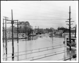
Part of City of Winnipeg (1874-1971)
A photograph of flooded Notre Dame Avenue East during the 1950 flood in Winnipeg.
Harold K. White Studio
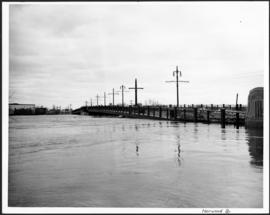
Part of City of Winnipeg (1874-1971)
A photograph of the flooded Norwood Bridge during the 1950 flood in Winnipeg.
Harold K. White Studio
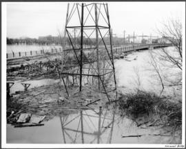
Part of City of Winnipeg (1874-1971)
A photograph of a hydro tower and the flooded Norwood Bridge during the 1950 flood in Winnipeg.
Harold K. White Studio
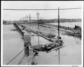
Part of City of Winnipeg (1874-1971)
A photograph of the flooded Norwood Bridge during the 1950 flood in Winnipeg.
Harold K. White Studio

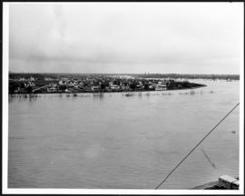
Part of City of Winnipeg (1874-1971)
A photograph of floodwater during the 1950 flood in Winnipeg. This photograph was taken looking north from the corner of Arnold Avenue and Hay Street; the Manitoba Legislature can be seen in the distance.
Harold K. White Studio

No. 8 A portion of the Lyndale dike in Norwood with the Norwood Bridge in the background
Photograph shows scene from 1950 flood. Description (on verso): Note the roof of the Greater Winnipeg Sanitary District Marion Street pumping station on the right. Stamp (on verso): City of Winnipeg - Engineering Dept., Water Works Division, Ross and Tecumseh.

Item is a photographic reproduction of map showing various sewer system details. Stamp (on verso): City of Winnipeg - Engineering Dept., Water Works Division, Ross and Tecumseh.
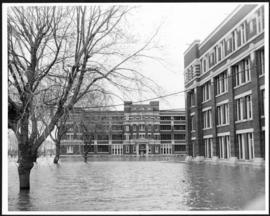
Part of City of Winnipeg (1874-1971)
A photograph of the Municipal Hospitals on Morley Street, surrounded by floodwater, during the 1950 flood in Winnipeg.
Harold K. White Studio
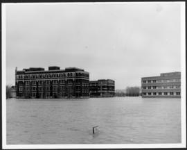
Part of City of Winnipeg (1874-1971)
A photograph of the Municipal Hospitals on Morley Street, surrounded by floodwater, during the 1950 flood in Winnipeg.
Harold K. White Studio
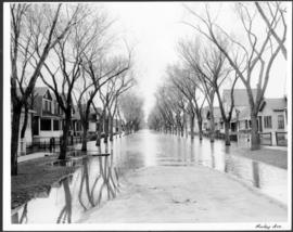
Part of City of Winnipeg (1874-1971)
A photograph of flooded Morley Avenue during the 1950 flood in Winnipeg.
Harold K. White Studio
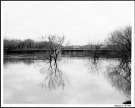
Part of City of Winnipeg (1874-1971)
A photograph of floodwater around the Maryland Bridge during the 1950 flood in Winnipeg.
Harold K. White Studio

Man in boat rowing down residential street, 1916 Flood, Norwood
Photograph shows scene from the 1916 flooding of the Assiniboine River in Norwood, unidentified man rowing down residential street at center-left of photograph.
Main Street looking south from Main Street Bridge
Part of City of Winnipeg (1874-1971)
A photograph of flooded Main Street, looking south from the Main Street Bridge, during the 1950 flood in Winnipeg.
Harold K. White Studio
Part of City of Winnipeg (1874-1971)
A photograph of the Main Street Bridge during the 1950 flood in Winnipeg. The Hotel Fort Garry can be seen in the background.
Harold K. White Studio

Part of City of Winnipeg (1874-1971)
A photograph of floodwater and sandbag dikes outside 368 and 372 Main Street during the 1950 flood in Winnipeg.
Harold K. White Studio
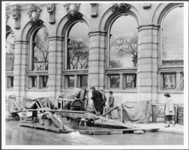
Part of City of Winnipeg (1874-1971)
A photograph of floodwater and a pump outside the Royal Bank on Main Street during the 1950 flood in Winnipeg.
Harold K. White Studio
Lyndale Drive from Pellissier Br. Roof
Part of City of Winnipeg (1874-1971)
A photograph of Lyndale Drive, surrounded by high floodwater, during the 1950 flood in Winnipeg.
Harold K. White Studio
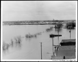
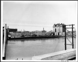
Louise and C.P.R. Bridge from top of Rover Station
Part of City of Winnipeg (1874-1971)
A photograph of the flooded Red River, nearly submerging the Louise and CPR bridges, taken from the roof of the Rover Street hydro station. Other flooded buildings can also be seen.
Harold K. White Studio
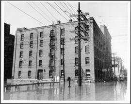
Part of City of Winnipeg (1874-1971)
A photograph of flooded Lombard Street during the 1950 flood in Winnipeg.
Harold K. White Studio