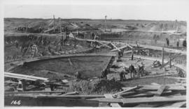
Placing material on Falcon River Diversion Dyke at Indian Bay
- i01192
- Item
- 1914
Photograph of workers using a scow to place material from cars onto the Falcon River Diversion Dyke at Indian Bay. Photograph taken by William G. Chace, Chief Engineer of the Winnipeg Aqueduct.
Greater Winnipeg Water District