
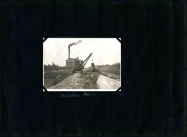
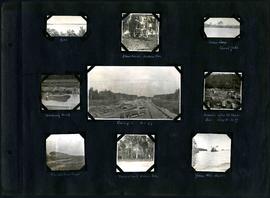
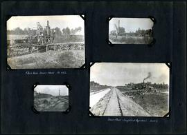
William Smaill Photo Album – Page 92
- p00210
- Part
- [1914?] - 1915
Fait partie de William Smaill fonds
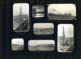
Captions read: Pile driver, mile 85 plus - Headquarter - Mile 86 - 4.5% grade - Mile 85 - Dominion Day, 1915, camp 6 - Mile 85 plus.
Sans titre
William Smaill Photo Album – Page 92
Fait partie de William Smaill fonds
Captions read: Pile driver, mile 85 plus - Headquarter - Mile 86 - 4.5% grade - Mile 85 - Dominion Day, 1915, camp 6 - Mile 85 plus.
Sans titre

William Smaill Photo Album – Page 98
Fait partie de William Smaill fonds
Captions read: Whitemouth River crossing.
Sans titre
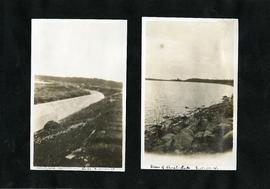
William Smaill Photo Album – Page 100
Fait partie de William Smaill fonds
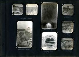
Captions read: Overflow section - Whitemouth syphon - Manhole form at sump well -Reinforcement in overflow - Bulkhead form for syphon - Overflow sump forms - Transition section.
Sans titre
William Smaill Photo Album – Page 101
Fait partie de William Smaill fonds
Captions read: Boat house, west bank - excavation for overflow and sump.
Sans titre
William Smaill Photo Album – Page 103
Fait partie de William Smaill fonds
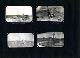
Captions read: Inverts on foundation fill, mile 71 - Trench in hardpan after rain - excavating hardpan by hand, mile 71.
Sans titre
William Smaill Photo Album – Page 105
Fait partie de William Smaill fonds
Captions read: Backfilling, mile 65.
Sans titre
William Smaill Photo Album – Page 106
Fait partie de William Smaill fonds
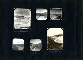
Captions read: Dyke - Blanchard's, Indian Bay - Indian Camp, Shoal Lake [Kekekoziibii Shoal Lake 40 First Nation] - Removing arch - Camp 5, mile 77 - Remains after oil House fire, camp 5, mile 77 - Excursion train, camp 6 -Tennis court, Indian Bay - Young wild ducks.
Sans titre

William Smaill Photo Album – Page 118
Fait partie de William Smaill fonds
Captions read: Blank Page.
Sans titre

William Smaill Photo Album – loose page
Fait partie de William Smaill fonds
Captions read: Bunk houses, rock plant, Greater Winnipeg Water District - Rock crushing plant, Greater Winnipeg Water District.
Sans titre
William Smaill Photo Album – loose page
Fait partie de William Smaill fonds
Captions read: Completed aqueduct tube, Greater Winnipeg Water District - View of Shoal Lake, Greater Winnipeg Water District.
Sans titre
William Smaill Photo Album – loose page
Fait partie de William Smaill fonds
Captions read: Rock plant camp, on a Sunday, Greater Winnipeg Water District.
Sans titre

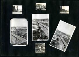
William Smaill Photo Album – Page 6
Fait partie de William Smaill fonds
Captions read: Meeting of the rails between Winnipeg and Shoal Lake - December 1914.
Sans titre
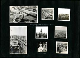
William Smaill Photo Album – Page 11
Fait partie de William Smaill fonds
Captions read: Views from office window, Decoration Day, 1914 - Mrs. Mclean and Kathleen.
Sans titre
William Smaill Photo Album – Page 12
Fait partie de William Smaill fonds
Captions read: Decoration Day, 1914.
Sans titre
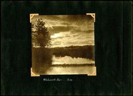
William Smaill Photo Album – Page 31
Fait partie de William Smaill fonds
Captions read: Whitemouth River, mile 64.
Sans titre

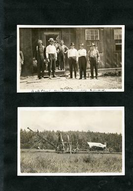
William Smaill Photo Album – Page 32
Fait partie de William Smaill fonds
Captions read: Concrete mixers, mile 77.
Sans titre

William Smaill Photo Album – Page 36
Fait partie de William Smaill fonds
Captions read: Culvert, mile 77 - In muskeg, mile 58 - Ditch after heavy rain, mile 57 - Muskeg, mile 58 - Shaping bottom for inverts camp, mile 57.5.
Sans titre

William Smaill Photo Album – Page 37
Fait partie de William Smaill fonds
Captions read: Blaw Forms - Camp 2, Mile 57, Rear View - 8 foot clear muskeg - Camp 2, front view.
Sans titre
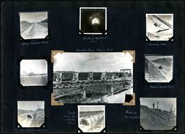
William Smaill Photo Album – Page 40
Fait partie de William Smaill fonds
Captions read: Dump ready for track - Inside of Aqueduct, mile 65 - Handling pads - Concrete train camp 3, mile 65 - Moving inside forms - First arch poured, mile 64 - Traveler moving the outside forms - Ready for pouring invert.
Sans titre
William Smaill Photo Album – Page 43
Fait partie de William Smaill fonds
Captions read: Close view, mixer plant, mile 64 1/2 - Mixer plant and completed aqueduct, mile 64.5.
Sans titre