

- i00121
- Pièce
- May 15, 1950
Fait partie de City of Winnipeg (1874-1971)
A photograph of flooding on Disraeli St during the 1950 flood. The photograph shows a child standing on a pile of lumber beside the flooded street.
Sans titre
Fait partie de City of Winnipeg (1874-1971)
A photograph of flooding on Disraeli St during the 1950 flood. The photograph shows a child standing on a pile of lumber beside the flooded street.
Sans titre

Fait partie de City of Winnipeg (1874-1971)
A photograph of children on Higgins Avenue during the 1950 flood. Piles of earth and sandbags line the street.
Sans titre

Fait partie de City of Winnipeg (1874-1971)
A photograph of a flooded underpass on Higgins Avenue during the 1950 flood.
Sans titre

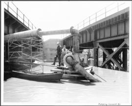
Pumping water on Robert Street
Fait partie de City of Winnipeg (1874-1971)
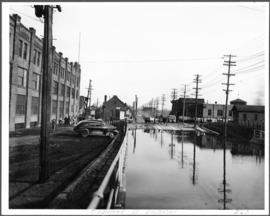
A photograph of a pipe pouring water onto tracks on Robert Street (Galt Avenue) during the 1950 flood. A pile of wood is along one side of the street. The Ogilvie Flour Mill can be seen in the background.
Sans titre
Fait partie de City of Winnipeg (1874-1971)
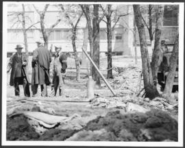
A photograph of three men building a dike during the 1950 flood.
Sans titre
Fait partie de City of Winnipeg (1874-1971)
A photograph of two men working with pumps to remove water from the Norwood Bridge during the 1950 flood in Winnipeg.
Sans titre
Fait partie de City of Winnipeg (1874-1971)
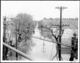
A photograph of hydro wires along flooded Bell Avenue during the 1950 flood in Winnipeg.
Sans titre

Fait partie de City of Winnipeg (1874-1971)
A photograph, taken from the north, of a flooded underpass on Anabella Street during the 1950 flood in Winnipeg. Some people in a boat are travelling down the street.
Sans titre
Fait partie de City of Winnipeg (1874-1971)
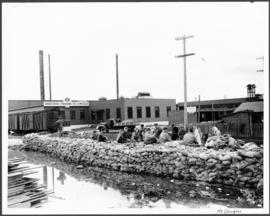
A photograph of a group of people sitting on a sandbag dike in Point Douglas during the 1950 flood in Winnipeg.
Sans titre
Fait partie de City of Winnipeg (1874-1971)
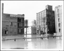
A photograph of floodwater surrounding the Canada Packers plant during the 1950 flood in Winnipeg.
Sans titre
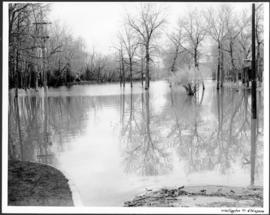
Fait partie de City of Winnipeg (1874-1971)
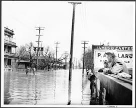
A photograph of flooded Notre Dame Avenue East during the 1950 flood in Winnipeg.
Sans titre
Fait partie de City of Winnipeg (1874-1971)
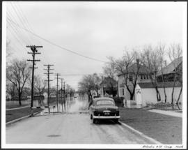
A photograph, looking north, of flooding at the intersection of Atlantic Avenue and St. Cross Street during the flood of 1950 in Winnipeg.
Sans titre
Fait partie de City of Winnipeg (1874-1971)
A photograph of an underpass on Osborne Street during the 1950 flood in Winnipeg.
Sans titre
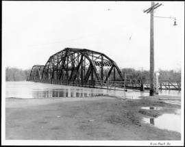
Fait partie de City of Winnipeg (1874-1971)
A photograph of the Elm Park Bridge during the 1950 flood in Winnipeg.
Sans titre
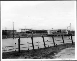
Fait partie de City of Winnipeg (1874-1971)
A photograph of a flooded underpass on Pembina Highway during the 1950 flood in Winnipeg.
Sans titre
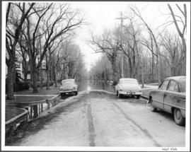
Fait partie de City of Winnipeg (1874-1971)
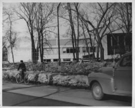
A photograph of flooding at the corner of Wellington Crescent and Niagara Street during the 1950 flood in Winnipeg.
Sans titre

Fait partie de City of Winnipeg (1874-1971)
A photograph of flooding at the corner of Wellington Crescent and Ash Street during the 1950 flood in Winnipeg.
Sans titre
Fait partie de City of Winnipeg (1874-1971)
A photograph of flooding on West Gate during the 1950 flood in Winnipeg.
Sans titre
Dyking built up around Shaarey Zedek Synagogue, 1950 Flood
Fait partie de City of Winnipeg Archives Photograph collection
Photograph taken at Shaarey Zedek Synagogue, 561 Wellington Crescent off Academy Road, on the western bank of the Assiniboine River. - Stamp (on verso): by Harold K. White Studio, 274 Fort St. Winnipeg, Phone 924 289.
Sans titre

Gladstone Street from Sutherland Avenue
Fait partie de City of Winnipeg (1874-1971)
A photograph of flooding on Gladstone Street during the 1950 flood in Winnipeg. The photograph was taken from Sutherland Avenue.
Sans titre