
- i01168
- Pièce
- 1939
Fait partie de City of Winnipeg (1874-1971)
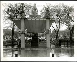
A photograph of a stage in front of City Hall, built for the visit to Winnipeg of Their Majesties King George VI and Queen Elizabeth on May 24, 1939.
Sans titre
77 résultats avec objets numériques Afficher les résultats avec des objets numériques
Fait partie de City of Winnipeg (1874-1971)
A photograph of a stage in front of City Hall, built for the visit to Winnipeg of Their Majesties King George VI and Queen Elizabeth on May 24, 1939.
Sans titre
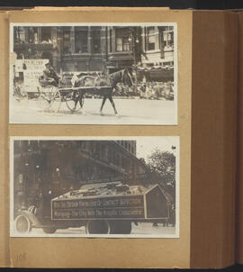
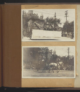
St. Boniface Police and Municipal Hospitals floats
Fait partie de City of Winnipeg (1874-1971)
Sans titre
Scrapbook [1950 flood photographs]
Fait partie de City of Winnipeg (1874-1971)
Subseries consists of a scrapbook assembled by the City Engineering Department to serve as photographic evidence of the 1950 flood. It contains black and white photographs that mostly document flooding in residential areas near the Red River (Fort Rouge, Riverview, North End, Point Douglas, Crescentwood, Armstrong's Point and others). Scrapbook appears to be organized geographically by area and street. In addition to documenting flooding, the photographs provide a detailed record of residential neighbourhoods, houses, streets, and businesses like corner grocery stores and laundries. All photographs were taken by Harold K. White Studio.
Sans titre
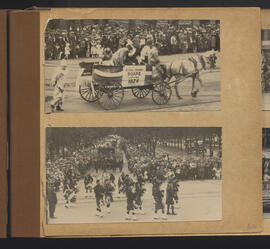
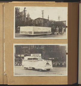
Royal Crown Soaps and marching bagpipers
Fait partie de City of Winnipeg (1874-1971)
Sans titre
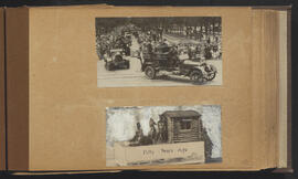
Row of cars and “Fifty Years Ago” drawing for Winnipeg’s 50th Anniversary parade
Fait partie de City of Winnipeg (1874-1971)
Sans titre
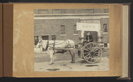
Robinson & Co. Float and horse-drawn cart
Fait partie de City of Winnipeg (1874-1971)
Sans titre
Robinson & Co. And Public Baths Department floats
Fait partie de City of Winnipeg (1874-1971)
Sans titre
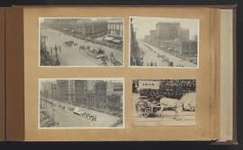
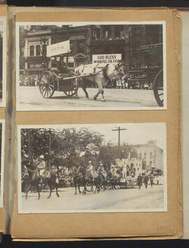
Red River cart and other parade scenes at Portage and Main and at Notre Dame
Fait partie de City of Winnipeg (1874-1971)
Sans titre
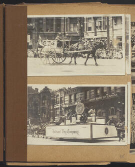
Red River cart and Hudson’s Bay Company float
Fait partie de City of Winnipeg (1874-1971)
Sans titre
Red River cart and Fort Garry floats
Fait partie de City of Winnipeg (1874-1971)
Sans titre
Fait partie de City of Winnipeg (1874-1971)
Sans titre

Pumping water on Robert Street
Fait partie de City of Winnipeg (1874-1971)
A photograph of a pipe pouring water onto tracks on Robert Street (Galt Avenue) during the 1950 flood. A pile of wood is along one side of the street. The Ogilvie Flour Mill can be seen in the background.
Sans titre

Pontoon Bridge, Fort Garry and Warehouse from south side Assiniboine River
Fait partie de City of Winnipeg (1874-1971)
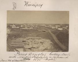
Point Douglas looking north with City Hall foundation in foreground, August 1875
Fait partie de City of Winnipeg (1874-1971)
Photograph taken from top of Courthouse.

Point Douglas from Courthouse, 1874
Fait partie de City of Winnipeg (1874-1971)

Part of East Ward, St. Boniface in the distance
Fait partie de City of Winnipeg (1874-1971)
Photograph taken from top of Courthouse.

Fait partie de City of Winnipeg (1874-1971)
A photograph of the intersection of Broadway and Osborne Street during the 1950 flood in Winnipeg. The photo is taken from Osborne Street, looking north; the stone cross of All Saints' Church can be seen near the left side of the image.
Sans titre

North side of Lombard, Rorie to Main Street
Fait partie de City of Winnipeg (1874-1971)
A photograph of storefronts and advertisements on the north side of Lombard Avenue, between Rorie Street and Main Street. The photograph is part of small album containing photographs of maps tracking the outbreak of typhoid from 1905 to 1909 and other scenes. Item is loose and at back of album.
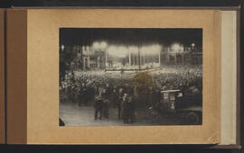
Night gathering for Winnipeg’s 50th anniversary
Fait partie de City of Winnipeg (1874-1971)
Sans titre
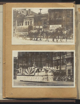
National Cartage and other float
Fait partie de City of Winnipeg (1874-1971)
Sans titre