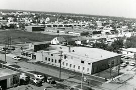
7-eleven and Shell station on Rothesay between Edison and Kingsford
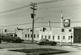
7-eleven and Shell station on Rothesay between Edison and Kingsford
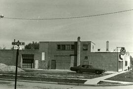
7-Eleven at the corner of Rothesay and Kingsford
![A corner of our flower bed [146 Spence Street]](/uploads/r/city-of-winnipeg-archives-amp-records-control-branch/8/3/0/8303d86cfc1c3c535a8e5720f2911f54450e682e3755309c35bb6135bc015541/C0013_0000_0000_P0022_0095_055_142.jpg)
A corner of our flower bed [146 Spence Street]

A few of Winnipeg's handsome buildings
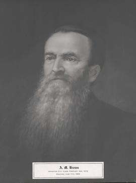
A. M. Brown, City Clerk

A military funeral, Broadway and Spence Streets, Winnipeg - 1914

Aerial photograph area west of Red River, south of Winnipeg City Limits, 1943
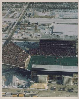
Aerial photograph of the Winnipeg Stadium during the 1991 Grey Cup Game

Aerial photograph Red River north from southern boundaries of North Kildonan and West St. Paul, north of Winnipeg, 1943

Aerial photograph south of Winnipeg, east of Red River, 1943

Aerial photograph south side of Assiniboine River, west from Assiniboine Park, 1943
Aerial view looking south from over Wesley Park at rear of United College

Aerial view of East Kildonan

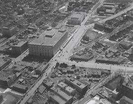
Aerial view of intersection at Portage Avenue and Main Street

Aerial view of Point Douglas, St. Boniface, and Elmwood areas

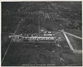
Aerial view of RCAF Equipment Depot Number 2

Aerial view of Riverview, St. Vital, and Wildwood
Aerial view of Stevenson Field looking South (Winnipeg Airport)

Aerial view of Stevenson Field (Winnipeg Airport)
