
- p00306
- Part
- [ca. 1903]
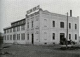
Photograph of the Vulcan Iron Works on page 153 of the Illustrated Souvenir of Winnipeg, published by W.M. Maretl and Sons, Half-Tone Engravers, in Winnipeg ca. 1903.
390 results with digital objects Show results with digital objects
Photograph of the Vulcan Iron Works on page 153 of the Illustrated Souvenir of Winnipeg, published by W.M. Maretl and Sons, Half-Tone Engravers, in Winnipeg ca. 1903.
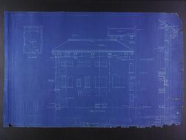
West elevation plans for the Club Building for the Columbus Hall Association
Part of City of Winnipeg (1874-1971)
Blueprint plans of west elevation of the Club Building for the Columbus Hall Association Ltd. on the southwest corner of Graham Avenue and Smith Street. Designed by John D. Atchison. Drawing 8 of 11.
Atchison, John D.
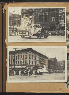
White Star float and parade at corner of Main and Market
Part of City of Winnipeg (1874-1971)
Winnipeg (Man.). Special Jubilee Committee

William Smaill Photo Album – loose page
Part of William Smaill fonds
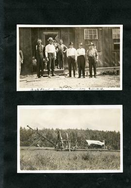
Captions read: Bunk houses, rock plant, Greater Winnipeg Water District - Rock crushing plant, Greater Winnipeg Water District.
Smaill, William
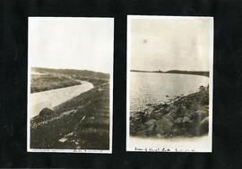
William Smaill Photo Album – loose page
Part of William Smaill fonds
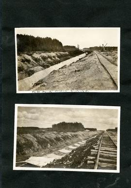
Captions read: Completed aqueduct tube, Greater Winnipeg Water District - View of Shoal Lake, Greater Winnipeg Water District.
Smaill, William
William Smaill Photo Album – loose page
Part of William Smaill fonds
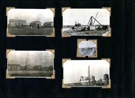
Captions read: Rock plant camp, on a Sunday, Greater Winnipeg Water District.
Smaill, William
William Smaill Photo Album – loose page
Part of William Smaill fonds
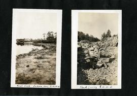
Captions read: Coal [dock?], Indian Bay, Greater Winnipeg Water District - Rock quarry, Greater Winnipeg Water District.
Smaill, William
William Smaill Photo Album – loose page
Part of William Smaill fonds
Captions read: Tube partly covered, Greater Winnipeg Water District.
Smaill, William
William Smaill Photo Album – loose page
Part of William Smaill fonds
Captions read: Contains no captions.
Smaill, William

William Smaill Photo Album – loose page
Part of William Smaill fonds
Captions read: Water tank, Indian Bay, Greater Winnipeg Water District.
Smaill, William
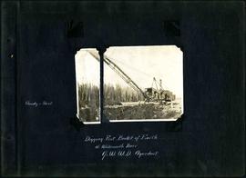
William Smaill Photo Album – Page 1
Part of William Smaill fonds
Captions read: Cloudy and sleet - Digging first bucket of earth at Whitemouth River, Greater Winnipeg Water District aqueduct.
Smaill, William

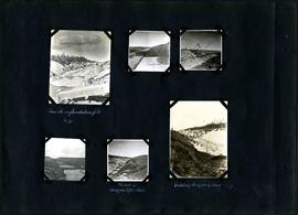
William Smaill Photo Album – Page 10
Part of William Smaill fonds
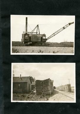
Captions read: Views at Greater Winnipeg Water District gravel pit.
Smaill, William
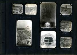
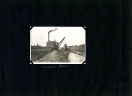
William Smaill Photo Album – Page 100
Part of William Smaill fonds
Captions read: Overflow section - Whitemouth syphon - Manhole form at sump well -Reinforcement in overflow - Bulkhead form for syphon - Overflow sump forms - Transition section.
Smaill, William
William Smaill Photo Album – Page 101
Part of William Smaill fonds
Captions read: Boat house, west bank - excavation for overflow and sump.
Smaill, William
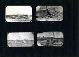
William Smaill Photo Album – Page 102
Part of William Smaill fonds
Captions read: Camp 2, mile 57 - Culvert - Camp 2- Mile 58.
Smaill, William
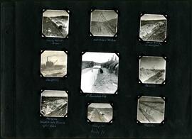
William Smaill Photo Album – Page 103
Part of William Smaill fonds
Captions read: Inverts on foundation fill, mile 71 - Trench in hardpan after rain - excavating hardpan by hand, mile 71.
Smaill, William
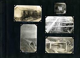
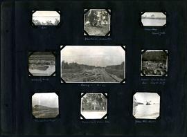
William Smaill Photo Album – Page 104
Part of William Smaill fonds
Captions read: Moving outside forms - Rails to hold sheeting - hand excavation in hardpan -Backfilling - 1st foundation fill - Rock Cut - Hardpan sloughed into trench after rain - Camp 4, mile 71 - Traveller.
Smaill, William
William Smaill Photo Album – Page 105
Part of William Smaill fonds
Captions read: Backfilling, mile 65.
Smaill, William
William Smaill Photo Album – Page 106
Part of William Smaill fonds
Captions read: Dyke - Blanchard's, Indian Bay - Indian Camp, Shoal Lake [Kekekoziibii Shoal Lake 40 First Nation] - Removing arch - Camp 5, mile 77 - Remains after oil House fire, camp 5, mile 77 - Excursion train, camp 6 -Tennis court, Indian Bay - Young wild ducks.
Smaill, William
William Smaill Photo Album – Page 107
Part of William Smaill fonds
Smaill, William