
- i02075
- Pièce
- 1950
Fait partie de City of Winnipeg Archives Photograph collection
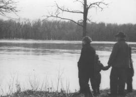
Photograph shows four people on riverbank looking out at high waters and flooded area in Wildwood Park during 1950 Flood.
31 résultats avec objets numériques Afficher les résultats avec des objets numériques
Fait partie de City of Winnipeg Archives Photograph collection
Photograph shows four people on riverbank looking out at high waters and flooded area in Wildwood Park during 1950 Flood.
![Kildonan Park [Aerial view]](/uploads/r/city-of-winnipeg-archives-amp-records-control-branch/f/1/2/f128f88f8d2c2c0c11c754244bf269182c057eec594b0ca1962384f7a8471152/C0013_0000_0000_P0018_0036_001_142.jpg)
Fait partie de City of Winnipeg Archives Photograph collection
Inscription (on recto): WG M35: 2-16, 5 Mar '45, Kildonan Park Wpg [Winnipeg], appox scale 1/12000.

Aerial photograph south of Winnipeg, east of Red River, 1943
Fait partie de City of Winnipeg Archives Photograph collection
Photograph shows an aerial view of south of Winnipeg, east of Red River. Photograph dated December 2, 1943.

Fait partie de City of Winnipeg Archives Photograph collection
Photograph shows an aerial view of the Red River north from the southern boundaries of North Kildonan and West St. Paul, north of Winnipeg. Photograph is dated December 2, 1943.

Aerial photograph south side of Assiniboine River, west from Assiniboine Park, 1943
Fait partie de City of Winnipeg Archives Photograph collection
Photograph shows an aerial view of the south side of the Assiniboine River, west from Assiniboine Park. Photograph is dated December 2, 1943.

Aerial photograph area west of Red River, south of Winnipeg City Limits, 1943
Fait partie de City of Winnipeg Archives Photograph collection
Photograph shows an aerial view of the area west of Red River, south of Winnipeg City Limits. Photograph is dated December 2, 1943.
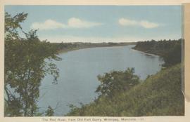
The Red River, from Old Fort Garry, Winnipeg, Manitoba
Fait partie de City of Winnipeg Archives Photograph collection
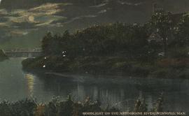
Moonlight on the Assiniboine River, Winnipeg, Man.
Fait partie de City of Winnipeg Archives Photograph collection
Date of postcard is uncertain, [before 1949].
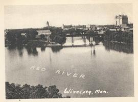
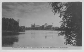
Junction of Red River and Assiniboine River
Fait partie de City of Winnipeg Archives Photograph collection
Photograph shows Fort Garry Hotel in background. Date of photograph is approximate, ca. 1940.
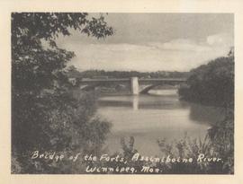
Bridge of the Forts, Assiniboine River, Winnipeg, Man.
Fait partie de City of Winnipeg Archives Photograph collection
Date of photograph is approximate, ca. 1940.
Junction of Red and Assiniboine Rivers, Winnipeg, Manitoba
Fait partie de City of Winnipeg Archives Photograph collection
Date of photograph is approximate, ca. 1940.
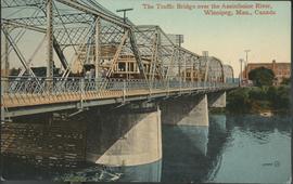
The Traffic Bridge over the Assiniboine River, Winnipeg
Fait partie de City of Winnipeg Archives Photograph collection
Date of postcard is uncertain, [before 1949].
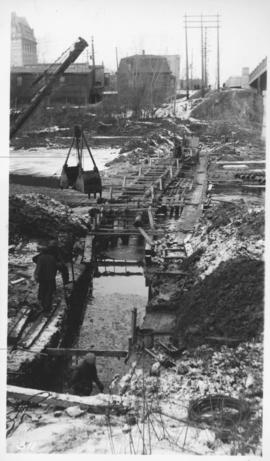
Assiniboine River crossing at Main Street, laying pipe
Fait partie de City of Winnipeg Archives Photograph collection
Photograph shows construction of sewer.
Fait partie de City of Winnipeg Archives Photograph collection
Photograph shows Assiniboine Park with pavilion and river in view. Date of photograph is approximate, ca. 1940.
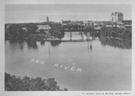
The Assiniboine River joining the Red River, Winnipeg, Manitoba
Fait partie de City of Winnipeg Archives Photograph collection
Print shows a photographic image of the Red and Assiniboine rivers joining at the Forks.
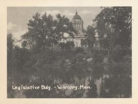
Legislative Bldg., Winnipeg, Man.
Fait partie de City of Winnipeg Archives Photograph collection
Photograph shows Legislative building and view looking north over Assiniboine River. Date of photograph is approximate, ca. 1940.
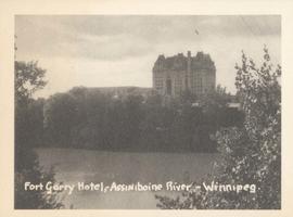
Fort Garry Hotel, Assiniboine River - Winnipeg
Fait partie de City of Winnipeg Archives Photograph collection
Photograph shows Fort Garry Hotel with view looking northwest over Assiniboine River. Date of photograph is approximate, ca. 1940.
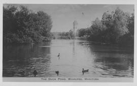
The Duck Pond, Winnipeg, Manitoba
Fait partie de City of Winnipeg Archives Photograph collection
Photograph shows duck pond in Assiniboine Park. Date of photograph is approximate, ca. 1940.
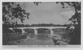
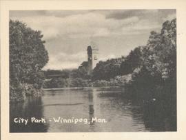
The Foot Bridge in City Park, Winnipeg, Manitoba
Fait partie de City of Winnipeg Archives Photograph collection
Photograph shows the foot bridge across the Assiniboine River in City Park. Date of photograph is approximate, ca. 1940.

View looking west over Red River into downtown Winnipeg from St. Boniface
Fait partie de City of Winnipeg Archives Photograph collection
Photograph shows view of downtown Winnipeg, between Notre Dame Avenue East (Pioneer Avenue) and Lombard Avenue. Barge on the Red River also appears in photograph. Date of photograph is approximate, ca. 1930.