
Showing 29 results
archival descriptions29 results with digital objects Show results with digital objects

1950 Flood - Flood Evacuees at the St. Boniface train station

Assiniboine Bridge

Colony Street and Whitehall Avenue
Dyking built up around Shaarey Zedek Synagogue, 1950 Flood
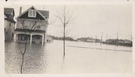
Flood water over front porch of home, 1916 Flood, Norwood

Flooded residential street, 1916 Flood, Norwood

Floods - St. Boniface and Norwood - April 1916

Foot of Colony Street

Foot of Water Street, C.N.R. Bridge - the Flood
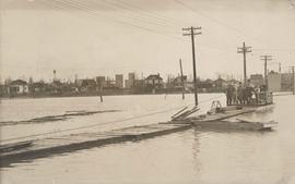
Group of people on barge with flood waters all around, 1916 Flood, Norwood
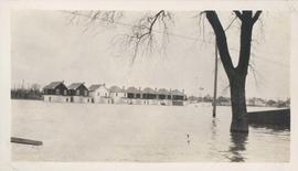
Homes under water on residential street, 1916 Flood, Norwood

Man in boat rowing down residential street, 1916 Flood, Norwood

No. 4 Plan of City of Winnipeg and environs showing sewer district boundaries, trunk sewers, Greater Winnipeg Sanitary District Interceptor, sewage pumping stations and underpasses

No. 8 A portion of the Lyndale dike in Norwood with the Norwood Bridge in the background
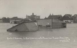
Rue De L'Hopital et Rue Langevin, St. Boniface Floods, April 1916

Rue Langevin, Floods, St. Boniface - April 1916

Rue Langevin, St. Boniface under water floods April 1916, showing men in boat
![Sandbags - E sec [section] (Wildwood Park - flood, 1950)](/uploads/r/city-of-winnipeg-archives-amp-records-control-branch/c/4/a/c4a7e5ee657f2cf565da1e983d41beae65af0b67f4b9fb5fa71c540b99003de4/C0013_0000_0000_P0022_0094_001_142.jpg)
Sandbags - E sec [section] (Wildwood Park - flood, 1950)

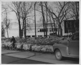
Sandbags on the dyke (Wildwood Park - flood, 1950)

St. Boniface
Results 1 to 20 of 29