
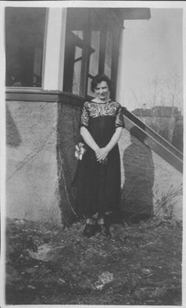
Neta Turner in front of house in Fort Garry, Winnipeg
- i02114
- Item
- 1918
Date of photograph is approximate, ca. 1918.
7 results with digital objects Show results with digital objects
Neta Turner in front of house in Fort Garry, Winnipeg
Date of photograph is approximate, ca. 1918.
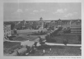
Basic Training Centre at Fort Garry, Winnipeg, Manitoba
Print shows a photographic image of the basic training centre at the University Manitoba in Fort Garry.

Aerial photograph south of Winnipeg, east of Red River, 1943
Photograph shows an aerial view of south of Winnipeg, east of Red River. Photograph dated December 2, 1943.

Aerial photograph area west of Red River, south of Winnipeg City Limits, 1943
Photograph shows an aerial view of the area west of Red River, south of Winnipeg City Limits. Photograph is dated December 2, 1943.

Aerial view of Riverview, St. Vital, and Wildwood
Aerial view of the Riverview area of Fort Rouge, including Osborne Street; the Wildwood area of Fort Garry; and the Kingston Crescent, Elm Park, Varennes, St. George, and Glenlawn areas of St. Vital, including Kingston Row, St. Mary’s Road, and St. Anne’s Road.

Winnipeg’s Best Tourist Cabin Camp on Pembina Highway
Postcard featuring “Winnipeg’s Best Tourist Cabin Camp”, located on Pembina Highway (then Highway Number 14) around Chevrier Boulevard.

Winnipeg Tourist Cabins and Camp Park on Pembina Highway
Postcard featuring “Winnipeg Tourist Cabins and Camp Park”, located on Pembina Highway (then Highway Number 14) around Chevrier Boulevard.