
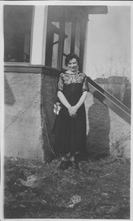
Neta Turner in front of house in Fort Garry, Winnipeg
- i02114
- Pièce
- 1918
Fait partie de City of Winnipeg Archives Photograph collection
Date of photograph is approximate, ca. 1918.
8 résultats avec objets numériques Afficher les résultats avec des objets numériques
Neta Turner in front of house in Fort Garry, Winnipeg
Fait partie de City of Winnipeg Archives Photograph collection
Date of photograph is approximate, ca. 1918.

Winnipeg’s Best Tourist Cabin Camp on Pembina Highway
Fait partie de City of Winnipeg Archives Photograph collection
Postcard featuring “Winnipeg’s Best Tourist Cabin Camp”, located on Pembina Highway (then Highway Number 14) around Chevrier Boulevard.

Winnipeg Tourist Cabins and Camp Park on Pembina Highway
Fait partie de City of Winnipeg Archives Photograph collection
Postcard featuring “Winnipeg Tourist Cabins and Camp Park”, located on Pembina Highway (then Highway Number 14) around Chevrier Boulevard.

Aerial photograph south of Winnipeg, east of Red River, 1943
Fait partie de City of Winnipeg Archives Photograph collection
Photograph shows an aerial view of south of Winnipeg, east of Red River. Photograph dated December 2, 1943.

Aerial photograph area west of Red River, south of Winnipeg City Limits, 1943
Fait partie de City of Winnipeg Archives Photograph collection
Photograph shows an aerial view of the area west of Red River, south of Winnipeg City Limits. Photograph is dated December 2, 1943.

Aerial view of Riverview, St. Vital, and Wildwood
Fait partie de City of Winnipeg Archives Photograph collection
Aerial view of the Riverview area of Fort Rouge, including Osborne Street; the Wildwood area of Fort Garry; and the Kingston Crescent, Elm Park, Varennes, St. George, and Glenlawn areas of St. Vital, including Kingston Row, St. Mary’s Road, and St. Anne’s Road.
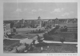
Basic Training Centre at Fort Garry, Winnipeg, Manitoba
Fait partie de City of Winnipeg Archives Photograph collection
Print shows a photographic image of the basic training centre at the University Manitoba in Fort Garry.

Southgate Shopping Centre panorama
Fait partie de City of Winnipeg Archives Photograph collection
View of Southgate Village Shopping Centre, 1305-1341 Pembina Highway at the southwest corner of McGillivray Boulevard, 3.3 acres. From left to right: Pembina Curling Rink, Imperial Cleaners, Safeway, The Place, Young Togs, Reid Marshall Pharmacy, The Village Gift Shop, The French Salon, Marshall Wells, The Toronto Dominion Bank, Safeway gas bar. Consists of 3 separate photographs pasted together on cardboard to create a panorama. The cardboard is a scrap made from an old sign of the Metropolitan Corporation of Greater Winnipeg (visible on the reverse). The cardboard is numbered “7”, presumably as part of a compilation with other shopping centre panoramas.
Sans titre