

1950 Flood - Flood Evacuees at the St. Boniface train station
- i01553
- Pièce
- 1950
Fait partie de City of Winnipeg Archives Photograph collection
A Short, Pictorial Documentary on the Winnipeg Flood of 1950
Sans titre
1950 Flood - Flood Evacuees at the St. Boniface train station
Fait partie de City of Winnipeg Archives Photograph collection
A Short, Pictorial Documentary on the Winnipeg Flood of 1950
Sans titre

No. 8 A portion of the Lyndale dike in Norwood with the Norwood Bridge in the background
Fait partie de City of Winnipeg Archives Photograph collection
Photograph shows scene from 1950 flood. Description (on verso): Note the roof of the Greater Winnipeg Sanitary District Marion Street pumping station on the right. Stamp (on verso): City of Winnipeg - Engineering Dept., Water Works Division, Ross and Tecumseh.
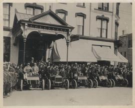
Cars and drivers, Clarendon Hotel
Fait partie de City of Winnipeg Archives Photograph collection
Photograph shows cars and drivers at Clarendon Hotel, northwest corner of Donald Street and Portage Avenue. - Inscription (on verso): 1st car, R. M. McLeod and R. Newman 2nd car, W. C. Power at wheel. 3rd car, Kelly Bros. 4th car, Douglas M. McLaughlin and Bert Wells (standing between cars is Ace Emmett). 5th car, Jack McCullock and Jimmy Boswell. - Date of photograph is approximate, ca. 1904.

Fait partie de City of Winnipeg Archives Photograph collection
Photograph shows old St. James Bridge approach, looking North up present Kintrye Street. Viscount Gort site centre right/Hydro sub-station - St. James Street and Portage Avenue far left. Date of photograph is uncertain [after 1932].

Fait partie de City of Winnipeg Archives Photograph collection
Photograph shows old St. James Bridge approach, looking north up Madison Street (now Century Street/Route 90). Present Viscount Gort site in center. Date of photograph is uncertain, [after 1932].
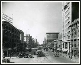
Portage Avenue looking west from Main Street
Fait partie de City of Winnipeg Archives Photograph collection
Date of photograph is approximate, ca. 1927.
Fait partie de City of Winnipeg Archives Photograph collection
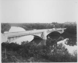
Photograph shows Maryland Street Bridge looking southeast into Crescentwood. Date of photograph is approximate, ca. 1925.
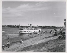
S.S. Keenora at Lower Fort Garry
Fait partie de City of Winnipeg Archives Photograph collection
Date of photograph is approximate, ca. 1940.

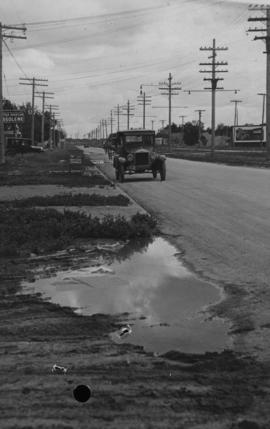
Main Street, south of Seven Oaks, 48 hours after rain
Fait partie de City of Winnipeg Archives Photograph collection
Date of photograph is July 8, 1932.

Crane and David, Bakers and Confectioners
Fait partie de City of Winnipeg Archives Photograph collection
Staff standing in front of Crane and David Bakers and Confectioners at 765 Dufferin Avenue and a horse-drawn delivery cart.

Winnipeg Street Railway on Portage Avenue in front of Merchants Hotel
Fait partie de City of Winnipeg Archives Photograph collection
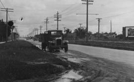
Main Street at Kilbridge, 48 hours after rain
Fait partie de City of Winnipeg Archives Photograph collection
Date of photograph is July 1, 1932.
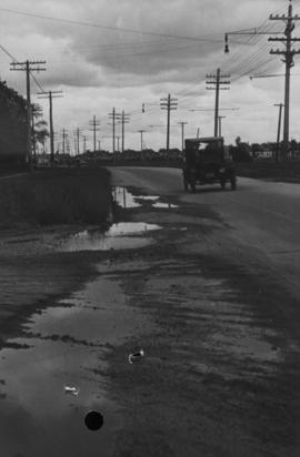
Main Street - Hartford to Belmont, 48 hours after rain
Fait partie de City of Winnipeg Archives Photograph collection
Date of photograph is July 1, 1932.
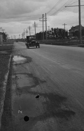
Main Street, corner Seven Oaks, Rainfall, June 29, 1932
Fait partie de City of Winnipeg Archives Photograph collection
Photograph is dated July 1, 1932.
Main Street - Perth to Hartford, Rainfall, June 29, 1932
Fait partie de City of Winnipeg Archives Photograph collection
Photograph is dated July 1, 1932.