

- i00179
- Item
- 1950
Part of City of Winnipeg (1874-1971)
A photograph of people boating down Oakwood Avenue in the Riverview neighbourhood during the 1950 flood in Winnipeg.
Harold K. White Studio
250 results with digital objects Show results with digital objects
Part of City of Winnipeg (1874-1971)
A photograph of people boating down Oakwood Avenue in the Riverview neighbourhood during the 1950 flood in Winnipeg.
Harold K. White Studio

Part of City of Winnipeg (1874-1971)
A photograph of floodwater being held back by a sandbag dike during the 1950 flood in Winnipeg.
Harold K. White Studio
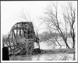
Part of City of Winnipeg (1874-1971)
A photograph of the Elm Park Bridge during the 1950 flood in Winnipeg.
Harold K. White Studio
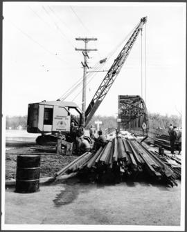
Part of City of Winnipeg (1874-1971)
A photograph of construction equipment and lumber at the Elm Park Bridge during the 1950 flood in Winnipeg.
Harold K. White Studio
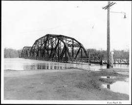
Part of City of Winnipeg (1874-1971)
A photograph of the Elm Park Bridge during the 1950 flood in Winnipeg.
Harold K. White Studio
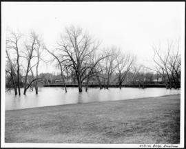
Part of City of Winnipeg (1874-1971)
A photograph of the downstream Osborne Street Bridge during the 1950 flood in Winnipeg.
Harold K. White Studio
Part of City of Winnipeg (1874-1971)
A photograph of an underpass on Osborne Street during the 1950 flood in Winnipeg.
Harold K. White Studio
Part of City of Winnipeg (1874-1971)
A photograph of an underpass on Osborne Street during the 1950 flood in Winnipeg.
Harold K. White Studio

Part of City of Winnipeg (1874-1971)
A photograph of the intersection of Broadway and Osborne Street during the 1950 flood in Winnipeg. The photo is taken from Osborne Street, looking north; the stone cross of All Saints' Church can be seen near the left side of the image.
Harold K. White Studio
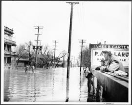
Part of City of Winnipeg (1874-1971)
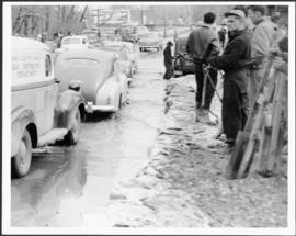
A photograph of cars driving through floodwater and beside people working to build dikes during the 1950 flood in Winnipeg.
Harold K. White Studio
Part of City of Winnipeg (1874-1971)
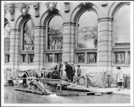
A photograph of floodwater and a pump outside the Royal Bank on Main Street during the 1950 flood in Winnipeg.
Harold K. White Studio

Part of City of Winnipeg (1874-1971)
A photograph of floodwater and sandbag dikes outside 368 and 372 Main Street during the 1950 flood in Winnipeg.
Harold K. White Studio
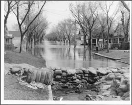
Flooding and diking in residential area
Part of City of Winnipeg (1874-1971)
A photograph of floodwater and sandbag dikes in a residential area during the 1950 flood in Winnipeg.
Harold K. White Studio
Flooding and diking in residential area
Part of City of Winnipeg (1874-1971)
A photograph of floodwater and sandbag dikes in a residential area during the 1950 flood in Winnipeg.
Harold K. White Studio

Bannerman and St. Cross looking east
Part of City of Winnipeg (1874-1971)
A photograph, looking east, of flooding at the intersection of Bannerman Avenue and St. Cross Street during the 1950 flood in Winnipeg.
Harold K. White Studio
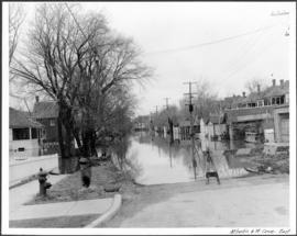
Part of City of Winnipeg (1874-1971)
A photograph, looking east, of flooding at the intersection of Atlantic Avenue and St. Cross Street during the 1950 flood in Winnipeg.
Harold K. White Studio
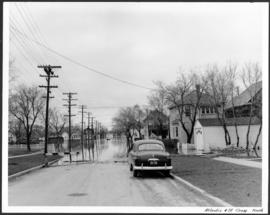
Part of City of Winnipeg (1874-1971)
A photograph, looking north, of flooding at the intersection of Atlantic Avenue and St. Cross Street during the flood of 1950 in Winnipeg.
Harold K. White Studio
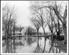
Part of City of Winnipeg (1874-1971)
A photograph of floodwaters at the corner of Scotia Street and Cathedral Avenue during the 1950 flood in Winnipeg.
Harold K. White Studio
Part of City of Winnipeg (1874-1971)
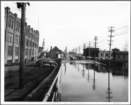
A photograph of flooded Notre Dame Avenue East during the 1950 flood in Winnipeg.
Harold K. White Studio

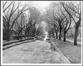
Part of City of Winnipeg (1874-1971)
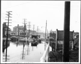
A photograph of flooded Lombard Street during the 1950 flood in Winnipeg.
Harold K. White Studio