

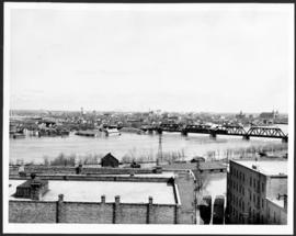
Part of East Ward, St. Boniface in the distance
- i00030
- Item
- 1875
Part of City of Winnipeg (1874-1971)
Photograph taken from top of Courthouse.
69 results with digital objects Show results with digital objects
Part of East Ward, St. Boniface in the distance
Part of City of Winnipeg (1874-1971)
Photograph taken from top of Courthouse.

Part of City of Winnipeg (1874-1971)
Flooding on the Red River towards St. Boniface.
Part of City of Winnipeg (1874-1971)
A photograph of the flooded Red River during the 1950 flood in Winnipeg. The photograph is taken looking toward St. Boniface.
Harold K. White Studio

Building Water Street causeway about 2nd day
Part of City of Winnipeg (1874-1971)
A photograph of the building of the Water Street causeway during the 1950 flood in Winnipeg. St. Boniface Cathedral can be seen in the background.
Harold K. White Studio
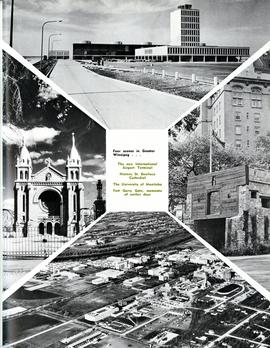
Four scenes in Greater Winnipeg
Photograph shows the then new International Airport Terminal, the St. Boniface Cathedral prior to the 1968 fire, the University of Manitoba and the Fort Garry Gate.
Metropolitan Corporation of Greater Winnipeg (Man.)
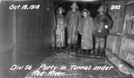
Party in Tunnel under Red River
Photograph of Greater Winnipeg Water District officials, engineers, and their families at the east end of the Winnipeg Aqueduct tunnel below the Red River linking downtown Winnipeg to St. Boniface. From left to right: Chief Engineer William G. Chace, Harriet Lily Waugh (née Logan), possibly Effie Waugh, and Division Engineer J. Armstrong. Photographer is unknown.
Greater Winnipeg Water District
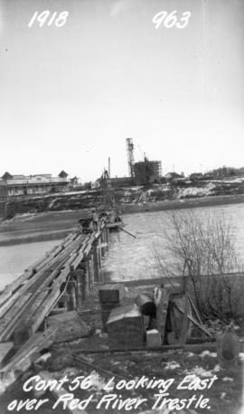
Looking east over Red River trestle bridge
Photograph of a Red River trestle bridge between downtown Winnipeg and St. Boniface, looking east towards the Taché surge tower. Photographer is unknown.
Greater Winnipeg Water District

Excavated and timbered Taché surge tower
Photograph of workers excavating the Taché surge tower, which is timbered to the floor. Photographer is unknown.
Greater Winnipeg Water District
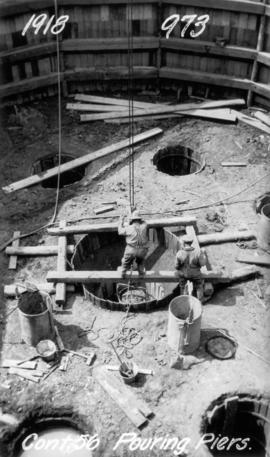
Pouring piers for Taché surge tower
Photograph of workers pouring piers for the Taché surge tower. Photographer is unknown.
Greater Winnipeg Water District
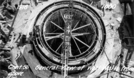
Walls of Taché surge tower from above
Photograph of the walls of the Taché surge tower, still under construction, taken from a concreting tower. Photographer is unknown.
Greater Winnipeg Water District
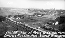
Aqueduct's route through St. Boniface
Photograph of the route of the Winnipeg Aqueduct's 66 inch diameter reinforced concrete pipeline, looking southeast towards where the Canadian Northern Railway line crosses Rue St. Joseph. Photograph taken from a concrete tower near the Taché surge tower by an unknown photographer.
Greater Winnipeg Water District

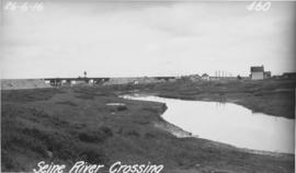
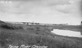
Seine River south of aqueduct crossing
Photograph of the Seine River just south of the Winnipeg Aqueduct's crossing, looking southeast towards Provencher Boulevard and the Tissot area. The St. Boniface water tower can be seen behind the buildings in the background. Photographer is unknown.
Greater Winnipeg Water District
Photograph of the Seine River where the Winnipeg Aqueduct crosses, looking northeast towards the Canadian Northern Railway main line and Rue Notre Dame (at right). Photographer is unknown.
Greater Winnipeg Water District
Photograph of the Seine River where the Winnipeg Aqueduct crosses, looking northeast towards the Canadian Northern Railway main line and Rue Notre Dame (at right). Photographer is unknown.
Greater Winnipeg Water District
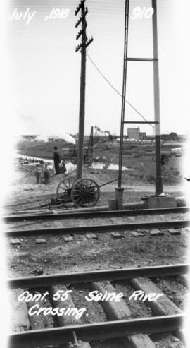
Photograph of the Seine River crossing of the Winnipeg Aqueduct, taken from the Canadian Northern Railway tracks north of Provencher Boulevard and looking northeast towards Rue Notre Dame. Photographer is unknown.
Greater Winnipeg Water District
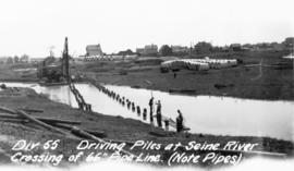
Driving piles into Seine River for aqueduct
Photograph of piles being driven into the Seine River for the Winnipeg Aqueduct, north of Provencher Boulevard. Photographer is unknown.
Greater Winnipeg Water District

View looking west over Red River into downtown Winnipeg from St. Boniface
Photograph shows view of downtown Winnipeg, between Notre Dame Avenue East (Pioneer Avenue) and Lombard Avenue. Barge on the Red River also appears in photograph. Date of photograph is approximate, ca. 1930.

Floods - St. Boniface and Norwood - April 1916
Postcard is a photographic print showing water flooding homes. Photograph taken by Advance Photo Company, Winnipeg. Azo mark appears in stamp box, made in Canada.
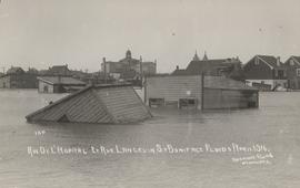
Rue De L'Hopital et Rue Langevin, St. Boniface Floods, April 1916
Postcard is a photographic print showing water flooding homes and other structures. Photograph taken by Advance Photo Company, Winnipeg. Azo mark appears in stamp box, made in Canada.

Rue Langevin, Floods, St. Boniface - April 1916
Postcard is a photographic print showing flood water and debris around buildings. Photograph taken by Advance Photo Company, Winnipeg. Azo mark appears in stamp box, made in Canada.