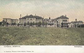
Postcard shows Winnipeg General Hospital in background, Bannatyne Avenue looking South across Alexandra Park. In foreground, Alexandra Park appears. Shows 1884 and 1897 buildings. Date of postcard is approximate, ca. 1897.
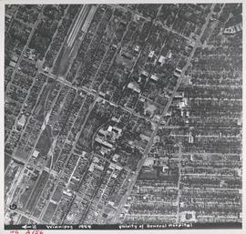
Description (on recto): WG A156, vicinity of General Hospital, Winnipeg, 1944. - Area around William Avenue and Sherbrook Street shown in photograph. - Photo credit: Royal Canadian Air Force Photograph.
View of cars and cyclists heading down Academy Road towards Wellington Crescent and the Maryland Bridge. The cupola of Misericordia Hospital can be seen across the bridge.
View of cars and cyclists heading down Academy Road towards Wellington Crescent and the Maryland Bridge. A small portion of Misericordia Hospital can be seen across the bridge.