
- i04584
- Item
- [ca. 1990]
Pagoda formerly located in Assiniboine Park. Now located in King's Park.
Winnipeg (Man.). Parks and Recreation Department
Pagoda formerly located in Assiniboine Park. Now located in King's Park.
Winnipeg (Man.). Parks and Recreation Department

People on bench in front of the pond at King Edward Park.
Winnipeg (Man.). Parks and Recreation Department
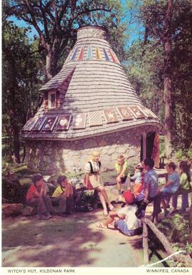
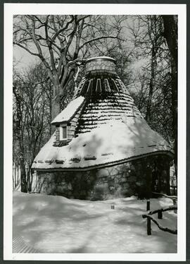
Witch’s hut at Kildonan Park in summer
Witch’s hut at Kildonan Park in summer.
Kalen, Henry
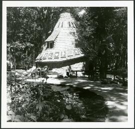
Witch’s hut at Kildonan Park in summer
Witch’s hut at Kildonan Park in summer.
Winnipeg (Man.). Parks and Recreation Department
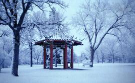
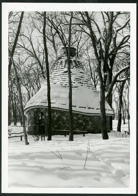
Witch’s hut at Kildonan Park in winter
Witch’s hut at Kildonan Park in winter.
Winnipeg (Man.). Parks and Recreation Department
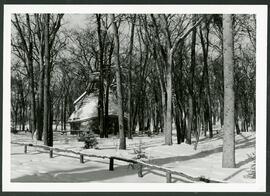
Witch’s hut at Kildonan Park in winter
Witch’s hut at Kildonan Park in winter.
Winnipeg (Man.). Parks and Recreation Department
Witch’s hut at Kildonan Park in winter
Witch’s hut at Kildonan Park in winter.
Winnipeg (Man.). Parks and Recreation Department
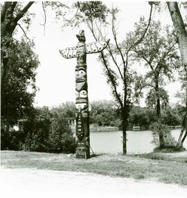
Ceremony to recognize erection of totem pole made by James F. Sutherland.
Winnipeg (Man.). Parks and Recreation Department

Chief Peguis Memorial in Kildonan Park.
Winnipeg (Man.). Parks and Recreation Department
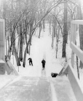
Cleaning toboggan slide in Kildonan Park
Park workers cleaning off the toboggan slide in Kildonan Park.
Winnipeg (Man.). Parks and Recreation Department

Kildonan Park in winter.
Winnipeg (Man.). Parks and Recreation Department

Aerial view of Bonnycastle Park
Aerial view of an occasion at Bonnycastle Park with people gathered around a portable stage watching a performance.
Winnipeg (Man.). Parks and Recreation Department
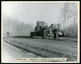
Perimeter road construction at Assiniboine Park Zoo
Construction of perimeter road west of the Assiniboine Park Zoo.
Winnipeg (Man.). Parks and Recreation Department
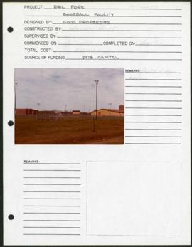
Riel Park – project development components
Project development components form for Riel Park with a colour photograph affixed.
Winnipeg (Man.). Parks and Recreation Department
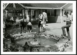
Aunt Sally's Farm at the Assiniboine Park Zoo
Photograph of visitors enjoying a fountain at Aunt Sally's Farm, in the Assiniboine Park Zoo. Photograph was taken by Gunter A. Schoch, Landscape Architect with the Metropolitan Corporation of Greater Winnipeg's Parks and Protection Division.
Metropolitan Corporation of Greater Winnipeg (Man.). Parks and Protection Division

Notre Dame Avenue facing west from Arlington Street
View of the boulevard on Notre Dame Avenue facing west, between Arlington and McPhillips Streets. Free Press Depot Number 2 can be seen on the right.

Plan of University section of Tuxedo Park
A map of the proposed Tuxedo Park residential suburb, specifically the area surrounding the old University of Manitoba campus and Olmsted and Assiniboine Parks. The map shows streets and lots as well as details of the university campus. The map was created by Charles Clifton Chataway (1869-1920) and Bulman Brothers Ltd.
A photograph of cows grazing in Fraser’s Grove Park in East Kildonan.
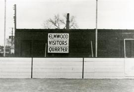
Original boxcar clubhouse at Kelvin Community Centre
The original boxcar clubhouse at the Kelvin Community Centre with a sign reading “Elmwood Visitors Quarter”.
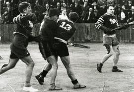
Elmwood Pats competing in lacrosse game
Action shot of the Elmwood Pats playing lacrosse, likely at the Kelvin Community Centre.