

- i04037
- Item
- 1944
An aerial view of East Kildonan between the roughly between the Red River and Watt Street, including Henderson Highway.
14 results with digital objects Show results with digital objects
An aerial view of East Kildonan between the roughly between the Red River and Watt Street, including Henderson Highway.
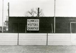
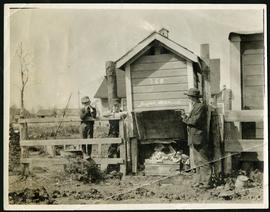
Original boxcar clubhouse at Kelvin Community Centre
The original boxcar clubhouse at the Kelvin Community Centre with a sign reading “Elmwood Visitors Quarter”.
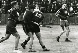
Elmwood Pats competing in lacrosse game
Action shot of the Elmwood Pats playing lacrosse, likely at the Kelvin Community Centre.
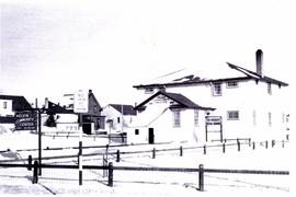
Exterior of Kelvin Community Centre
Photograph of the exterior of the Kelvin Community Centre.

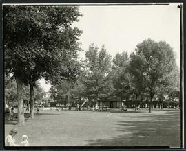
View of a pond at King Edward Park
Photograph of a pond surrounded by people in King Edward Park.

View of a pond at King Edward Park
Photograph of a pond in King Edward Park. Photograph by Cyril Jessop.

View of a pond at King Edward Park
Photograph of a pond in King Edward Park. Photograph by Cyril Jessop.
Families enjoying a playground in Elmwood Park.
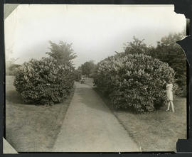
Photograph of a child picking lilacs from a hedge in Elmwood Park. Photograph by Cyril Jessop, 502 Sherburne Street.

Aerial view of Point Douglas, St. Boniface, and Elmwood areas
Aerial photograph of Point Douglas, St. Boniface, and west Elmwood.
![Vicinity of Elmwood Park [Aerial view]](/uploads/r/city-of-winnipeg-archives-amp-records-control-branch/c/6/d/c6dc0bd0b8c2199f232fe8c7f5245d25e681a6a759be00e013a35a7a1ecada23/C0013_0000_0000_P0018_0042_001_142.jpg)
Vicinity of Elmwood Park [Aerial view]
Inscription (on recto): WG M35: 3-16, 5 Mar '45, vicinity Elmwood Park Wpg, appr scale 1/12000.
![Vicinity of Elmwood Park [Aerial view]](/uploads/r/city-of-winnipeg-archives-amp-records-control-branch/5/b/9/5b929d618c2f619e557788462eee14587693511e7959bc6ca77ae96654d1bc98/C0013_0000_0000_P0018_0041_001_142.jpg)
Vicinity of Elmwood Park [Aerial view]
Inscription (on recto): WG M35: 3-15, 5 Mar '45, vicinity Elmwood Park Wpg, appr. scale 1/12000.
![East Kildonan [Aerial view]](/uploads/r/city-of-winnipeg-archives-amp-records-control-branch/8/6/0/860fdea3b1f6bcb68bd68a791365ae9deb8f9cd14834a8814d48663ae6ce80b6/C0013_0000_0000_P0018_0031_001_142.jpg)
Inscription (on recto): WG A155, East Kildonan - 1944.
Part of City of Winnipeg (1874-1971)
Item is part of small album containing photographs of maps tracking the outbreak of typhoid from 1905 to 1908 and other scenes. Item is loose and at back of album. Date of item is approximate, [circa 1909].