

Main Street Winnipeg looking south from City Hall
- i01518
- Item
- 1882
957 results with digital objects Show results with digital objects
Main Street Winnipeg looking south from City Hall
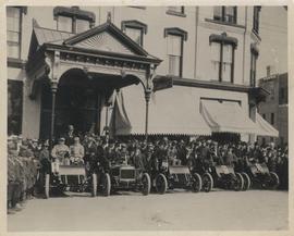
Cars and drivers, Clarendon Hotel
Photograph shows cars and drivers at Clarendon Hotel, northwest corner of Donald Street and Portage Avenue. - Inscription (on verso): 1st car, R. M. McLeod and R. Newman 2nd car, W. C. Power at wheel. 3rd car, Kelly Bros. 4th car, Douglas M. McLaughlin and Bert Wells (standing between cars is Ace Emmett). 5th car, Jack McCullock and Jimmy Boswell. - Date of photograph is approximate, ca. 1904.
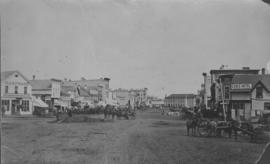
View of Main Street looking north
City of Winnipeg businesses shown in photograph: George Ashdown Hardware, Davis House, Symonds Furrier, Gable Hotel, J. Lister, Outfitter, Rossin House, the Blue Store, and the first City Hall is shown in background.

Item is a photographic reproduction of map showing various sewer system details. Stamp (on verso): City of Winnipeg - Engineering Dept., Water Works Division, Ross and Tecumseh.
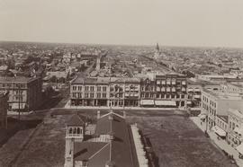
Winnipeg looking west from the tower of City Hall
Winnipeg looking west from the tower of City Hall, September 5, 1900. Present site of Red River College's Princess Street campus. Campus design included stabilization of five historic building facades along Princess Street: right to left from the corner of Elgin Avenue and Princess Street, the Utility Building (Winnipeg's first Grain Exchange) at 164 Princess; the Exchange Building II at 160 Princess; the Harris Building (Hochman's) at 154 Princess; the Bawlf Block at 150 Princess; and the Drake Hotel (Benson Block) at 146 Princess.

No. 8 A portion of the Lyndale dike in Norwood with the Norwood Bridge in the background
Photograph shows scene from 1950 flood. Description (on verso): Note the roof of the Greater Winnipeg Sanitary District Marion Street pumping station on the right. Stamp (on verso): City of Winnipeg - Engineering Dept., Water Works Division, Ross and Tecumseh.
Dyking built up around Shaarey Zedek Synagogue, 1950 Flood
Photograph taken at Shaarey Zedek Synagogue, 561 Wellington Crescent off Academy Road, on the western bank of the Assiniboine River. - Stamp (on verso): by Harold K. White Studio, 274 Fort St. Winnipeg, Phone 924 289.
Harold K. White Studio

1950 Flood - Flood Evacuees at the St. Boniface train station
A Short, Pictorial Documentary on the Winnipeg Flood of 1950
Portigal & Wardle
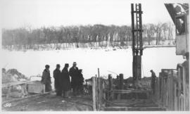
Photograph shows construction of sewer. Date of photograph is probable, [1936?].
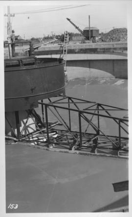
Outfall sewer, reinforcing diffuser, 1936
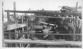
Photograph shows construction of sewer. Date of photograph is March 26, 1936.
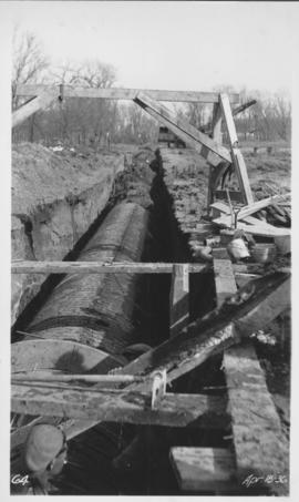
Photograph shows construction of sewer. Date of photograph April 18, 1936.
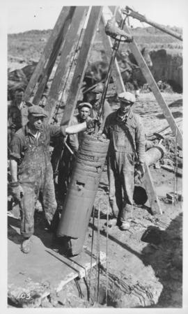
Outfall sewer, Armco iron pipe, 1936
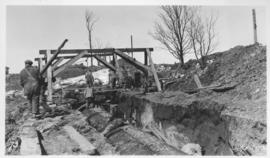
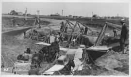
Photograph shows construction of sewer. Date of photograph is April 17, 1936.
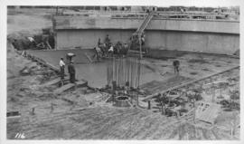
East Clarifier, placing mortar finish
Photograph shows construction of sewer. Date of photograph is uncertain, [before 1949].
Photograph shows construction of sewer. Date of photograph is uncertain, [before 1949].
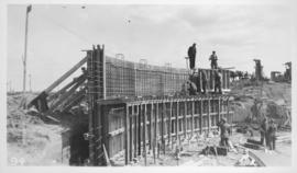
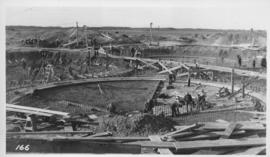
West Clarifier, 1st section wall
Photograph shows construction of sewer. Date of photograph is uncertain, [before 1949].
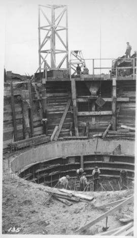
West Clarifier, pile foundation - clay core
Photograph shows construction of sewer. Date of photograph is unknown.
Photograph shows construction of sewer. Date of photograph is uncertain, [before 1949].
Photograph shows construction of sewer. Date of photograph is uncertain, [before 1949].
Looking east in tunnel from Clarifier control
Photograph shows construction of sewer. Date of photograph is uncertain, [before 1949].
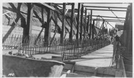
Placing steel in Digestor slab
Photograph shows construction of sewer. Date of photograph is uncertain, [before 1949].