
St. James Parks Board photo album
- d01173
- File
- 1956-1964
Photographs from a photo album from the St. James Parks Board. Photos are of parks, boulevards, and playgrounds in the St. James area.
St. James (Man.). Parks Board
88 results with digital objects Show results with digital objects
St. James Parks Board photo album
Photographs from a photo album from the St. James Parks Board. Photos are of parks, boulevards, and playgrounds in the St. James area.
St. James (Man.). Parks Board
Photographs from a photo album from the St. James Parks Board. Photos are of parks, boulevards, and playgrounds in the St. James area.
St. James (Man.). Parks Board
Photos from the opening of St. James Parks
Photographs are from albums of the opening of Wightman Green, Benjaminsen, and Bourkvale Parks in the St. James area.
Winnipeg (Man.). Parks and Recreation Department
Photos from the opening of the A.W Hanks dedication
Photographs, newspaper clippings, and other notes from an album of the opening of the A.W Hanks dedication in Bruce Park.
Winnipeg (Man.). Parks and Recreation Department
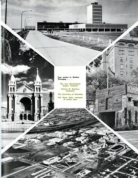
Four scenes in Greater Winnipeg
Photograph shows the then new International Airport Terminal, the St. Boniface Cathedral prior to the 1968 fire, the University of Manitoba and the Fort Garry Gate.
Metropolitan Corporation of Greater Winnipeg (Man.)

Photograph shows old St. James Bridge approach, looking north up Madison Street (now Century Street/Route 90). Present Viscount Gort site in center. Date of photograph is uncertain, [after 1932].

Photograph shows old St. James Bridge approach, looking North up present Kintrye Street. Viscount Gort site centre right/Hydro sub-station - St. James Street and Portage Avenue far left. Date of photograph is uncertain [after 1932].

Aerial view of Stevenson Field (Winnipeg Airport)
Inscription (on recto): NE WG F24 AP117 45:55N 97.14W Stevenson Field 27-9-43 15:55 8" 6000'.
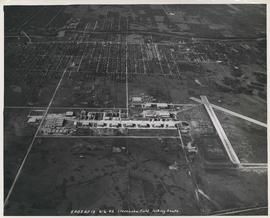
Aerial view of Stevenson Field looking South (Winnipeg Airport)
Inscription (on recto): 5A0S AP13 6-6-42 Stevenson Field looking South.
![Assiniboine to Airport, St. James [Aerial view]](/uploads/r/city-of-winnipeg-archives-amp-records-control-branch/c/9/8/c986dd715644d9b7d48854b59c8285d029a7db80cb4798af462d336b696964c9/C0013_0000_0000_P0018_0043_001_142.jpg)
Assiniboine to Airport, St. James [Aerial view]
Inscription (on recto): WG M35: 7-16, 5 Mar '45, Assiniboine to Airport, St. James, app scale 1/12000.

A photograph of the Portage Avenue underpass, which crosses Century Street on the north side of the St. James Bridge. The photographer is unknown.
Metropolitan Corporation of Greater Winnipeg (Man.). Information Officer
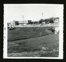
Scenes from around St. James and the St. James Bridge
Consists of several photos of the area around the St. James Bridge and includes small parks and green spaces, and the St. James Shopping Centre on Portage Avenue near Moray Street. Photographer is unknown.
Metropolitan Corporation of Greater Winnipeg (Man.). Information Officer
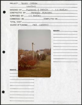
Truro Creek Parkway – project development components
Project development components form for Truro Creek Parkway with a colour photograph affixed.
Winnipeg (Man.). Parks and Recreation Department
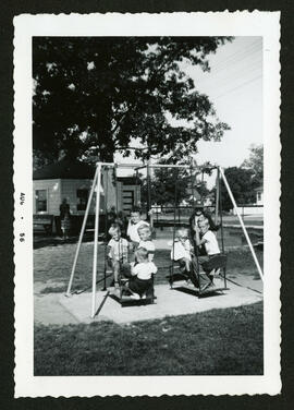
A photo of children playing on a swing set at Amherst Park, located on the corner of Amherst and Ness Avenue.
St. James (Man.). Parks Board
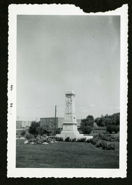
A photo of the cenotaph in Bruce Park.
St. James (Man.). Parks Board
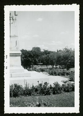
A photo of the cenotaph in Bruce Park.
St. James (Man.). Parks Board
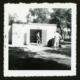
A photo of Jim Turner and George Anderson trying out new lawn equipment in Bourkevale Park.
St. James (Man.). Parks Board
A photo of the Assiniboine Hotel, across the street from Bruce Park.
St. James (Man.). Parks Board

Bruce Park wading pool shelter
A photo of the Bruce Park wading pool shelter, completed in 1959.
St. James (Man.). Parks Board