Page 28 of a photograph album created by brothers Arthur and Fred Landen of Hull, England. Page consists of 6 photographs taken by Fred Landen depicting, clockwise from top-left: bricklayers in front of houses; women on a horse-drawn sleigh (captioned “Cutter”); police in raccoon-skin uniforms; a streetcar crossing the Osborne Bridge; a Ox-drawn sleigh in front of the Royal Oak Hotel in Market Square (Market Avenue and King Street); and a woman pushing a baby in a sleigh in at the northwest corner of Broadway and Kennedy Street.
Page 26 of a photograph album created by brothers Arthur and Fred Landen of Hull, England. Page consists of 6 photographs taken by Fred Landen depicting, clockwise from top-left: Winnipeg’s second City Hall and the Volunteer Monument (which is captioned “Scott’s Monument, Fish Creek”); the Osborne Bridge over the Assiniboine River; a horse drawn sleigh carrying cords of wood in front of City Hall; a large house on Broadway, a dog sleigh in front of H. Laffrezen's Central Bakery at 333 1/2 William Avenue; and floating ice on the Assiniboine River.
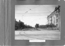
A photograph of streetcar on Broadway, looking west from Main Street. The Manitoba Club building can be seen on the left. Photographed by Steele and Company.
Page 9 of a photograph scrapbook made by Corporal John Wallace in April 1940. Photographs depict a street in Gladstone Manitoba, a trolley bus in Winnipeg on Kennedy Street (between Ellice and Qu'Appelle), and the Butler family, acquaintances of Wallace. See page three of this scrapbook for more details on the Butler family.
Page 2 of a photograph scrapbook made by Corporal John Wallace in April 1940. Photos consist of Portage Avenue looking west from around Vaughn Street, a rail line at Portage Avenue and St. James Street, troops in formation, and Mrs. and Shirley Gardiner. See general notes section for more details.
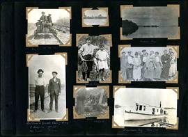
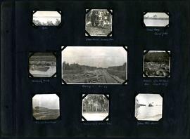
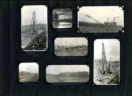
Captions read: My car at mile 38 - Indian Bay - First crew to operate class 7 drag, C. Walgren, operator, [W.H.?] Smaill, fireman - Lassie, Hamish - Fisherman's Tug, Shoal Lake. Also contains a photo showing Kekekoziibii Shoal Lake 40 First Nation in the distance.
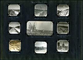
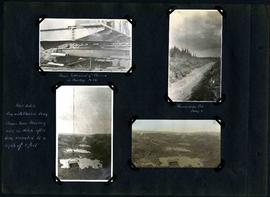
Captions read: Dyke - Blanchard's, Indian Bay - Indian Camp, Shoal Lake [Kekekoziibii Shoal Lake 40 First Nation] - Removing arch - Camp 5, mile 77 - Remains after oil House fire, camp 5, mile 77 - Excursion train, camp 6 -Tennis court, Indian Bay - Young wild ducks.
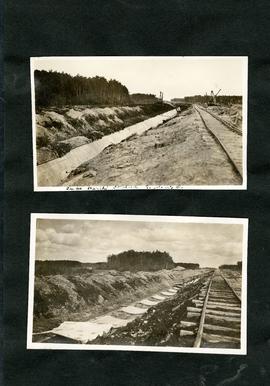
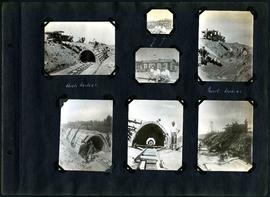
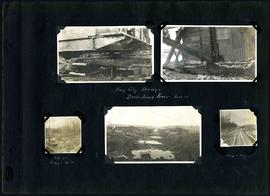
Captions read: Views at Camp 2, Mile 51 - Packed backfill, gravel - Inverst after Rainstorm - Boulders from trench - Mixer, concrete cars, and gas dinkey - Pads protected from frost with moss - Manhole and blowoff - Mixer.
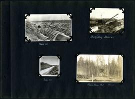
Captions read: Shows settlement of class 19[?] in muskeg, mile 86 - Foundation Fill, camp 6 - Pilot ditch dug with class in drag, shows how muskeg rises in ditch after being excavated to a depth of 8 feet.
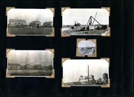
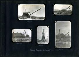
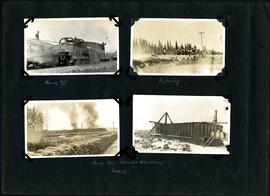
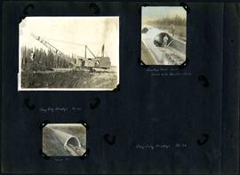
1 photograph appears to be missing. Captions read: Bay City dredge, mile 91 - Cracked arch, mile 85, broke with traveler sacks - Mile 58 - Bay City dredge, Mile 91.