
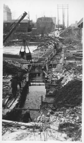
Assiniboine River crossing at Main Street, laying pipe
- i01506
- Item
- [194-?]
Photograph shows construction of sewer.
47 results directly related Exclude narrower terms
Assiniboine River crossing at Main Street, laying pipe
Photograph shows construction of sewer.
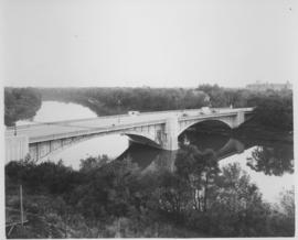
Photograph shows Maryland Street Bridge looking southeast into Crescentwood. Date of photograph is approximate, ca. 1925.

View looking west over Red River into downtown Winnipeg from St. Boniface
Photograph shows view of downtown Winnipeg, between Notre Dame Avenue East (Pioneer Avenue) and Lombard Avenue. Barge on the Red River also appears in photograph. Date of photograph is approximate, ca. 1930.

Pontoon Bridge, Fort Garry and Warehouse from south side Assiniboine River
Part of City of Winnipeg (1874-1971)

Part of City of Winnipeg (1874-1971)

Footbridge in La Barriere Park
Photograph of a footbridge across the La Salle River in La Barriere Park. A description of the photo used for publication is recorded on a separate piece of paper. Photo's reverse is stamped by the Parks and Protection Division of the Metro Government.
Metropolitan Corporation of Greater Winnipeg (Man.). Information Officer
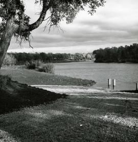
Boat ramp at Crescent Drive Park
Photograph of the first public boat ramp in Winnipeg, built in 1967 and located in Crescent Drive Park. Photo's reverse is stamped by the Parks and Protection Division of the Metro Government.
Metropolitan Corporation of Greater Winnipeg (Man.). Information Officer