Affichage de 47 résultats

description archivistique
Rivers
Aperçu avant impression Hierarchy Affichage :

46 résultats avec objets numériques Afficher les résultats avec des objets numériques

Photograph album of Winnipeg during WW1: Page 1
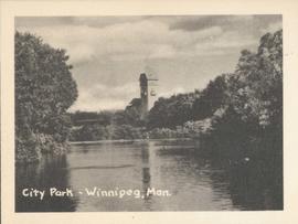
City Park - Winnipeg, Man.
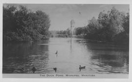
The Duck Pond, Winnipeg, Manitoba
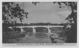
The Foot Bridge in City Park, Winnipeg, Manitoba
Riverwalk
Riverwalk
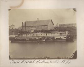
First arrival of Mennonites, 1874
Aerial of 1974 Flood – Pritchard Avenue Boat Dock and Redwood Bridge
Aerial of 1974 Flood – Fraser’s Grove Park
Aerial of 1974 Flood – Red River between East and West Kildonan
Aerial of 1974 Flood – Bergen Cutoff Bridge
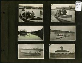
Arthur and Fred Landen photograph album – page 32
Aerial of 1974 Flood – Red River between North and West Kildonan
Arthur and Fred Landen photograph album – page 26
Arthur and Fred Landen photograph album – page 29
Arthur and Fred Landen photograph album – page 31
Arthur and Fred Landen photograph album – page 28
Aerial photograph south of Winnipeg, east of Red River, 1943
Aerial photograph Red River north from southern boundaries of North Kildonan and West St. Paul, n...
Aerial photograph Red River north from southern boundaries of North Kildonan and West St. Paul, north of Winnipeg, 1943
Aerial photograph south side of Assiniboine River, west from Assiniboine Park, 1943
Aerial photograph area west of Red River, south of Winnipeg City Limits, 1943
Résultats 1 à 20 sur 47