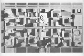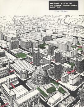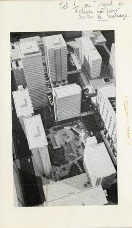
Conceptual plan of the Japanese Garden and surrounding area
- i03492
- Pièce
- [ca. 1970]
Fait partie de Metropolitan Corporation of Greater Winnipeg
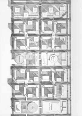
Photograph shows a conceptual model of the Japanese Gardens and the area between Carlton and Hargrave Streets, and York and St. Mary Avenues. Most of the buildings in the model were never built and the Japanese Gardens are significantly different than that which currently exists. The photographer is unknown.
Sans titre