
Eaton's promotional stereogram no. 23 - receiving new goods
- i04493
- Pièce
- [ca. 1920]
Fait partie de Morris Block collection
Sans titre
69 résultats avec objets numériques Afficher les résultats avec des objets numériques
Eaton's promotional stereogram no. 23 - receiving new goods
Fait partie de Morris Block collection
Sans titre
Eaton's promotional stereogram no. 27 - mail orders leaving the building
Fait partie de Morris Block collection
Sans titre

Eaton's promotional stereogram no. 32 - city delivery
Fait partie de Morris Block collection
Sans titre
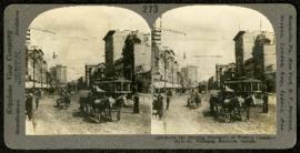
Main Street, looking north from Portage
Fait partie de Morris Block collection
A promotional stereogram showing traffic and streetcars on Main Street, looking north from Portage Avenue, made by the Keystone View Company. The reverse side of the image contains information about Winnipeg.
Sans titre
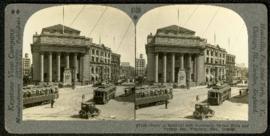
Bank of Montreal building, Portage and Main
Fait partie de Morris Block collection
A promotional stereogram showing traffic and streetcars in front of the Bank of Montreal building at Portage Avenue and Main Street, made by the Keystone View Company. The reverse side of the image contains information about Winnipeg.
Sans titre
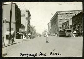
Portage looking east from around Carlton
Fait partie de Morris Block collection
Photograph of a woman crossing Portage Avenue, looking east from around Carlton Street. The Eaton’s building can be seen on the right.
Sans titre
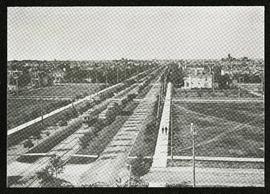
Broadway looking west from Fort Garry Court
Fait partie de Morris Block collection
Photograph taken from Fort Garry Court, located at Broadway and Main Street, looking west down Broadway. St. Mary’s Academy, the Parliament Building (Legislature), and Law Courts are labeled off in the distance.
Sans titre

Banfiend’s Furniture carts in front of Empire Hotel
Fait partie de Morris Block collection
Photograph mounted on cardboard of a cavalcade of horse-drawn wagons in front of the Empire Hotel on Main Street and York Avenue, advertising deals on 3-room furniture suites at Banfield’s Furniture, 492 Main Street.
Sans titre

Waghorn's Guide map and street index
Fait partie de City Clerk's Library collection
Waghorn's Guide - a small promotional pamphlet published by J.R. Waghorn in 1895. The pamphlet contains a street map of Winnipeg, a street index, and advertisements for various Winnipeg businesses including the Clarendon Hotel, the Redwood Brewery, and the Massey-Harris Company. The map shows the old City of Winnipeg from the Red River on the east to Waverly, Aubrey, and McPhillips Streets on the west, and from Athole Avenue (now Luxton Avenue) in the north to Parker Avenue in the south. Southern Elmwood, Old St. Boniface, and Norwood are also shown on the east side of the river. Railway lines are in black and electric street railway lines are in red.
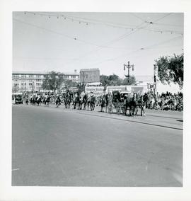
Winnipeg's 75th Anniversary parade - riders on horseback
Fait partie de City of Winnipeg Archives Photograph collection
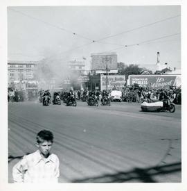
Winnipeg's 75th Anniversary parade - men on motorcycles
Fait partie de City of Winnipeg Archives Photograph collection
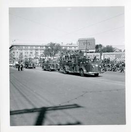
Winnipeg's 75th Anniversary parade - fire trucks
Fait partie de City of Winnipeg Archives Photograph collection

Winnipeg's 75th Anniversary parade - National Motors float
Fait partie de City of Winnipeg Archives Photograph collection
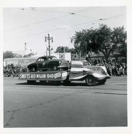
Winnipeg's 75th Anniversary parade - Swift's Red Wagon 1949 float
Fait partie de City of Winnipeg Archives Photograph collection
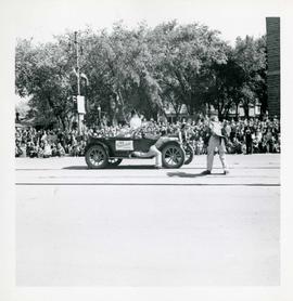
Winnipeg's 75th Anniversary parade - G. Meech 1912 Hupmobile float
Fait partie de City of Winnipeg Archives Photograph collection
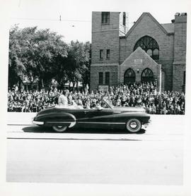
Winnipeg's 75th Anniversary parade - car carrying women
Fait partie de City of Winnipeg Archives Photograph collection
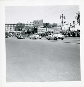
Winnipeg's 75th Anniversary parade - line of cars
Fait partie de City of Winnipeg Archives Photograph collection
![Winnipeg's 75th Anniversary parade - Dickson Motors [?] 1912 Buick float](/uploads/r/city-of-winnipeg-archives-amp-records-control-branch/8/d/0/8d0709294d37f435845ca7e123faef1c524ae3c590b22bddaebd73e1dbfec56f/C0013_0000_0000_P0044_0011_037_142.jpg)
Winnipeg's 75th Anniversary parade - Dickson Motors [?] 1912 Buick float
Fait partie de City of Winnipeg Archives Photograph collection

Winnipeg's 75th Anniversary parade - car with skull and crossbones labelled "Dunc Johnny"
Fait partie de City of Winnipeg Archives Photograph collection
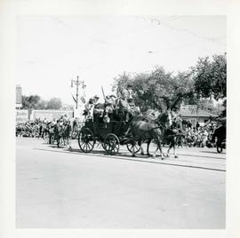
Winnipeg's 75th Anniversary parade – Cowboys on stagecoach
Fait partie de City of Winnipeg Archives Photograph collection