
Showing 34 results
archival descriptions34 results with digital objects Show results with digital objects

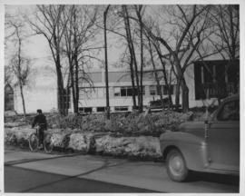
Wildwood Park - Three weeks before flood, 1950

No. 8 A portion of the Lyndale dike in Norwood with the Norwood Bridge in the background
Dyking built up around Shaarey Zedek Synagogue, 1950 Flood

Wildwood Park - Three weeks before flood, 1950
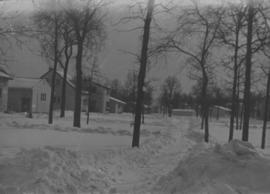
Wildwood Park - Three weeks before flood, 1950
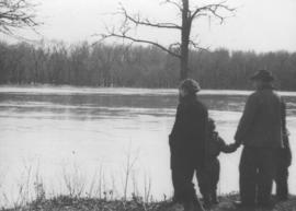
Wildwood Park - flood, 1950

Sandbags on the dyke (Wildwood Park - flood, 1950)

1950 Flood - Flood Evacuees at the St. Boniface train station
![Sandbags - E sec [section] (Wildwood Park - flood, 1950)](/uploads/r/city-of-winnipeg-archives-amp-records-control-branch/c/4/a/c4a7e5ee657f2cf565da1e983d41beae65af0b67f4b9fb5fa71c540b99003de4/C0013_0000_0000_P0022_0094_001_142.jpg)
Sandbags - E sec [section] (Wildwood Park - flood, 1950)

Aerial of 1974 Flood – Red River between East and West Kildonan

Aerial of 1974 Flood – Pritchard Avenue Boat Dock and Redwood Bridge

Aerial of 1974 Flood – Fraser’s Grove Park

Aerial of 1974 Flood – Bergen Cutoff Bridge

Aerial of 1974 Flood – Red River between North and West Kildonan
Results 21 to 34 of 34
- « Previous
- 1
- 2