
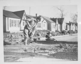
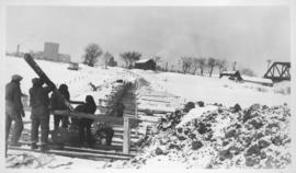
Screed - Inkster Boulevard, east of McKenzie Street
- i01571
- Item
- 1947
Item consists of a photograph showing construction of concrete road.
185 results with digital objects Show results with digital objects
Screed - Inkster Boulevard, east of McKenzie Street
Item consists of a photograph showing construction of concrete road.

Screeds, new concrete road, Inkster, east of McKenzie
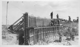
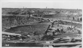
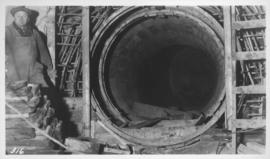
West Clarifier, 1st section wall
Photograph shows construction of sewer. Date of photograph is uncertain, [before 1949].
Photograph shows construction of sewer. Date of photograph is uncertain, [before 1949].
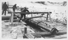
Outfall sewer, Armco iron pipe, 1936
Photograph shows construction of sewer. Date of photograph is April 17, 1936.
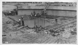
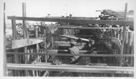
Placing steel in Digestor slab
Photograph shows construction of sewer. Date of photograph is uncertain, [before 1949].
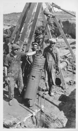
Outfall sewer, reinforcing diffuser, 1936
Photograph shows construction of sewer. Date of photograph is March 26, 1936.
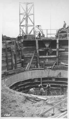
West Clarifier, pile foundation - clay core
Photograph shows construction of sewer. Date of photograph is unknown.
Photograph shows construction of sewer. Date of photograph is uncertain, [before 1949].
Montcalm Street, river crossing
Photograph shows construction of sewer. Date of photograph is uncertain, [before 1949].
Montcalm Street, river crossing
Photograph shows construction of sewer. Date of photograph is uncertain, [before 1949].
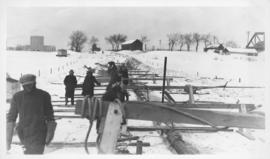
Montcalm Street, river crossing
Photograph shows construction of sewer. Date of photograph is uncertain, [before 1949].
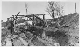
Junction, main interceptor and surge tank
Photograph shows construction of sewer. Date of photograph is uncertain, [before 1949].
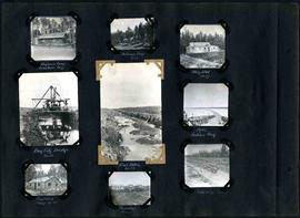
William Smaill Photo Album – Page 20
Part of William Smaill fonds
Captions read: Mile 85 - Old Fort Garry and hotel - Fort Garry apartments - Hudson's Bay stores, Winnipeg - Bay City dredge - Whitemouth, April 1914 - W.G. Chas, J.H. Fuertes [?], A. C.H. Blanchard [?] - Mile 57.
Smaill, William
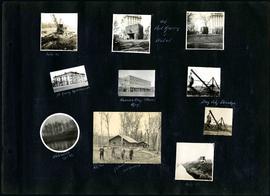
William Smaill Photo Album – Page 29
Part of William Smaill fonds
Captions read: Engineer's camp, Birch River, mile 77 - Sailman's camp, mile 88 - Hospital, mile 77 - Bay City dredge, mile 89 - Pilot ditch, mile 89 - Dyke, Indian Bay - Engineer's camp, mile 88 - Tremblays camp 1 - Mile 85.5, '16.
Smaill, William

View of men mucking trench for 48-inch diameter Branch 1 aqueduct at Sta. 169+00 on Pacific Avenue
Contract 65 - Mile 3.2 - View of men mucking trench for 48 inch diameter Branch 1 aqueduct at Sta. 169+00 on Pacific Avenue. Looking west between Louise Street and Main Street. Work progressed westward from the west tunnel shaft. Buiilding of The James
Greater Winnipeg Water District
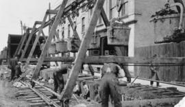
View of men mucking trench for 48-inch diameter Branch 1 aqueduct at Sta. 169+00 on Pacific Avenue
Contract 65 - Mile 3.2 - View of men mucking trench for 48 inch diameter Branch 1 aqueduct at Sta. 169+00 on Pacific Avenue. Looking west between Louise Street and Main Street. Work progressed westward from the west tunnel shaft. Building of The James
Greater Winnipeg Water District

Contract 65 - Mile 3.2 - View of men mucking trench for 48 inch diameter Branch 1 aqueduct at Sta. 169+00 on Pacific Avenue, looking west between Louise Street and Main Street. Work progressed westward from the west tunnel shaft. Building of The James R
Greater Winnipeg Water District
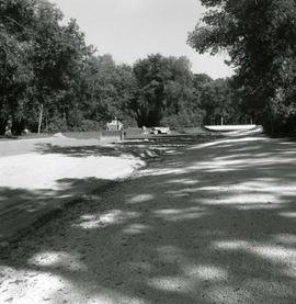
Landscaping of lake in St. Vital Park
Photograph of sunken lawn in St. Vital Park being prepared to become a filled lake. The lake was excavated in 1931, but was not filled until 1966. A description of the photo used for publication is recorded on a separate piece of paper. Photo's reverse is stamped by the Parks and Protection Division of the Metro Government.
Metropolitan Corporation of Greater Winnipeg (Man.). Information Officer

William Smaill Photo Album – loose page
Part of William Smaill fonds
Captions read: Water tank, Indian Bay, Greater Winnipeg Water District.
Smaill, William