

William Smaill Photo Album – loose page
- p00238
- Part
- [1914 or 1915]
Part of William Smaill fonds
Captions read: Water tank, Indian Bay, Greater Winnipeg Water District.
Smaill, William
William Smaill Photo Album – loose page
Part of William Smaill fonds
Captions read: Water tank, Indian Bay, Greater Winnipeg Water District.
Smaill, William
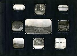
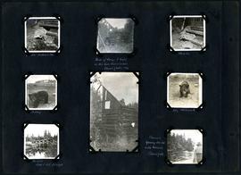
William Smaill Photo Album – Page 106
Part of William Smaill fonds
Captions read: Dyke - Blanchard's, Indian Bay - Indian Camp, Shoal Lake [Kekekoziibii Shoal Lake 40 First Nation] - Removing arch - Camp 5, mile 77 - Remains after oil House fire, camp 5, mile 77 - Excursion train, camp 6 -Tennis court, Indian Bay - Young wild ducks.
Smaill, William
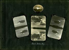
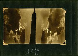
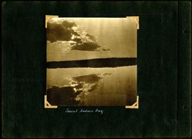
William Smaill Photo Album – Page 68
Part of William Smaill fonds
Captions read: Sunset, Indian Bay.
Smaill, William

William Smaill Photo Album – Page 81
Part of William Smaill fonds
Captions read: Mayor R.D. Waugh, Indian Bay, 1915.
Smaill, William
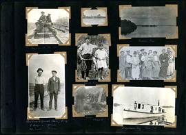
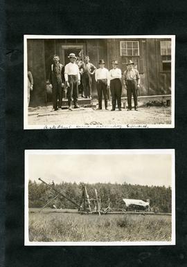
William Smaill Photo Album – Page 108
Part of William Smaill fonds
Captions read: My car at mile 38 - Indian Bay - First crew to operate class 7 drag, C. Walgren, operator, [W.H.?] Smaill, fireman - Lassie, Hamish - Fisherman's Tug, Shoal Lake. Also contains a photo showing Kekekoziibii Shoal Lake 40 First Nation in the distance.
Smaill, William
William Smaill Photo Album – Page 77
Part of William Smaill fonds
Captions read: Indian Bay, looking west from dyke.
Smaill, William
William Smaill Photo Album – Page 49
Part of William Smaill fonds
Captions read: Jumbo[?], Indian Bay - Ruins of camp 1 built on Ontario gold concessions, Shoal Lake, 1896 - Jumbo - Teddy - Teddy, Whitemouth - Birch River railroad bridge - Chasing young ducks with launch, Shoal Lake.
Smaill, William
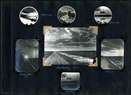
William Smaill Photo Album – Page 61
Part of William Smaill fonds
Captions read: Sunset, Indian Bay.
Smaill, William

William Smaill Photo Album – Page 15
Part of William Smaill fonds
Captions read: Anderson's dredge making cut between Indian Bay and Snowshoe Bay.
Smaill, William
William Smaill Photo Album – Page 30
Part of William Smaill fonds
Captions read: Whitemouth - Indian Bay - Heading west, mile 68 - Big muskeg, mile 91 - Mile 89 - Indian Bay.
Smaill, William

William Smaill Photo Album – Page 9
Part of William Smaill fonds
Captions read: Station men's shack - Boggy number 1 - Hadashville - Settlers' house - Whitemouth - camp 3 - Indian Bay, April 1914.
Smaill, William

William Smaill Photo Album – Page 13
Part of William Smaill fonds
Captions read: Jackfish - Whitemouth - Trail, Indian Bay - Whitemouth - Birch River - Whitemouth - McLerie's.
Smaill, William
William Smaill Photo Album – loose page
Part of William Smaill fonds
Captions read: Rock plant camp, on a Sunday, Greater Winnipeg Water District.
Smaill, William
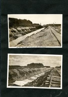
William Smaill Photo Album – loose page
Part of William Smaill fonds
Captions read: Tube partly covered, Greater Winnipeg Water District.
Smaill, William
William Smaill Photo Album – Page 118
Part of William Smaill fonds
Captions read: Blank Page.
Smaill, William

William Smaill Photo Album – loose page
Part of William Smaill fonds
Captions read: Bunk houses, rock plant, Greater Winnipeg Water District - Rock crushing plant, Greater Winnipeg Water District.
Smaill, William

William Smaill Photo Album – Page 119
Part of William Smaill fonds
Captions read: Blank Page.
Smaill, William
William Smaill Photo Album – Page 116
Part of William Smaill fonds
Blank page.
Smaill, William
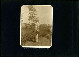
William Smaill Photo Album – Page 117
Part of William Smaill fonds
Captions read: W.G. Chace, Chief Engineer - Greater Winnipeg Water District, 9/16.
Smaill, William
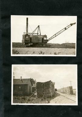
William Smaill Photo Album – loose page
Part of William Smaill fonds
Captions read: Contains no captions.
Smaill, William