

Winnipeg, Main Street looking south, Spring of 1874
- i00036
- Pièce
- 1874
Fait partie de City of Winnipeg (1874-1971)
Photograph taken from top of Courthouse.
69 résultats avec objets numériques Afficher les résultats avec des objets numériques
Winnipeg, Main Street looking south, Spring of 1874
Fait partie de City of Winnipeg (1874-1971)
Photograph taken from top of Courthouse.

Part of East Ward, St. Boniface in the distance
Fait partie de City of Winnipeg (1874-1971)
Photograph taken from top of Courthouse.

Foot of Robert Street (Galt Ave)
Fait partie de City of Winnipeg (1874-1971)
A photograph of the Eaton's printing plant and warehouse on Robert Street (Galt Avenue) during the 1950 flood. The building is surrounded by a sandbag dike and water.
Sans titre
William Smaill Photo Album – Page 20
Fait partie de William Smaill fonds
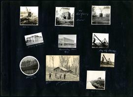
Captions read: Mile 85 - Old Fort Garry and hotel - Fort Garry apartments - Hudson's Bay stores, Winnipeg - Bay City dredge - Whitemouth, April 1914 - W.G. Chas, J.H. Fuertes [?], A. C.H. Blanchard [?] - Mile 57.
Sans titre

Scrapbook of Corporal Wallace – page 9
Fait partie de City of Winnipeg Archives Photograph collection
Page 9 of a photograph scrapbook made by Corporal John Wallace in April 1940. Photographs depict a street in Gladstone Manitoba, a trolley bus in Winnipeg on Kennedy Street (between Ellice and Qu'Appelle), and the Butler family, acquaintances of Wallace. See page three of this scrapbook for more details on the Butler family.
Sans titre

1932 Relief Works and Committee Winnipeg
Fait partie de City of Winnipeg Archives Photograph collection
Photograph collage of the 1932 Winnipeg Relief Works and Committee. Portraits of committee members are surrounding photographs of projects the committee had worked on. The committee members are, clockwise from top left: Alderman John Blumberg, Alderman H. Andrews, City Clerk Magnus Peterson, Alderman J.A. Barry, Alderman A.A. Ryley, Alderman W.B. Simpson, City Engineer W.P. Brereton, G.W. Northwood, Alderman E.D. Honeyman, Mayor Ralph Webb, Alderman J.A. McKerschar, A. MacNamara, Resident Engineer A.J. Taunton, Alderman L.F. Borrowman, and Alderman C.E. Simonite. The works projects showcased in the center are, clockwise from top left: the Main Street Bridge, the Norwood Bridge, the Assiniboine Park Bridge, the Winnipeg Auditorium, the Sargent Park Swimming Pool, and the Salter Street Bridge. Created by Robson Photo.
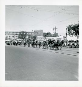
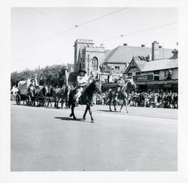
Winnipeg's 75th Anniversary parade - riders on horseback
Fait partie de City of Winnipeg Archives Photograph collection
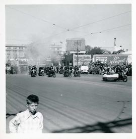
Winnipeg's 75th Anniversary parade - men on motorcycles
Fait partie de City of Winnipeg Archives Photograph collection
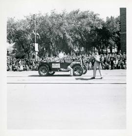
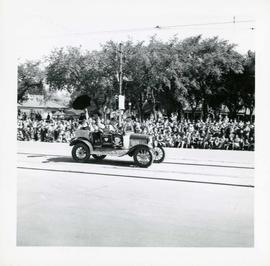
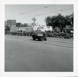
Winnipeg's 75th Anniversary parade - G. Meech 1912 Hupmobile float
Fait partie de City of Winnipeg Archives Photograph collection
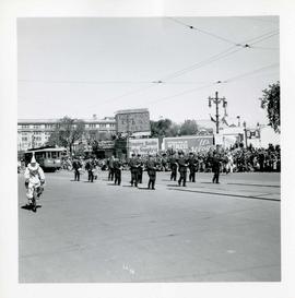
Winnipeg's 75th Anniversary parade - marching band and street car
Fait partie de City of Winnipeg Archives Photograph collection
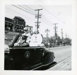
Winnipeg's 75th Anniversary parade - crowned woman in car
Fait partie de City of Winnipeg Archives Photograph collection
Winnipeg's 75th Anniversary parade - car with skull and crossbones labelled "Dunc Johnny"
Fait partie de City of Winnipeg Archives Photograph collection
Winnipeg's 75th Anniversary parade - boy on horseback waving
Fait partie de City of Winnipeg Archives Photograph collection
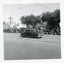
Winnipeg's 75th Anniversary parade - unmarked car
Fait partie de City of Winnipeg Archives Photograph collection
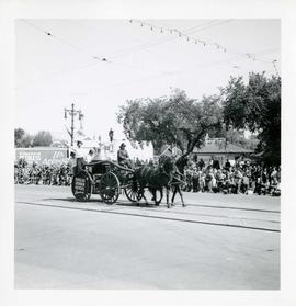
Winnipeg's 75th Anniversary parade - horse drawn fire engine
Fait partie de City of Winnipeg Archives Photograph collection
Float advertises Douglas Chisholm Agencies Insurance
Winnipeg's 75th Anniversary parade - Parade Marshal
Fait partie de City of Winnipeg Archives Photograph collection

Pumping water on Robert Street
Fait partie de City of Winnipeg (1874-1971)
A photograph of a pipe pouring water onto tracks on Robert Street (Galt Avenue) during the 1950 flood. A pile of wood is along one side of the street. The Ogilvie Flour Mill can be seen in the background.
Sans titre
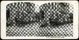
Eaton's promotional stereogram no. 23 - receiving new goods
Fait partie de Morris Block collection
Sans titre
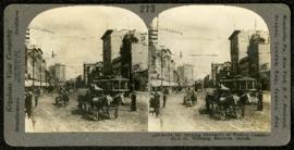
Main Street, looking north from Portage
Fait partie de Morris Block collection
A promotional stereogram showing traffic and streetcars on Main Street, looking north from Portage Avenue, made by the Keystone View Company. The reverse side of the image contains information about Winnipeg.
Sans titre
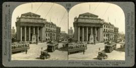
Bank of Montreal building, Portage and Main
Fait partie de Morris Block collection
A promotional stereogram showing traffic and streetcars in front of the Bank of Montreal building at Portage Avenue and Main Street, made by the Keystone View Company. The reverse side of the image contains information about Winnipeg.
Sans titre