
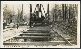
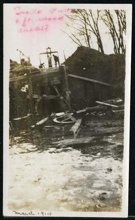
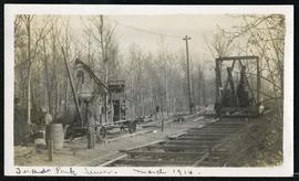
Heubach Park - South and North
- d00279
- Dossier
- 1970-1974
Fait partie de Parks and Recreation Photograph collection
10 résultats avec objets numériques Afficher les résultats avec des objets numériques
Heubach Park - South and North
Fait partie de Parks and Recreation Photograph collection
![No. 3 W.S. and Assiniboine Park [Aerial view]](/uploads/r/city-of-winnipeg-archives-amp-records-control-branch/0/2/f/02fa7ece5584f4fa43e0835434562e4c2231167b495e3777cf859d3e7d3500f4/C0013_0000_0000_P0018_0047_001_142.jpg)
No. 3 W.S. and Assiniboine Park [Aerial view]
Fait partie de City of Winnipeg Archives Photograph collection
Inscription (on recto): WG M35: 7-4, 5 Mar. 1945, No. 3 W.S. and Assiniboine Park, app. scale 1/12000.
Scrapbook of Corporal Wallace – page 8
Fait partie de City of Winnipeg Archives Photograph collection
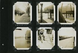
Page 8 of a photograph scrapbook made by Corporal John Wallace in April 1940. Photographs depict the Queen’s Own Cameron Highlanders of Canada near the Raleigh Apartments at Vaughan Street and Ellice Avenue, Memorial Boulevard (likely at Broadway, facing west with the Mall Hotel in the distance), a road outside Fort Osborne Barracks, and Corporal Wallace at the home of “The Dowlings” (likely on Beaverbrook Street).
Sans titre
Scrapbook of Corporal Wallace – page 5
Fait partie de City of Winnipeg Archives Photograph collection
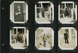
Page 5 of a photograph scrapbook made by Corporal John Wallace in April 1940. Photographs depict several acquaintenance of Wallace including two fellow soldiers, “Sonny” Robertson and Joseph “Fuss” McGrath, a Mrs. Penny, and a Frank Dowling and his family. See the general notes section for more details.
Sans titre
Scrapbook of Corporal Wallace – page 7
Fait partie de City of Winnipeg Archives Photograph collection
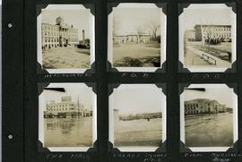
Page 7 of a photograph scrapbook made by Corporal John Wallace in April 1940. Photographs depict Fort Osborne Barracks and its Parade Square, soldiers marching, the Civic Auditorium, and the Mall Hotel on Portage Avenue between Colony and Balmoral Streets.
Sans titre


Plan of University section of Tuxedo Park
Fait partie de Parks and Recreation Photograph collection
A map of the proposed Tuxedo Park residential suburb, specifically the area surrounding the old University of Manitoba campus and Olmsted and Assiniboine Parks. The map shows streets and lots as well as details of the university campus. The map was created by Charles Clifton Chataway (1869-1920) and Bulman Brothers Ltd.