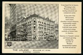
The Leland Hotel, William at King
- i01698
- Item
- [194-?]
Postcard shows Leland Hotel at William Avenue and King Street. Date of postcard is uncertain [before 1949].
The Leland Hotel, William at King
Postcard shows Leland Hotel at William Avenue and King Street. Date of postcard is uncertain [before 1949].
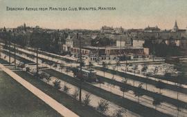
Broadway Avenue from Manitoba Club, Winnipeg
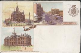
Canadian Postal Card showing Winnipeg City Hall, Main Street and Parliament Buildings
Postcard shows Winnipeg's second city hall (1886-1962), Main Street and Parliament buildings.
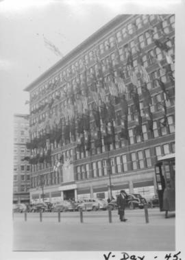
VE Day in Winnipeg showing Eaton's Building on Portage Avenue adorned with flags
Photograph shows Victory in Europe Day (VE Day) celebrations marking the end of World War 2 in Europe.

C.P.R. Depot and Royal Alexandra Hotel, Winnipeg, Manitoba
Photograph shows Canadian Pacific Railway depot and Royal Alexandra Hotel on Higgins Avenue. Date of photograph is approximate, ca. 1940.
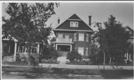
Our place - 49 Balmoral Place, Winnipeg, Manitoba

Postcard shows Portage Avenue, from Main Street looking west. Published by Valentine & Sons' Publishing Co., Ltd. Montreal and Toronto. Printed in Great Britain. Date of postcarcd is uncertain.

Main Street North, Winnipeg, Manitoba, Canada
Print is a photographic image of Main Street North. The McLaren Hotel, Hotel Cornwall and C.P.R. Station can be seen in photograph

Winnipeg, Main Street looking south, Spring of 1874
Part of City of Winnipeg (1874-1971)
Photograph taken from top of Courthouse.

Part of City of Winnipeg (1874-1971)
A photograph of flooding in a residential area of Winnipeg during the 1950 flood. The photograph was taken at the intersection of Disraeli and Euclid.
Harold K. White Studio

Portage and Main, looking west down Portage Avenue
Photograph of Portage Avenue looking west from the intersection at Main Street. Various shops and business are featured in buildings at Portage and Main that no longer exist, including the towering McArthur/Child's Building on the right. Photograph by Henry Kalen.
Metropolitan Corporation of Greater Winnipeg (Man.). Information Officer

For Your Guidance While in Winnipeg promotional map
Part of Morris Block collection
A promotional map created by the Publicity Bureau of Winnipeg and Manitoba titled "For Your Guidance While in Winnipeg". Map was originally folded as a pamphlet, the front page of which features a graphic of two people driving down Highway 14 (now Highway 75) to Winnipeg. The map is not scale and features cartoon depictions of tourist destinations and landmarks around Winnipeg and St. Boniface. The maps shows major streets, railroads, and street railway lines. The map side was originally framed and cut to fit. At a result a small part of the front page is cut off, including a stamp reading "St. Raphael's Ukrainian Immigrants' Welfare Association of Can[ada]".
Block, Morris

Page shows five street views of Winnipeg, ca. 1903: 1) Main Street from Commercial Club, 2) Elgin Avenue, 3) Geo. Velie, Wholesale Wines and Liquors, 4) William Avenue, looking west, and 5) Main Street, looking north from Portage Avenue.

View of Main Street south from Higgins showing Alberta Hotel
Date of photograph is uncertain, [before 1949].

Photograph shows old St. James Bridge approach, looking north up Madison Street (now Century Street/Route 90). Present Viscount Gort site in center. Date of photograph is uncertain, [after 1932].

Overhanging Signs: North side of Portage Avenue looking West from Young Street
Photograph shows signs for multiple businesses, including Club Morocco, Riviera Restaurant, Princeton Café Fish and Chips, Portage Credit Jewellers. Date of photograph is uncertain, [196-?].
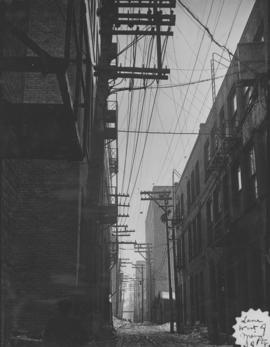
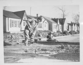
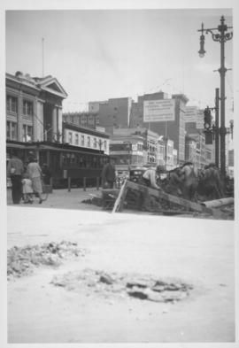
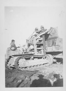
Screed - Inkster Boulevard, east of McKenzie Street
Item consists of a photograph showing construction of concrete road.