
William Smaill Photo Album – Page 50
- p00168
- Part
- [1914 or 1915]
Part of William Smaill fonds
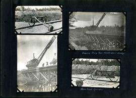
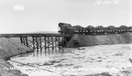
Captions read: Moving drag over Birch River bridge - Home made speeder.
Smaill, William
93 results with digital objects Show results with digital objects
William Smaill Photo Album – Page 50
Part of William Smaill fonds
Captions read: Moving drag over Birch River bridge - Home made speeder.
Smaill, William
William Smaill Photo Album – Page 51
Part of William Smaill fonds
Captions read: Contains no captions.
Smaill, William
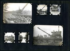
William Smaill Photo Album – Page 54
Part of William Smaill fonds
Captions read: Class 14 in muskeg, mile 86.
Smaill, William
William Smaill Photo Album – Page 75
Part of William Smaill fonds
Smaill, William
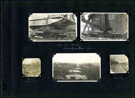
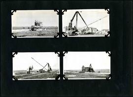
William Smaill Photo Album – Page 86
Part of William Smaill fonds
Captions read: Bay City dredge, Brokenhead River, March15 - Site for camp 8, December 15 - Camp 8, December 15.
Smaill, William
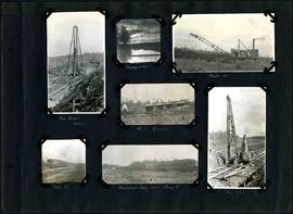
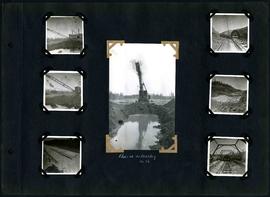
William Smaill Photo Album – Page 92
Part of William Smaill fonds
Captions read: Pile driver, mile 85 plus - Headquarter - Mile 86 - 4.5% grade - Mile 85 - Dominion Day, 1915, camp 6 - Mile 85 plus.
Smaill, William
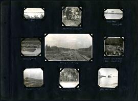
William Smaill Photo Album – Page 106
Part of William Smaill fonds
Captions read: Dyke - Blanchard's, Indian Bay - Indian Camp, Shoal Lake [Kekekoziibii Shoal Lake 40 First Nation] - Removing arch - Camp 5, mile 77 - Remains after oil House fire, camp 5, mile 77 - Excursion train, camp 6 -Tennis court, Indian Bay - Young wild ducks.
Smaill, William

William Smaill Photo Album – loose page
Part of William Smaill fonds
Captions read: Bunk houses, rock plant, Greater Winnipeg Water District - Rock crushing plant, Greater Winnipeg Water District.
Smaill, William
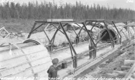
Device for moving aqueduct arch forms near Spruce Siding
Photograph of workers using a contractor's device for moving outside arch forms of the Winnipeg Aqueduct near Spruce Siding, Manitoba. Photographer is unknown.
Greater Winnipeg Water District
Filling in cofferdam for aqueduct's intake at Indian Bay
Photograph of dump cars filling in last gap of a cofferdam between dykes at the intake of the Winnipeg Aqueduct at Indian Bay, taken from the west dyke. Photographer is unknown.
Greater Winnipeg Water District

Clearing debris for aqueduct west of Snake Lake
Photograph of workers clearing debris between pole piling for the Winnipeg Aqueduct west of Snake Lake. Photographer is unknown.
Greater Winnipeg Water District
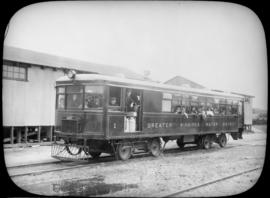
Passengers aboard GWWD Railway Service car at St. Boniface Station
Passengers aboard GWWD Railway Service car at St. Boniface Station. Image derived from glass lantern slide.
Greater Winnipeg Water District
L.B. Foote photos of tourists at Shoal Lake
Glass lantern slides taken by L.B. [Lewis Benjamin] Foote of the tourists taking the Greater Winnipeg Water District Railway to and enjoying leisure time at Shoal Lake. The Greater Winnipeg Water District hired Foote to take these photos.
Greater Winnipeg Water District
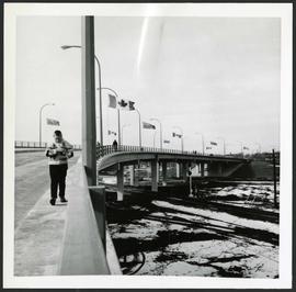
People walking across overpass
Photograph of people walking across the Nairn Overpass with snow on the ground below. The overpass is lined with flags. Photographed by Gunter A. Schoch, Landscape Architect for the Metro Parks and Protection Division.
Metropolitan Corporation of Greater Winnipeg (Man.). Information Officer
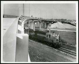
Nairn Overpass approaching completion
Photograph of the Nairn Overpass as it nears completion, looking west, as a train passes underneath.
Metropolitan Corporation of Greater Winnipeg (Man.). Information Officer

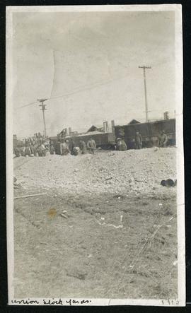
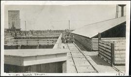
Cars hauling gravel material at Union Stock Yards
Part of Morris Block collection
Block, Morris

For Your Guidance While in Winnipeg promotional map
Part of Morris Block collection
A promotional map created by the Publicity Bureau of Winnipeg and Manitoba titled "For Your Guidance While in Winnipeg". Map was originally folded as a pamphlet, the front page of which features a graphic of two people driving down Highway 14 (now Highway 75) to Winnipeg. The map is not scale and features cartoon depictions of tourist destinations and landmarks around Winnipeg and St. Boniface. The maps shows major streets, railroads, and street railway lines. The map side was originally framed and cut to fit. At a result a small part of the front page is cut off, including a stamp reading "St. Raphael's Ukrainian Immigrants' Welfare Association of Can[ada]".
Block, Morris

William Smaill Photo Album – Page 6
Part of William Smaill fonds
Captions read: Meeting of the rails between Winnipeg and Shoal Lake - December 1914.
Smaill, William