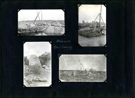
William Smaill Photo Album – Page 98
- p00216
- Part
- [1914 or 1915]
Part of William Smaill fonds
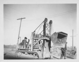
Captions read: Whitemouth River crossing.
Smaill, William
William Smaill Photo Album – Page 98
Part of William Smaill fonds
Captions read: Whitemouth River crossing.
Smaill, William
William Smaill Photo Album – Page 100
Part of William Smaill fonds
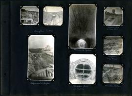
Captions read: Overflow section - Whitemouth syphon - Manhole form at sump well -Reinforcement in overflow - Bulkhead form for syphon - Overflow sump forms - Transition section.
Smaill, William
William Smaill Photo Album – Page 101
Part of William Smaill fonds
Captions read: Boat house, west bank - excavation for overflow and sump.
Smaill, William
William Smaill Photo Album – Page 102
Part of William Smaill fonds
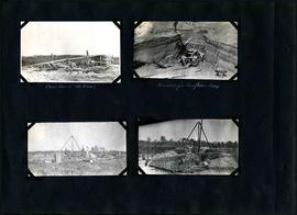
Captions read: Camp 2, mile 57 - Culvert - Camp 2- Mile 58.
Smaill, William
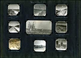
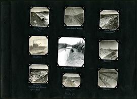
William Smaill Photo Album – Page 97
Part of William Smaill fonds
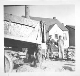
Captions read: Views at Camp 2, Mile 51 - Packed backfill, gravel - Inverst after Rainstorm - Boulders from trench - Mixer, concrete cars, and gas dinkey - Pads protected from frost with moss - Manhole and blowoff - Mixer.
Smaill, William
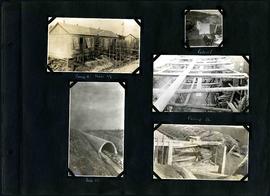
William Smaill Photo Album – Page 99
Part of William Smaill fonds
Captions read: Whitemouth River crossing.
Smaill, William
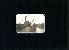
William Smaill Photo Album – Page 105
Part of William Smaill fonds
Captions read: Backfilling, mile 65.
Smaill, William
William Smaill Photo Album – Page 104
Part of William Smaill fonds
Captions read: Moving outside forms - Rails to hold sheeting - hand excavation in hardpan -Backfilling - 1st foundation fill - Rock Cut - Hardpan sloughed into trench after rain - Camp 4, mile 71 - Traveller.
Smaill, William
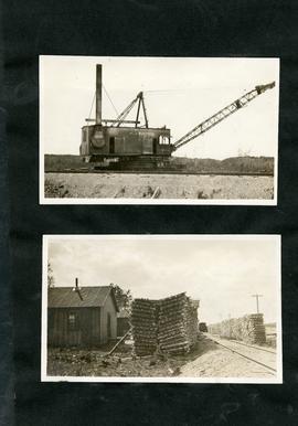
William Smaill Photo Album – Page 107
Part of William Smaill fonds
Smaill, William

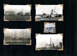
William Smaill Photo Album – loose page
Part of William Smaill fonds
Captions read: Bunk houses, rock plant, Greater Winnipeg Water District - Rock crushing plant, Greater Winnipeg Water District.
Smaill, William
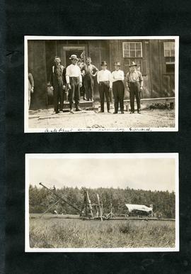
William Smaill Photo Album – loose page
Part of William Smaill fonds
Captions read: Contains no captions.
Smaill, William
William Smaill Photo Album – loose page
Part of William Smaill fonds
Captions read: Rock plant camp, on a Sunday, Greater Winnipeg Water District.
Smaill, William
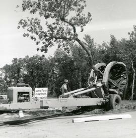
Vermeer Tree Mover in operation
Photograph of a Vermeer brand tree mover being operated by Metro employee pulling a treet out of the ground. The tree mover was acquired by Metro in 1966. A description of the photo used for publication is recorded on a separate piece of paper. Photo's reverse is stamped by the Parks and Protection Division of the Metro Government.
Metropolitan Corporation of Greater Winnipeg (Man.). Information Officer

William Smaill Photo Album – Page 15
Part of William Smaill fonds
Captions read: Anderson's dredge making cut between Indian Bay and Snowshoe Bay.
Smaill, William

William Smaill Photo Album – loose page
Part of William Smaill fonds
Captions read: Water tank, Indian Bay, Greater Winnipeg Water District.
Smaill, William
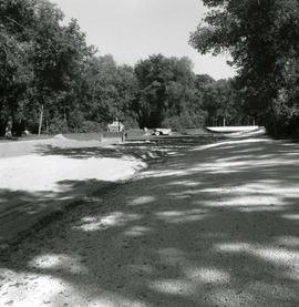
Landscaping of lake in St. Vital Park
Photograph of sunken lawn in St. Vital Park being prepared to become a filled lake. The lake was excavated in 1931, but was not filled until 1966. A description of the photo used for publication is recorded on a separate piece of paper. Photo's reverse is stamped by the Parks and Protection Division of the Metro Government.
Metropolitan Corporation of Greater Winnipeg (Man.). Information Officer
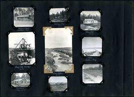
William Smaill Photo Album – Page 29
Part of William Smaill fonds
Captions read: Engineer's camp, Birch River, mile 77 - Sailman's camp, mile 88 - Hospital, mile 77 - Bay City dredge, mile 89 - Pilot ditch, mile 89 - Dyke, Indian Bay - Engineer's camp, mile 88 - Tremblays camp 1 - Mile 85.5, '16.
Smaill, William
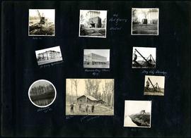
William Smaill Photo Album – Page 20
Part of William Smaill fonds
Captions read: Mile 85 - Old Fort Garry and hotel - Fort Garry apartments - Hudson's Bay stores, Winnipeg - Bay City dredge - Whitemouth, April 1914 - W.G. Chas, J.H. Fuertes [?], A. C.H. Blanchard [?] - Mile 57.
Smaill, William