
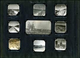
William Smaill Photo Album – Page 96
- p00214
- Part
- [1914 or 1915]
Fait partie de William Smaill fonds
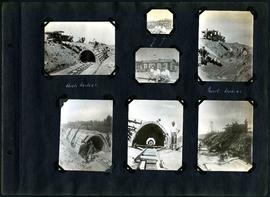
Captions read: Arch, mile 65 - Harold, Monty - Invert, mile 65.
Sans titre
124 résultats avec objets numériques Afficher les résultats avec des objets numériques
William Smaill Photo Album – Page 96
Fait partie de William Smaill fonds
Captions read: Arch, mile 65 - Harold, Monty - Invert, mile 65.
Sans titre

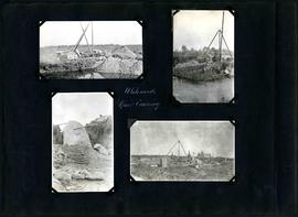
William Smaill Photo Album – Page 98
Fait partie de William Smaill fonds
Captions read: Whitemouth River crossing.
Sans titre
William Smaill Photo Album – Page 100
Fait partie de William Smaill fonds
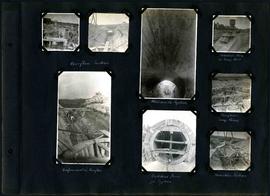
Captions read: Overflow section - Whitemouth syphon - Manhole form at sump well -Reinforcement in overflow - Bulkhead form for syphon - Overflow sump forms - Transition section.
Sans titre
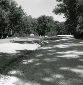
William Smaill Photo Album – Page 101
Fait partie de William Smaill fonds
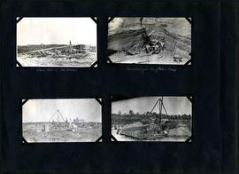
Captions read: Boat house, west bank - excavation for overflow and sump.
Sans titre
William Smaill Photo Album – Page 102
Fait partie de William Smaill fonds
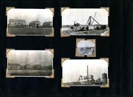
Captions read: Camp 2, mile 57 - Culvert - Camp 2- Mile 58.
Sans titre
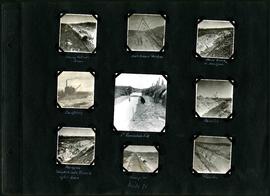
William Smaill Photo Album – Page 97
Fait partie de William Smaill fonds
Captions read: Views at Camp 2, Mile 51 - Packed backfill, gravel - Inverst after Rainstorm - Boulders from trench - Mixer, concrete cars, and gas dinkey - Pads protected from frost with moss - Manhole and blowoff - Mixer.
Sans titre
William Smaill Photo Album – Page 99
Fait partie de William Smaill fonds
Captions read: Whitemouth River crossing.
Sans titre
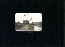
William Smaill Photo Album – Page 105
Fait partie de William Smaill fonds
Captions read: Backfilling, mile 65.
Sans titre
William Smaill Photo Album – Page 104
Fait partie de William Smaill fonds
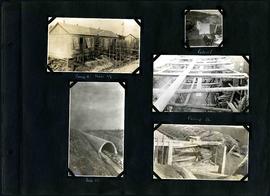
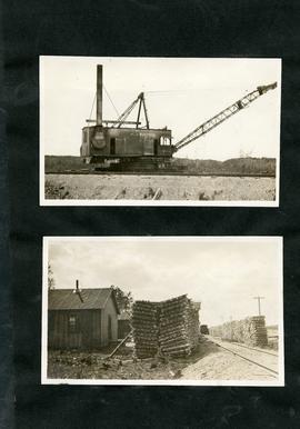
Captions read: Moving outside forms - Rails to hold sheeting - hand excavation in hardpan -Backfilling - 1st foundation fill - Rock Cut - Hardpan sloughed into trench after rain - Camp 4, mile 71 - Traveller.
Sans titre
William Smaill Photo Album – Page 107
Fait partie de William Smaill fonds
Sans titre

William Smaill Photo Album – loose page
Fait partie de William Smaill fonds
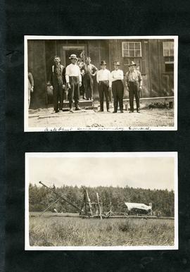
Captions read: Bunk houses, rock plant, Greater Winnipeg Water District - Rock crushing plant, Greater Winnipeg Water District.
Sans titre
William Smaill Photo Album – loose page
Fait partie de William Smaill fonds
Captions read: Contains no captions.
Sans titre
William Smaill Photo Album – loose page
Fait partie de William Smaill fonds
Captions read: Rock plant camp, on a Sunday, Greater Winnipeg Water District.
Sans titre
Fonds consists of a photo album created by William Smaill, Superintendent of the Winnipeg Aqueduct Construction Company, Ltd. The album contains photographs of the aqueduct’s construction, company men and their families, recreation, camps and homes used during construction, the Greater Winnipeg Water District Railway, and the surrounding landscape (Shoal Lake, Whitemouth River, Indian Bay, Birch River). There are also several photos of Winnipeg during Decoration Day 1914, photos of Mayors T.R. Deacon, Thomas Sharpe, and R.D. Waugh, and two photos of an Anishinaabe camp at Kekekoziibii Shoal Lake 40 First Nation.
The photos are heavily annotated. The annotations consist of names, locations, descriptions, and sometimes the section or specific mile of the aqueduct. A few photos appear to be missing and there are several loose pages with similar content. The photos are arranged somewhat chronologically – photos from 1914 generally precede photos from 1915 – but there are many exceptions.
Sans titre
Fait partie de Greater Winnipeg Water District fonds
Forms part of Fonds 15. Series consists of photographs taken by GWWD employees during the building of the Greater Winnipeg Aqueduct that brings water from Shoal Lake to Winnipeg. Photos are made up of nitrate negatives and lantern slides.
Sans titre
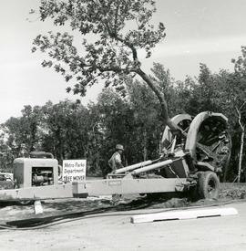
Vermeer Tree Mover in operation
Fait partie de Metropolitan Corporation of Greater Winnipeg
Photograph of a Vermeer brand tree mover being operated by Metro employee pulling a treet out of the ground. The tree mover was acquired by Metro in 1966. A description of the photo used for publication is recorded on a separate piece of paper. Photo's reverse is stamped by the Parks and Protection Division of the Metro Government.
Sans titre

William Smaill Photo Album – Page 15
Fait partie de William Smaill fonds
Captions read: Anderson's dredge making cut between Indian Bay and Snowshoe Bay.
Sans titre

William Smaill Photo Album – loose page
Fait partie de William Smaill fonds
Captions read: Water tank, Indian Bay, Greater Winnipeg Water District.
Sans titre
Landscaping of lake in St. Vital Park
Fait partie de Metropolitan Corporation of Greater Winnipeg
Photograph of sunken lawn in St. Vital Park being prepared to become a filled lake. The lake was excavated in 1931, but was not filled until 1966. A description of the photo used for publication is recorded on a separate piece of paper. Photo's reverse is stamped by the Parks and Protection Division of the Metro Government.
Sans titre
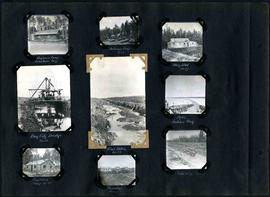
William Smaill Photo Album – Page 29
Fait partie de William Smaill fonds
Captions read: Engineer's camp, Birch River, mile 77 - Sailman's camp, mile 88 - Hospital, mile 77 - Bay City dredge, mile 89 - Pilot ditch, mile 89 - Dyke, Indian Bay - Engineer's camp, mile 88 - Tremblays camp 1 - Mile 85.5, '16.
Sans titre