View of Rossmere Shopping Centre, 1070 Henderson Highway, southwest corner Rowandale, 4.25 acres. From left to right: a garage or car wash, Red River Co-Op Store, Rossmere Lanes Bowling Alley, Library, Dry Cleaners, Co-operators Credit Union Society Limited, Rowandale Baptist Church, Rowandale Apartments, Red River Co-Op Gas Station. Consists of 3 separate photographs pasted together on cardboard to create a panorama. The cardboard is a scrap made from an old sign of the Metropolitan Corporation of Greater Winnipeg (visible on the reverse). The cardboard is numbered “2”, presumably as part of a compilation with other shopping centre panoramas.
Metropolitan Corporation of Greater Winnipeg (Man.). Planning Division


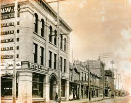
![Side view of Drug Store [Dunlop Drug Store - January 25, 1918]](/uploads/r/city-of-winnipeg-archives-amp-records-control-branch/9/7/c/97c0e1ca7dce9cc12cb7481bda6214c7c2576dd2fb09909be39f08f4404a5194/C0013_0000_0000_P0022_0095_047_142.jpg)