

- i00187
- Item
- 1950
Part of City of Winnipeg (1874-1971)
A photograph of flooded Assiniboine Avenue during the 1950 flood in Winnipeg.
Harold K. White Studio
Part of City of Winnipeg (1874-1971)
A photograph of flooded Assiniboine Avenue during the 1950 flood in Winnipeg.
Harold K. White Studio
![Assistant Engineer Gorrie[?]](/uploads/r/city-of-winnipeg-archives-amp-records-control-branch/7/c/e/7ce41a305d314f1a011d56c382532437129222267a65925399273029c7569d46/F0001_0083_0000_A0569_0000_030_142.jpg)
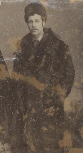
Part of City of Winnipeg (1874-1971)
Date of photograph is probable, [1884?].
Bennetto, Israel
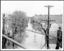
Part of City of Winnipeg (1874-1971)
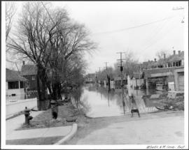
A photograph, looking east, of flooding at the intersection of Atlantic Avenue and St. Cross Street during the 1950 flood in Winnipeg.
Harold K. White Studio
Part of City of Winnipeg (1874-1971)
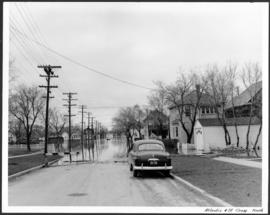
A photograph, looking north, of flooding at the intersection of Atlantic Avenue and St. Cross Street during the flood of 1950 in Winnipeg.
Harold K. White Studio

Bannerman and St. Cross looking east
Part of City of Winnipeg (1874-1971)
A photograph, looking east, of flooding at the intersection of Bannerman Avenue and St. Cross Street during the 1950 flood in Winnipeg.
Harold K. White Studio
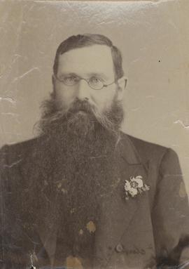
![Barber, Architect [Charles Arnold Barber]](/uploads/r/city-of-winnipeg-archives-amp-records-control-branch/1/9/7/1972349bb8753ad18c9501382bcb261030dcd76cf03eded633bdb8e4d51dab0b/F0001_0083_0000_A0569_0000_027_142.jpg)
Barber, Architect [Charles Arnold Barber]
Part of City of Winnipeg (1874-1971)
Photograph shows Charles Arnold Barber (1848-1915), Architect. Date of photograph is probable [1884?].
Bennetto, Israel
![Barber, Architect [Earl William Barber]](/uploads/r/city-of-winnipeg-archives-amp-records-control-branch/9/f/9/9f9e6a0454c0f00f12f7337976295ff8a6972834bfaa14d64d25a56cd46ccc7b/F0001_0083_0000_A0569_0000_028_142.jpg)
Barber, Architect [Earl William Barber]
Part of City of Winnipeg (1874-1971)
Photograph shows Earl William Barber (1855-1915), Architect. Date of photograph is probable, [1884?].
Bennetto, Israel
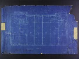
Basement plans for 383-389 Portage Avenue and 290 Edmonton Street (The Edmonton Block)
Part of City of Winnipeg (1874-1971)
Blueprint plans of first floor of 383-389 Portage Avenue and 290 Edmonton Street (the Edmonton Block), designed by John. D. Atchison for W.H. Gardner. Drawing 2 of 5.
Atchison, John D.
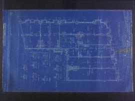
Basement plans for Medical Arts Building at the corner of Graham Avenue and Kennedy Street
Part of City of Winnipeg (1874-1971)
Blueprint plans of basement of the Medical Arts Building at the corner of Graham Avenue and Kennedy Street. Designed by John D. Atchison. Drawing 1 of 6.
Atchison, John D.
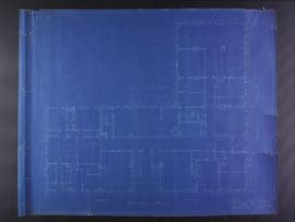
Basement plans the Club Building for the Columbus Hall Association
Part of City of Winnipeg (1874-1971)
Blueprint plans of basement of the Club Building for the Columbus Hall Association Ltd. on the southwest corner of Graham Avenue and Smith Street. Designed by John D. Atchison. Drawing 1 of 11.
Atchison, John D.

Beginning of Causeway Sutherland at Disraeli
Part of City of Winnipeg (1874-1971)
A photograph of equipment and vehicles at the beginning of a rock causeway at the intersection of Sutherland Avenue and Disraeli Street during the 1950 flood.
Harold K. White Studio
Part of City of Winnipeg (1874-1971)
A photograph of hydro wires along flooded Bell Avenue during the 1950 flood in Winnipeg.
Harold K. White Studio
Part of City of Winnipeg (1874-1971)
Photograph shows Israel Bennetto, Photographer. Date of photograph is approximate, ca. 1884.
Part of City of Winnipeg (1874-1971)
Item is part of small album containing photographs of maps tracking the outbreak of typhoid from 1905 to 1908 and other scenes. Item is loose and at back of album. Date of item is approximate, [circa 1909].
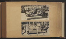
British Empire and United Commercial Travellers floats
Part of City of Winnipeg (1874-1971)
Winnipeg (Man.). Special Jubilee Committee

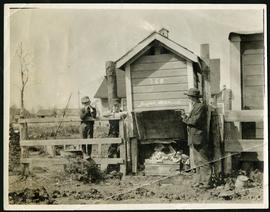
Building Water Street causeway about 2nd day
Part of City of Winnipeg (1874-1971)
A photograph of the building of the Water Street causeway during the 1950 flood in Winnipeg. St. Boniface Cathedral can be seen in the background.
Harold K. White Studio
Part of City of Winnipeg (1874-1971)
Photograph of City Clerk C. J. Brown taken by Israel Bennetto and placed in the cornerstone of Winnipeg's second City Hall, completed in 1886.
Bennetto, Israel
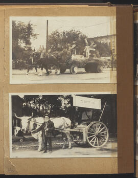
Calhoun Hat float and Red River cart
Part of City of Winnipeg (1874-1971)
Winnipeg (Man.). Special Jubilee Committee

Canadian National Railways and Icelandic pioneers floats
Part of City of Winnipeg (1874-1971)
Winnipeg (Man.). Special Jubilee Committee
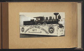
Canadian Pacific Railway Company float
Part of City of Winnipeg (1874-1971)
Winnipeg (Man.). Special Jubilee Committee