

Horse drawn Fire Department vehicle.
- i01737
- Item
- [188-?]
Philip C. Dolsen holding reins - driver for Winnipeg Fire Dept.
2569 results with digital objects Show results with digital objects
Horse drawn Fire Department vehicle.
Philip C. Dolsen holding reins - driver for Winnipeg Fire Dept.
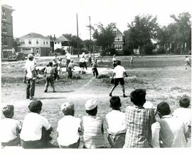
Children playing baseball at community diamond (Arbuthnot St. and Fleet Ave.).
Winnipeg (Man.). Parks and Recreation Department

Part of City of Winnipeg (1874-1971)
A photograph, taken from the north, of a flooded underpass on Anabella Street during the 1950 flood in Winnipeg. Some people in a boat are travelling down the street.
Harold K. White Studio
Part of City of Winnipeg (1874-1971)
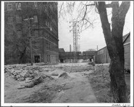
A photograph of a flooded underpass on Anabella Street during the 1950 flood in Winnipeg.
Harold K. White Studio
Part of City of Winnipeg (1874-1971)
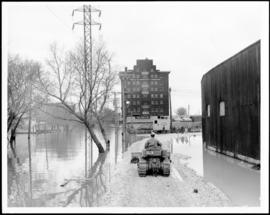
A photograph of a causeway near an underpass on Anabella Street during the 1950 flood in Winnipeg. A city employee is driving some equipment down the causeway.
Harold K. White Studio
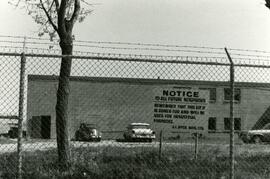
Sign about industrial zoning at business near Rothesay Street
Sign put up by J.I. Dyck Mfg. Ltd. Informing other that the property (near Rothesay Street) is zoned for industrial purposes.
Businesses at the corner of Rothesay and Edison
Hagemier Corporation and 7-Eleven at the corner of Rothesay Street and Edison Avenue.
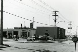
7-eleven and Shell station on Rothesay between Edison and Kingsford
7-Eleven store and Shell Service Station on Rothesay Street between Edison and Kingsford Avenues.
7-eleven and Shell station on Rothesay between Edison and Kingsford
7-Eleven store and sign of Shell Service Station on Rothesay Street between Edison and Kingsford Avenues.
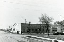
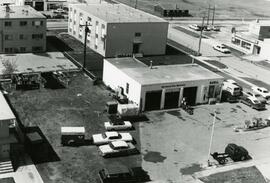
Shell station on Rothesay Street near Kingsford
Shell Service Station at the corner of Rothesay Street and Kingsford Avenue.
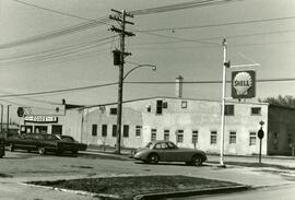
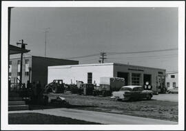
Shell station on Rothesay Street near Kingsford
Shell Service Station at the corner of Rothesay Street and Kingsford Avenue.
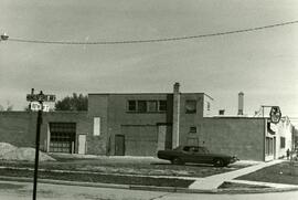
Shell station on Rothesay Street near Kingsford
Shell Service Station at the corner of Rothesay Street and Kingsford Avenue.
7-Eleven at the corner of Rothesay and Kingsford
Photograph of a 7-Eleven store at the corner of Rothesay Street and Kingsford Avenue.
Strip mall on Rothesay at Kingsford
Springfield Heights Value Centre strip mall on Rothesay Street near Kingsford Avenue. Businesses include a barber shop, a pharmacy, Kwik Shop, and Penner’s Food.

Apartment block at 415 Edison Avenue
Apartment block at 415 Edison Avenue, near Rothesay Street.
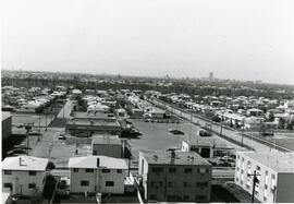
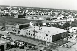
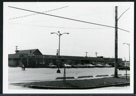
Aerial view of strip mall at Rothesay and Kingsford
Aerial view of Springfield Heights strip mall at Rothesay Street and Kingsford Avenue, facing south. Businesses include Easton’s and a Husky Service Centre.
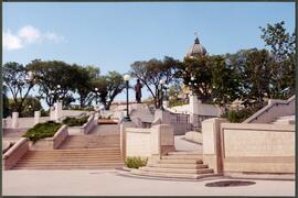
Louis Riel statue along the River Walk
Statue of Louis Riel and Legislature, looking north from the River Walk.
Winnipeg (Man.). Parks and Recreation Department
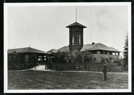
Assiniboine Park Pavilion and Annex
A man standing in front of the Pavilion and Annex at Assiniboine Park.
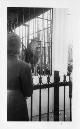
Photograph shows a lion at the Assiniboine Park Zoo. Stamp (on verso): Processed Feb 18 1947.
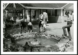
Aunt Sally's Farm at the Assiniboine Park Zoo
Photograph of visitors enjoying a fountain at Aunt Sally's Farm, in the Assiniboine Park Zoo. Photograph was taken by Gunter A. Schoch, Landscape Architect with the Metropolitan Corporation of Greater Winnipeg's Parks and Protection Division.
Metropolitan Corporation of Greater Winnipeg (Man.). Parks and Protection Division