

E.L. Drewry, Chairman of Public Parks Board
- i03100
- Item
- 1893
Photograph shows E.L. Drewry, Chairman of the Public Parks Board from 1893 to 1897.
224 results with digital objects Show results with digital objects
E.L. Drewry, Chairman of Public Parks Board
Photograph shows E.L. Drewry, Chairman of the Public Parks Board from 1893 to 1897.
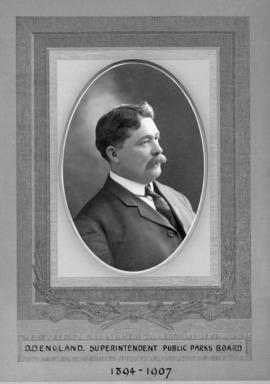
D.D. England, Chairman of Public Parks Board
Photograph shows D.D. England, Superintendent of the Public Parks Board from 1894 to 1907.
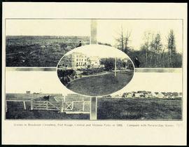
Scenes in Brookside Cemetery, Fort Rouge, Central and Victoria Parks in 1898
A printed page consisting of a 5 photograph collage of scenes from Fort Rouge Park, Central Park, Victoria Park, and Brookside Cemetery. The photographs date from 1898, but the page itself is likely from 1913.

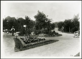
Two young children on a path in Central Park. Photographed by Steele and Company.
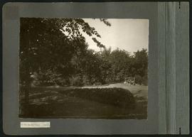
A wooden bench on a path in Central Park.

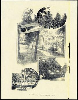
Item features reproductions of five photographs showing Fort Rouge Park in 1905. Caption reads, "In Fort Rouge Park, Winnipeg."

G. Champion, Superintendent of Public Parks Board
Photograph shows G. Champion, Superintendent for the Public Parks Board from 1907 to 1935.

Plan of University section of Tuxedo Park
A map of the proposed Tuxedo Park residential suburb, specifically the area surrounding the old University of Manitoba campus and Olmsted and Assiniboine Parks. The map shows streets and lots as well as details of the university campus. The map was created by Charles Clifton Chataway (1869-1920) and Bulman Brothers Ltd.

Women at Assiniboine Park lily pond
Two young women sitting near the lily pond and the Pergola at Assiniboine Park.

Young trees planted in a grassy area intersected with stone paths. Caption: "Two Years Work".
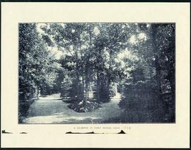
Item is a reproduction of a photograph showing Fort Rouge Park in 1908. Caption reads, "A Glimpse in Fort Rouge Park."
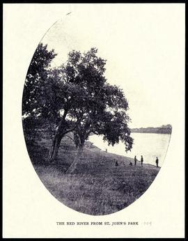
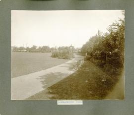
The Red River from St. John's Park.
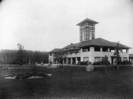
Photograph shows a view of the Assiniboine Park Pavilion (former). Date of photograph is uncertain, [ca. 1920].
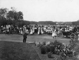
Playground Sports Day at Assiniboine Park
Photograph shows playground sports day at Assiniboine Park.
One of two photographs affixed to page. This photograph shows Selkirk Park, and the one on the other side shows Dufferin Park. Inscription (on recto): "a-859- Selkirk Park." Date of photograph is approximate, [ca. 1910].
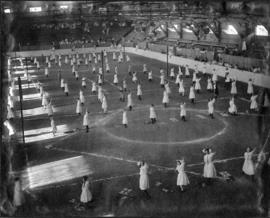
Rhythmic movement demonstration at Old Exhibition Grounds
Photograph shows rhythmic movement demonstration at the Old Exhibition Grounds.
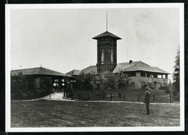
Assiniboine Park Pavilion and Annex
A man standing in front of the Pavilion and Annex at Assiniboine Park.